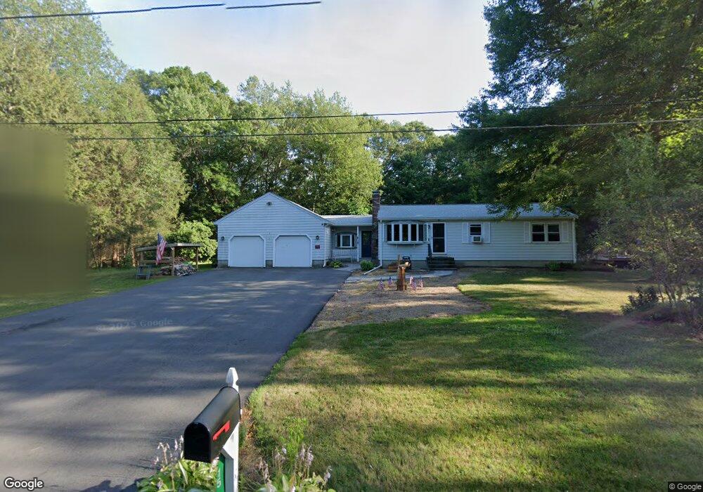
15 Brander Rd Rehoboth, MA 02769
Estimated Value: $498,000 - $536,000
3
Beds
1
Bath
1,864
Sq Ft
$279/Sq Ft
Est. Value
About This Home
This home is located at 15 Brander Rd, Rehoboth, MA 02769 and is currently estimated at $519,479, approximately $278 per square foot. 15 Brander Rd is a home located in Bristol County with nearby schools including Dighton-Rehoboth Regional High School, Grace Baptist Christian Academy, and The Pinecroft School.
Ownership History
Date
Name
Owned For
Owner Type
Purchase Details
Closed on
Jan 5, 2007
Sold by
Chapman Donald D and Chapman Hazel F
Bought by
Holman Mark G and Holman Anne D
Current Estimated Value
Home Financials for this Owner
Home Financials are based on the most recent Mortgage that was taken out on this home.
Original Mortgage
$246,750
Outstanding Balance
$146,200
Interest Rate
6.24%
Mortgage Type
Purchase Money Mortgage
Estimated Equity
$373,279
Purchase Details
Closed on
Mar 15, 2005
Sold by
Chapman Donald D and Chapman Hazel F
Bought by
Cournoyer Amy Rae and Dorrance Donna C
Purchase Details
Closed on
May 14, 1998
Sold by
Wright William S
Bought by
Chapman Donald D and Chapman Hazel F
Create a Home Valuation Report for This Property
The Home Valuation Report is an in-depth analysis detailing your home's value as well as a comparison with similar homes in the area
Home Values in the Area
Average Home Value in this Area
Purchase History
| Date | Buyer | Sale Price | Title Company |
|---|---|---|---|
| Holman Mark G | $329,000 | -- | |
| Cournoyer Amy Rae | $250,000 | -- | |
| Chapman Donald D | $10,000 | -- |
Source: Public Records
Mortgage History
| Date | Status | Borrower | Loan Amount |
|---|---|---|---|
| Open | Holman Mark G | $246,750 | |
| Previous Owner | Chapman Donald D | $29,000 | |
| Previous Owner | Chapman Donald D | $25,000 | |
| Previous Owner | Chapman Donald D | $14,000 |
Source: Public Records
Tax History Compared to Growth
Tax History
| Year | Tax Paid | Tax Assessment Tax Assessment Total Assessment is a certain percentage of the fair market value that is determined by local assessors to be the total taxable value of land and additions on the property. | Land | Improvement |
|---|---|---|---|---|
| 2025 | $42 | $377,900 | $172,800 | $205,100 |
| 2024 | $3,945 | $347,300 | $172,800 | $174,500 |
| 2023 | $3,871 | $332,800 | $169,200 | $163,600 |
| 2022 | $3,871 | $305,500 | $169,200 | $136,300 |
| 2021 | $3,760 | $284,000 | $161,400 | $122,600 |
| 2020 | $3,601 | $274,500 | $161,400 | $113,100 |
| 2018 | $3,232 | $270,000 | $153,600 | $116,400 |
| 2017 | $3,066 | $244,100 | $153,600 | $90,500 |
| 2016 | $3,001 | $247,000 | $153,600 | $93,400 |
| 2015 | $2,808 | $228,100 | $146,400 | $81,700 |
| 2014 | $2,748 | $220,900 | $139,200 | $81,700 |
Source: Public Records
Map
Nearby Homes
- 99 Brigham Hill Rd
- 240 Smith St
- 8 Kasmira Way
- 2 Round Farm Rd
- 1 Round Farm Rd
- 48 Round Farm Rd
- 58 Peck St
- 45 Spruce Ln
- 14 Tremont St
- 20 Mine Brook Rd
- 3 Wilmarth St
- 8 Preservation Way
- 4 Colonial Dr Unit 4
- 84 Fairview Ave
- 730 Pike Ave
- 73 Butterworth Dr
- 29 & 43 Francis St
- 36 Catherine Dr
- 64 Ridgehill Rd
- 27 Run Brook Cir
- Lot#16 Round Farm Rd
- 11 Brander Rd
- 18 Brander Rd
- 0 Fran Lee Dr Unit 70900691
- 10 Brander Rd
- 9 Brander Rd
- 19 Brander Rd
- 15 Wright St
- 11 Wright St
- 8 Slater St
- 9 King Philip Dr
- 16 Slater St
- 16 Slater St
- 8 King Philip Dr
- 20 Slater St
- 4 King Phillip Dr
- 21 King Phillip Dr
- 12 King Phillip Dr
- 12 King Philip Dr
- 17 Slater St