Estimated Value: $199,281
Studio
--
Bath
1,050
Sq Ft
$190/Sq Ft
Est. Value
About This Home
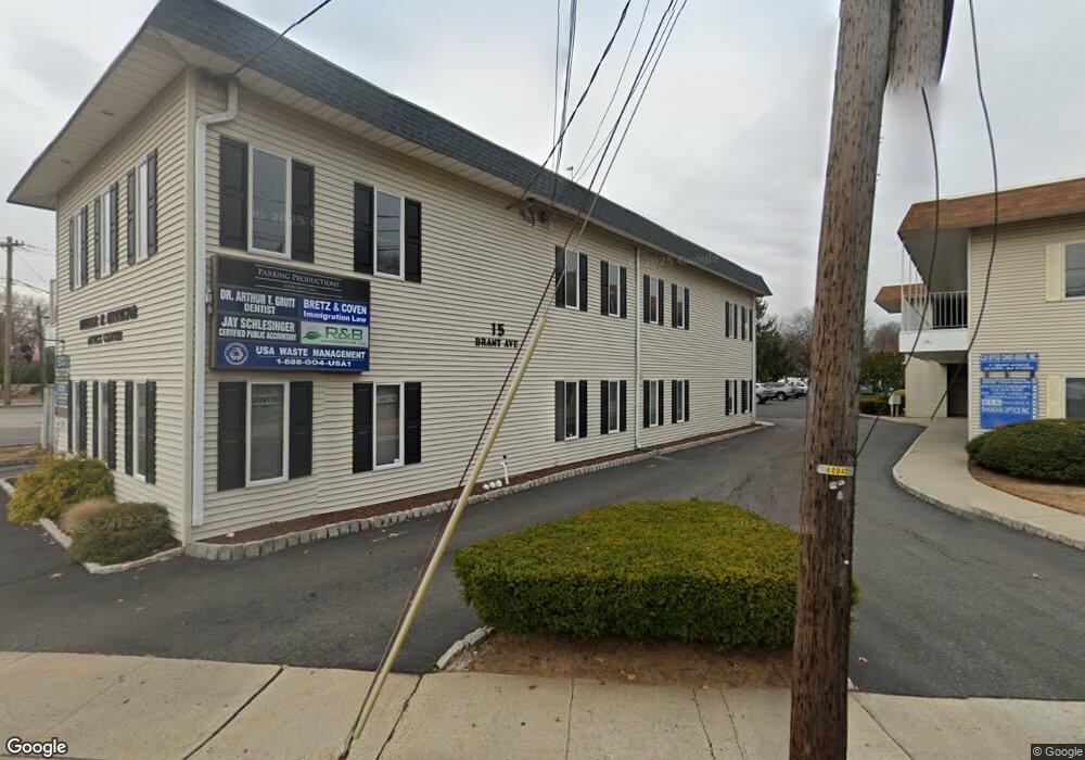
This home is located at 15 Brant Ave Unit 1&2, Clark, NJ 07066 and is currently estimated at $199,281, approximately $189 per square foot. 15 Brant Ave Unit 1&2 is a home located in Union County with nearby schools including Valley Road Elementary School, Carl H. Kumpf Middle School, and Arthur L. Johnson High School.
Ownership History
Date
Name
Owned For
Owner Type
Purchase Details
Closed on
Mar 27, 2018
Sold by
Vazirani Seema
Bought by
Parking Productions John Dent Incorporat
Current Estimated Value
Home Financials for this Owner
Home Financials are based on the most recent Mortgage that was taken out on this home.
Original Mortgage
$108,000
Outstanding Balance
$92,792
Interest Rate
4.4%
Mortgage Type
Commercial
Estimated Equity
$106,489
Purchase Details
Closed on
Jun 9, 2017
Sold by
Ravenwood Enterprises Llc
Bought by
Vazirani Seema
Purchase Details
Closed on
Nov 13, 2007
Sold by
Angelo William and Angelo Diane
Bought by
Ravenwood Enterprises Llc
Create a Home Valuation Report for This Property
The Home Valuation Report is an in-depth analysis detailing your home's value as well as a comparison with similar homes in the area
Home Values in the Area
Average Home Value in this Area
Purchase History
| Date | Buyer | Sale Price | Title Company |
|---|---|---|---|
| Parking Productions John Dent Incorporat | $135,000 | Ensure Title | |
| Vazirani Seema | $920,000 | None Available | |
| Ravenwood Enterprises Llc | $119,000 | None Available |
Source: Public Records
Mortgage History
| Date | Status | Borrower | Loan Amount |
|---|---|---|---|
| Open | Parking Productions John Dent Incorporat | $108,000 |
Source: Public Records
Tax History
| Year | Tax Paid | Tax Assessment Tax Assessment Total Assessment is a certain percentage of the fair market value that is determined by local assessors to be the total taxable value of land and additions on the property. | Land | Improvement |
|---|---|---|---|---|
| 2025 | $1,689 | $76,300 | $18,300 | $58,000 |
| 2024 | $1,664 | $76,300 | $18,300 | $58,000 |
| 2023 | $1,664 | $76,300 | $18,300 | $58,000 |
| 2022 | $1,616 | $76,300 | $18,300 | $58,000 |
| 2021 | $2,400 | $27,000 | $10,000 | $17,000 |
| 2020 | $2,361 | $27,000 | $10,000 | $17,000 |
| 2019 | $2,337 | $27,000 | $10,000 | $17,000 |
| 2018 | $2,278 | $27,000 | $10,000 | $17,000 |
| 2017 | $2,272 | $27,000 | $10,000 | $17,000 |
| 2016 | $2,189 | $27,000 | $10,000 | $17,000 |
| 2015 | $2,166 | $27,000 | $10,000 | $17,000 |
| 2014 | $2,121 | $27,000 | $10,000 | $17,000 |
Source: Public Records
Map
Nearby Homes
- 30 Brant Ave
- 45 Lexington Blvd
- 272 Westfield Ave
- 157 Westfield Ave
- 85 Fulton St
- 44 Joseph St
- 52 Broadway
- 122 Central Ave
- 22 Washington St
- 33 Cornell Dr
- 66 Lincoln Blvd
- 1044 Madison Hill Rd
- 262 Valley Rd
- 81 Hutchinson St
- 1206 Westfield Ave
- 275 Valley Rd
- 205 West Ln
- 814 Falesky St
- 302 New York Ave
- 17 Rolling Hill Way
- 15 Brant Ave Unit 8
- 15 Brant Ave Unit 5
- 15 Brant Ave Unit 3
- 15 Brant Ave
- 226 Westfield Ave
- 17 Brant Ave Unit 1
- 17 Brant Ave Unit 7
- 17 Brant Ave Unit 6-7
- 17 Brant Ave Unit 6
- 17 Brant Ave
- 17 Brant Ave Unit 2
- 21 Brant Ave
- 21 Brant Ave
- 21 Brant Ave Unit 3RD
- 21 Brant Ave Unit 1
- 210 Westfield Ave Unit 2A&B
- 24 Brant Ave
- 206 Westfield Ave
- 206 Westfield Ave Unit 2
- 251 Westfield Ave
Your Personal Tour Guide
Ask me questions while you tour the home.