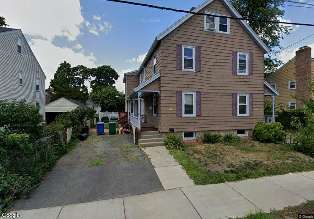
15 Bridges Ave Unit 17 Newtonville, MA 02460
Newtonville NeighborhoodEstimated Value: $1,304,000 - $1,510,000
6
Beds
4
Baths
2,868
Sq Ft
$498/Sq Ft
Est. Value
About This Home
This home is located at 15 Bridges Ave Unit 17, Newtonville, MA 02460 and is currently estimated at $1,427,167, approximately $497 per square foot. 15 Bridges Ave Unit 17 is a home located in Middlesex County with nearby schools including Cabot Elementary School, F.A. Day Middle School, and Newton North High School.
Ownership History
Date
Name
Owned For
Owner Type
Purchase Details
Closed on
Dec 15, 2005
Sold by
Buckton Kimberly M and Buckton Martin H
Bought by
Lam Jamson T and Lam Wanda Y
Current Estimated Value
Home Financials for this Owner
Home Financials are based on the most recent Mortgage that was taken out on this home.
Original Mortgage
$260,000
Interest Rate
6.34%
Mortgage Type
Purchase Money Mortgage
Purchase Details
Closed on
Aug 25, 1995
Sold by
Totaro Concetta
Bought by
Buckton Martin H and Moore Kimberly Q
Home Financials for this Owner
Home Financials are based on the most recent Mortgage that was taken out on this home.
Original Mortgage
$200,000
Interest Rate
7.32%
Mortgage Type
Purchase Money Mortgage
Create a Home Valuation Report for This Property
The Home Valuation Report is an in-depth analysis detailing your home's value as well as a comparison with similar homes in the area
Home Values in the Area
Average Home Value in this Area
Purchase History
| Date | Buyer | Sale Price | Title Company |
|---|---|---|---|
| Lam Jamson T | $658,000 | -- | |
| Buckton Martin H | $250,000 | -- |
Source: Public Records
Mortgage History
| Date | Status | Borrower | Loan Amount |
|---|---|---|---|
| Open | Buckton Martin H | $238,000 | |
| Closed | Lam Jamson T | $260,000 | |
| Previous Owner | Buckton Martin H | $200,000 |
Source: Public Records
Tax History Compared to Growth
Tax History
| Year | Tax Paid | Tax Assessment Tax Assessment Total Assessment is a certain percentage of the fair market value that is determined by local assessors to be the total taxable value of land and additions on the property. | Land | Improvement |
|---|---|---|---|---|
| 2025 | $11,303 | $1,153,400 | $860,600 | $292,800 |
| 2024 | $10,929 | $1,119,800 | $835,500 | $284,300 |
| 2023 | $10,519 | $1,033,300 | $670,800 | $362,500 |
| 2022 | $10,066 | $956,800 | $621,100 | $335,700 |
| 2021 | $9,445 | $877,800 | $569,800 | $308,000 |
| 2020 | $9,164 | $877,800 | $569,800 | $308,000 |
| 2019 | $8,573 | $820,400 | $532,500 | $287,900 |
| 2018 | $8,535 | $788,800 | $501,300 | $287,500 |
| 2017 | $8,048 | $723,700 | $459,900 | $263,800 |
| 2016 | $7,555 | $663,900 | $421,900 | $242,000 |
| 2015 | $7,204 | $620,500 | $394,300 | $226,200 |
Source: Public Records
Map
Nearby Homes
- 48 Harvard St Unit 1
- 110 Harvard St Unit A
- 10 Washington Park
- 10 Washington Park Unit 2
- 10 Washington Park Unit 1
- 300 Cabot St
- 44 Blake St Unit 2
- 127-129 Withington Rd Unit 1
- 77 Court St Unit 205
- 324 Adams St Unit 2
- 22-24 Emerald St
- 22 Walnut Place Unit 1
- 14 Summit St
- 3 Ashmont Ave
- 12-14 Middle St
- 168 Walnut St
- 11 Murphy Ct
- 42-44 Judkins St
- 49 Hawthorn St
- 911 Washington St
- 15 Bridges Ave Unit 15
- 15-17 Bridges Ave
- 9 Bridges Ave Unit 11
- 9 Bridges Ave Unit 1
- 19 Bridges Ave Unit 21
- 122 Norwood Ave Unit B
- 7 Bridges Ave
- 120 Norwood Ave
- 120 Norwood Ave Unit A
- 23 Bridges Ave Unit 25
- 23 Bridges Ave Unit 1
- 20 Bridges Ave Unit 20
- 23-25 Bridges Ave Unit 23
- 23-25 Bridges Ave Unit 25
- 23-25 Bridges Ave
- 18 Bridges Ave Unit 20
- 12 Bridges Ave Unit 14
- 108 Norwood Ave
- 112 Norwood Ave Unit 114
- 112 Norwood Ave Unit 114