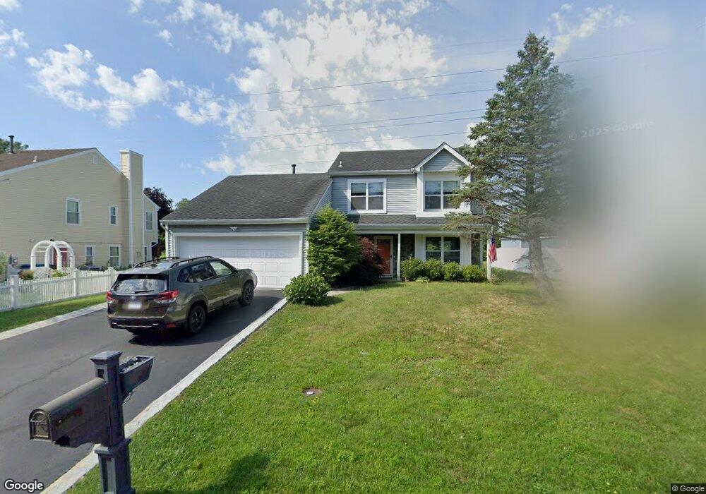
15 Bridle Path Tinton Falls, NJ 07753
Estimated Value: $642,000 - $697,000
3
Beds
2
Baths
1,710
Sq Ft
$389/Sq Ft
Est. Value
About This Home
This home is located at 15 Bridle Path, Tinton Falls, NJ 07753 and is currently estimated at $665,990, approximately $389 per square foot. 15 Bridle Path is a home located in Monmouth County with nearby schools including Mahala F. Atchinson Elementary School, Swimming River Elementary School, and Tinton Falls Middle School.
Ownership History
Date
Name
Owned For
Owner Type
Purchase Details
Closed on
Nov 25, 2002
Sold by
Glick Dennis
Bought by
Kado Karl
Current Estimated Value
Home Financials for this Owner
Home Financials are based on the most recent Mortgage that was taken out on this home.
Original Mortgage
$220,000
Outstanding Balance
$95,180
Interest Rate
6.34%
Estimated Equity
$570,810
Purchase Details
Closed on
Aug 13, 2001
Sold by
Golba John
Bought by
Glick Dennis and Glick Lora
Home Financials for this Owner
Home Financials are based on the most recent Mortgage that was taken out on this home.
Original Mortgage
$175,000
Interest Rate
7.21%
Purchase Details
Closed on
Mar 30, 1994
Sold by
Greenblatt Paul
Bought by
Golba John and Disomma Daniele
Home Financials for this Owner
Home Financials are based on the most recent Mortgage that was taken out on this home.
Original Mortgage
$112,000
Interest Rate
7.07%
Create a Home Valuation Report for This Property
The Home Valuation Report is an in-depth analysis detailing your home's value as well as a comparison with similar homes in the area
Home Values in the Area
Average Home Value in this Area
Purchase History
| Date | Buyer | Sale Price | Title Company |
|---|---|---|---|
| Kado Karl | $275,000 | -- | |
| Glick Dennis | $243,000 | -- | |
| Golba John | $140,000 | -- |
Source: Public Records
Mortgage History
| Date | Status | Borrower | Loan Amount |
|---|---|---|---|
| Open | Kado Karl | $220,000 | |
| Previous Owner | Glick Dennis | $175,000 | |
| Previous Owner | Golba John | $112,000 |
Source: Public Records
Tax History
| Year | Tax Paid | Tax Assessment Tax Assessment Total Assessment is a certain percentage of the fair market value that is determined by local assessors to be the total taxable value of land and additions on the property. | Land | Improvement |
|---|---|---|---|---|
| 2025 | $7,425 | $544,700 | $288,800 | $255,900 |
| 2024 | $7,082 | $516,000 | $266,000 | $250,000 |
| 2023 | $7,082 | $464,100 | $218,800 | $245,300 |
| 2022 | $6,816 | $423,000 | $201,300 | $221,700 |
| 2021 | $6,837 | $353,900 | $172,500 | $181,400 |
| 2020 | $6,665 | $334,100 | $156,800 | $177,300 |
| 2019 | $6,837 | $343,200 | $166,900 | $176,300 |
| 2018 | $6,827 | $341,700 | $173,600 | $168,100 |
| 2017 | $6,821 | $332,900 | $177,000 | $155,900 |
| 2016 | $6,919 | $330,100 | $177,000 | $153,100 |
| 2015 | $6,893 | $333,000 | $183,800 | $149,200 |
| 2014 | $6,886 | $318,200 | $158,800 | $159,400 |
Source: Public Records
Map
Nearby Homes
- 1 Canidae Ct Unit 1
- 8 Nutmeg Ct Unit 2128
- 62 Santa Rosa Ln
- 4 Gait Ct Unit 4
- 25 Thoroughbred Fare
- 25 Jockey Ln Unit 73
- 18 Charles Dr
- 161 Frontier Way
- 5 Mount Run
- 162 Frontier Way Unit 2
- 52 Diane Dr
- 13 Cranberry Dr
- 57 Diane Dr
- 18 Diane Dr
- 78 Diane Dr
- 75 Diane Dr
- 652 Wardell Rd
- 16 Karen Dr
- 3020 Shafto Rd
- 24 Topeka Ct
Your Personal Tour Guide
Ask me questions while you tour the home.