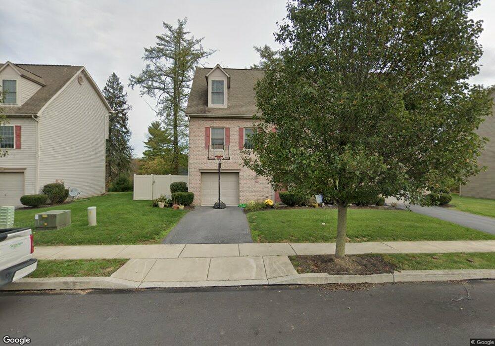
15 Brook Side Dr Unit Dr Carlisle, PA 17013
Estimated Value: $243,000 - $258,645
2
Beds
3
Baths
1,560
Sq Ft
$160/Sq Ft
Est. Value
About This Home
This home is located at 15 Brook Side Dr Unit Dr, Carlisle, PA 17013 and is currently estimated at $248,911, approximately $159 per square foot. 15 Brook Side Dr Unit Dr is a home located in Cumberland County with nearby schools including Mooreland Elementary School, Lamberton Middle School, and Carlisle Area High School.
Ownership History
Date
Name
Owned For
Owner Type
Purchase Details
Closed on
May 25, 2010
Sold by
Letort Meadows Assoc
Bought by
Mccafferty Kenneth P
Current Estimated Value
Home Financials for this Owner
Home Financials are based on the most recent Mortgage that was taken out on this home.
Original Mortgage
$182,161
Interest Rate
4.73%
Mortgage Type
New Conventional
Create a Home Valuation Report for This Property
The Home Valuation Report is an in-depth analysis detailing your home's value as well as a comparison with similar homes in the area
Home Values in the Area
Average Home Value in this Area
Purchase History
| Date | Buyer | Sale Price | Title Company |
|---|---|---|---|
| Mccafferty Kenneth P | $175,770 | -- |
Source: Public Records
Mortgage History
| Date | Status | Borrower | Loan Amount |
|---|---|---|---|
| Previous Owner | Mccafferty Kenneth P | $182,161 |
Source: Public Records
Tax History
| Year | Tax Paid | Tax Assessment Tax Assessment Total Assessment is a certain percentage of the fair market value that is determined by local assessors to be the total taxable value of land and additions on the property. | Land | Improvement |
|---|---|---|---|---|
| 2025 | $4,029 | $171,100 | $0 | $171,100 |
| 2024 | $3,904 | $170,700 | $0 | $170,700 |
| 2023 | $3,726 | $170,700 | $0 | $170,700 |
| 2022 | $3,673 | $170,700 | $0 | $170,700 |
| 2021 | $3,620 | $170,700 | $0 | $170,700 |
| 2020 | $3,544 | $170,700 | $0 | $170,700 |
| 2019 | $3,470 | $170,700 | $0 | $170,700 |
| 2018 | $3,396 | $170,700 | $0 | $170,700 |
| 2017 | -- | $170,700 | $0 | $170,700 |
| 2016 | -- | $170,700 | $0 | $170,700 |
| 2015 | -- | $170,700 | $0 | $170,700 |
| 2014 | -- | $170,700 | $0 | $170,700 |
Source: Public Records
Map
Nearby Homes
- 31 Carter Place
- 0 S Hanover St
- 300 Acre Dr
- 50 W Ridge St
- 433 Mill Race Rd
- 413 Juniper St
- 38 W Willow St
- 508 S Pitt St
- 417 Arch St
- 50 Eastwick Ln
- 891 Ashfield Dr
- 1003 Rockledge Dr
- 257 W Willow St
- 1010 Blackstone Run
- 1012 Blackstone Run
- 1018 Blackstone Run
- 1020 Blackstone Run
- 704 Belvedere St
- 141 Sable Dr
- 110 S Bedford St
- 15 Brook Side Dr
- 17 Brook Side Dr Unit Dr
- 17 Brook Side Dr
- 13 Brook Side Dr
- 11 Brook Side Dr
- 21 Brook Side Dr
- 23 Brook Side Dr
- 23 Brook Side Dr Unit Drive
- 16 Brook Side Dr
- 16 Brook Side Dr Unit Dr.
- 18 Brook Side Dr
- 18 Brook Side Dr Unit Dr.
- 14 Brook Side Dr
- 20 Brook Side Dr
- 20 Brook Side Dr Unit Dr.
- 12 Brook Side Dr
- 12 Brook Side Dr Unit Drive
- 22 Brook Side Dr
- 22 Brook Side Dr Unit Dr.
- 22 Brook Side Dr Unit Drive
Your Personal Tour Guide
Ask me questions while you tour the home.