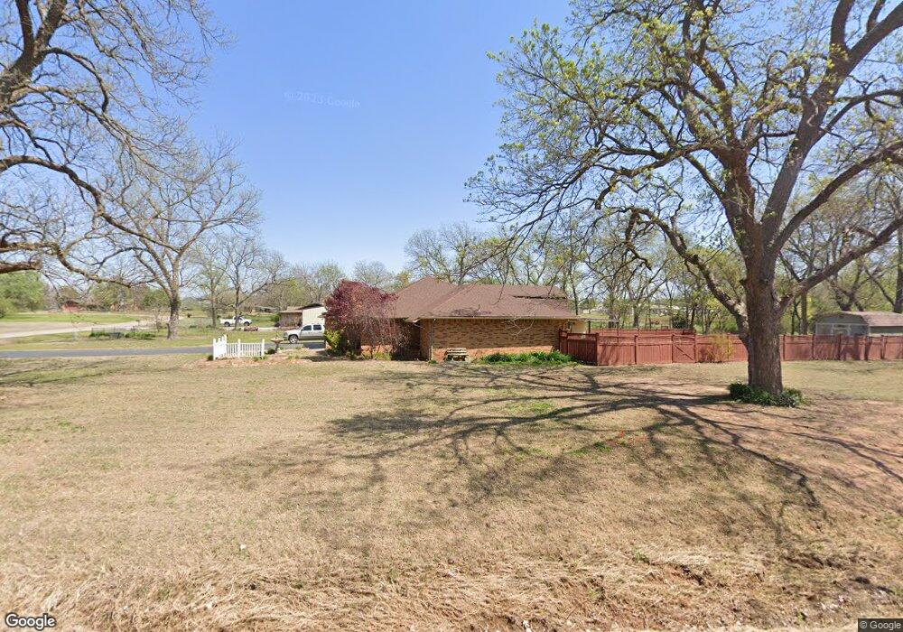
15 Brookridge Shawnee, OK 74804
Estimated Value: $232,613 - $260,000
3
Beds
2
Baths
1,595
Sq Ft
$157/Sq Ft
Est. Value
About This Home
This home is located at 15 Brookridge, Shawnee, OK 74804 and is currently estimated at $249,903, approximately $156 per square foot. 15 Brookridge is a home located in Pottawatomie County with nearby schools including Family Of Faith Christian School.
Ownership History
Date
Name
Owned For
Owner Type
Purchase Details
Closed on
Nov 21, 2006
Sold by
Williams H D and Williams Shirley
Bought by
Williams H D and Williams Shirley A
Current Estimated Value
Purchase Details
Closed on
May 3, 2005
Sold by
Ward Richard E and Ward Cheri A
Bought by
Williams Harold and Williams Shirley
Purchase Details
Closed on
Jul 25, 1997
Sold by
Brim Charles and Brim Candace
Bought by
Ward Richard and Ward Cheri
Purchase Details
Closed on
Jul 11, 1994
Sold by
Dilliner Tracy and Dilliner Saundra
Bought by
Brim Charles and Brim Candace
Create a Home Valuation Report for This Property
The Home Valuation Report is an in-depth analysis detailing your home's value as well as a comparison with similar homes in the area
Home Values in the Area
Average Home Value in this Area
Purchase History
| Date | Buyer | Sale Price | Title Company |
|---|---|---|---|
| Williams H D | -- | None Available | |
| Williams Harold | $122,500 | None Available | |
| Ward Richard | $88,000 | -- | |
| Brim Charles | $86,000 | -- |
Source: Public Records
Tax History Compared to Growth
Tax History
| Year | Tax Paid | Tax Assessment Tax Assessment Total Assessment is a certain percentage of the fair market value that is determined by local assessors to be the total taxable value of land and additions on the property. | Land | Improvement |
|---|---|---|---|---|
| 2024 | -- | $17,115 | $1,200 | $15,915 |
| 2023 | -- | $17,115 | $1,200 | $15,915 |
| 2022 | $0 | $17,115 | $1,200 | $15,915 |
| 2021 | $0 | $17,115 | $1,200 | $15,915 |
| 2020 | $2,023 | $17,060 | $1,200 | $15,860 |
| 2019 | $2,069 | $17,574 | $1,200 | $16,374 |
| 2018 | $0 | $16,874 | $1,142 | $15,732 |
| 2017 | $1,756 | $16,383 | $1,093 | $15,290 |
| 2016 | $1,404 | $15,906 | $1,043 | $14,863 |
| 2015 | $1,357 | $15,442 | $1,095 | $14,347 |
| 2014 | $1,315 | $14,993 | $1,055 | $13,938 |
Source: Public Records
Map
Nearby Homes
- 9676 Bryan Rd
- 10400 Bryan (40 Acres Tract #2) Rd
- 0 Carmin Dr
- 9429 Bryan Rd
- 10400 Rd
- 000 N Hwy 18 - 14 59 Acres
- 42072 Cadens Trail
- 10450 N Harrison
- 43304 Moccasin Trail Rd
- 0 Sebastian Trail
- 0 Steele St Unit 1153442
- 0 Steele St Unit 1153549
- 0 Steele St Unit 1153450
- 0 Steele St Unit 1153543
- 0 Steele St Unit 1153447
- 0 Steele St Unit 1153463
- 0 Steele St Unit 1153437
- 0 Steele St Unit 1153553
- 0 Steele St Unit 1153453
- 0 Steele St Unit 1153554