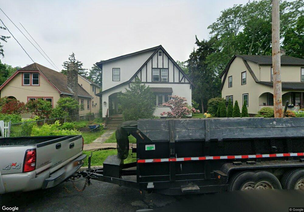
15 Brookside Ave Nyack, NY 10960
South Nyack NeighborhoodEstimated Value: $750,000
4
Beds
2
Baths
1,839
Sq Ft
$408/Sq Ft
Est. Value
About This Home
This home is located at 15 Brookside Ave, Nyack, NY 10960 and is currently priced at $750,000, approximately $407 per square foot. 15 Brookside Ave is a home located in Rockland County with nearby schools including Nyack Senior High School and Montessori Center Of Nyack-The River School.
Ownership History
Date
Name
Owned For
Owner Type
Purchase Details
Closed on
Oct 21, 2011
Sold by
Schulz Raymond W
Bought by
Louis Scott N
Current Estimated Value
Home Financials for this Owner
Home Financials are based on the most recent Mortgage that was taken out on this home.
Original Mortgage
$350,800
Outstanding Balance
$239,375
Interest Rate
4.11%
Mortgage Type
New Conventional
Purchase Details
Closed on
Oct 23, 2008
Sold by
Schulz Raymond W and Schulz Linda J
Bought by
Schulz Raymond W and Schulz Linda J
Create a Home Valuation Report for This Property
The Home Valuation Report is an in-depth analysis detailing your home's value as well as a comparison with similar homes in the area
Home Values in the Area
Average Home Value in this Area
Purchase History
| Date | Buyer | Sale Price | Title Company |
|---|---|---|---|
| Louis Scott N | $438,500 | Cynthia Costa-Trahan | |
| Louis Scott N | $438,500 | First American Title Ins Co | |
| Schulz Raymond W | -- | None Available |
Source: Public Records
Mortgage History
| Date | Status | Borrower | Loan Amount |
|---|---|---|---|
| Open | Louis Scott N | $350,800 |
Source: Public Records
Tax History
| Year | Tax Paid | Tax Assessment Tax Assessment Total Assessment is a certain percentage of the fair market value that is determined by local assessors to be the total taxable value of land and additions on the property. | Land | Improvement |
|---|---|---|---|---|
| 2021 | $12,934 | $172,800 | $32,700 | $140,100 |
| 2020 | $7,645 | $172,800 | $32,700 | $140,100 |
| 2019 | $2,636 | $172,800 | $32,700 | $140,100 |
| 2018 | $7,162 | $172,800 | $32,700 | $140,100 |
| 2017 | $9,291 | $172,800 | $32,700 | $140,100 |
| 2016 | $9,291 | $172,800 | $32,700 | $140,100 |
| 2015 | -- | $172,800 | $32,700 | $140,100 |
| 2014 | -- | $172,800 | $32,700 | $140,100 |
Source: Public Records
Map
Nearby Homes
- 53 Brookside Ave
- 9 Voorhis Point
- 64 White Ave
- 36 Prospect St
- 81 Elysian Ave
- 10 Prospect St
- 123 Depew Ave
- 1 Washington Ave
- 3 Remsen St
- 52 Glen Byron Ave
- 105 Jackson Ave
- 2 Shadyside Ave
- 2 Burd St Unit 3102
- 321 S Broadway
- 50 Gedney St
- 218 High Ave
- 17 1st Ave
- 28 Catherine St
- 26 Catherine St
- 52 Gedney St
- 11 Brookside Ave
- 17 Brookside Ave
- 128 Depot Place
- 127 Depot Place
- 9 Brookside Ave
- 194 S Franklin St
- 188 S Franklin St
- 126 Depot Place
- 198 S Franklin St
- 18 Brookside Ave
- 7 Brookside Ave
- 198A S Franklin St
- 200 S Franklin St
- 10 Brookside Ave
- 90 Clinton Ave
- 43 Brookside Ave
- 110 Clinton Ave
- 88 Clinton Ave
- 112 Clinton Ave
- 180 S Broadway
Your Personal Tour Guide
Ask me questions while you tour the home.