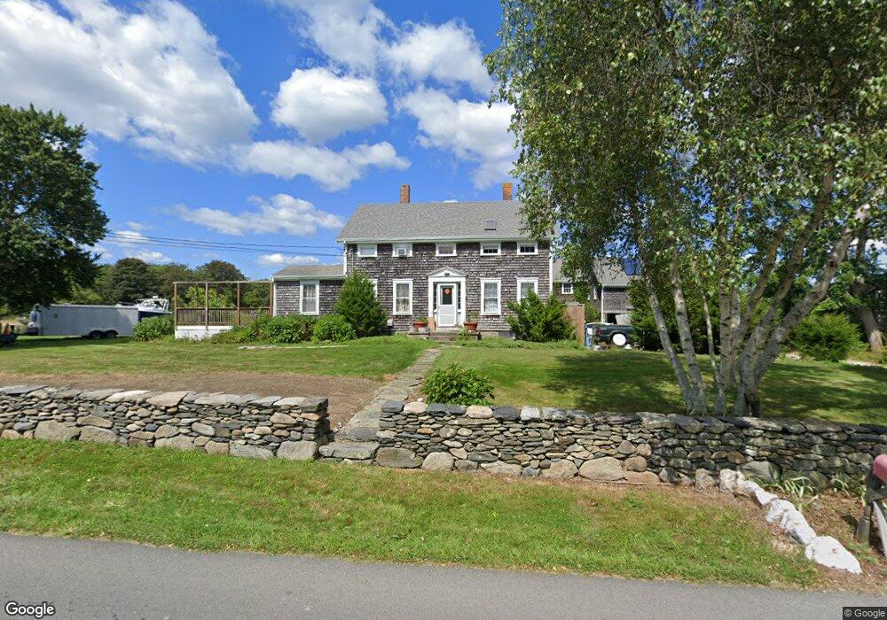
15 Brownell Rd Little Compton, RI 02837
Estimated Value: $1,208,000 - $1,914,891
--
Bed
--
Bath
--
Sq Ft
12.5
Acres
About This Home
This home is located at 15 Brownell Rd, Little Compton, RI 02837 and is currently estimated at $1,415,223. 15 Brownell Rd is a home located in Newport County with nearby schools including Wilbur & McMahon School.
Ownership History
Date
Name
Owned For
Owner Type
Purchase Details
Closed on
Jun 27, 1997
Sold by
Fisk Alice J Mclain
Bought by
Field Noel M
Current Estimated Value
Home Financials for this Owner
Home Financials are based on the most recent Mortgage that was taken out on this home.
Original Mortgage
$188,000
Interest Rate
7.81%
Create a Home Valuation Report for This Property
The Home Valuation Report is an in-depth analysis detailing your home's value as well as a comparison with similar homes in the area
Home Values in the Area
Average Home Value in this Area
Purchase History
| Date | Buyer | Sale Price | Title Company |
|---|---|---|---|
| Field Noel M | $235,000 | -- |
Source: Public Records
Mortgage History
| Date | Status | Borrower | Loan Amount |
|---|---|---|---|
| Open | Field Noel M | $178,143 | |
| Closed | Field Noel M | $230,000 | |
| Closed | Field Noel M | $25,000 | |
| Closed | Field Noel M | $188,000 |
Source: Public Records
Tax History Compared to Growth
Tax History
| Year | Tax Paid | Tax Assessment Tax Assessment Total Assessment is a certain percentage of the fair market value that is determined by local assessors to be the total taxable value of land and additions on the property. | Land | Improvement |
|---|---|---|---|---|
| 2025 | $5,326 | $1,111,900 | $556,100 | $555,800 |
| 2024 | $4,846 | $953,900 | $518,800 | $435,100 |
| 2023 | $4,731 | $953,900 | $518,800 | $435,100 |
| 2022 | $4,674 | $953,900 | $518,800 | $435,100 |
| 2021 | $4,720 | $781,400 | $468,400 | $313,000 |
| 2020 | $4,681 | $781,400 | $468,400 | $313,000 |
| 2019 | $4,634 | $781,400 | $468,400 | $313,000 |
| 2018 | $4,645 | $779,300 | $468,400 | $310,900 |
| 2016 | $4,419 | $779,300 | $468,400 | $310,900 |
| 2015 | $4,557 | $792,500 | $449,900 | $342,600 |
| 2014 | $4,470 | $792,500 | $449,900 | $342,600 |
Source: Public Records
Map
Nearby Homes
- 128 Maple Ave
- 141 S Of Commons Rd
- 18 Old Barn Rd
- 536 W Main Rd
- 0 Willow Ave
- 189 Brayton Point Rd
- 304 Brayton Point Rd
- 505 Long Hwy
- 255 John Dyer Rd
- 441 W Main Rd
- 19 Seabury Ln
- 180 W Main Rd
- 245 John Dyer Rd
- 17 Ferolbink Way
- 155 W Main Rd
- 83 Long Hwy
- 116 Amy Hart Path
- 6 June Way
- 55 W Main Rd
- 90 Two Rod Rd