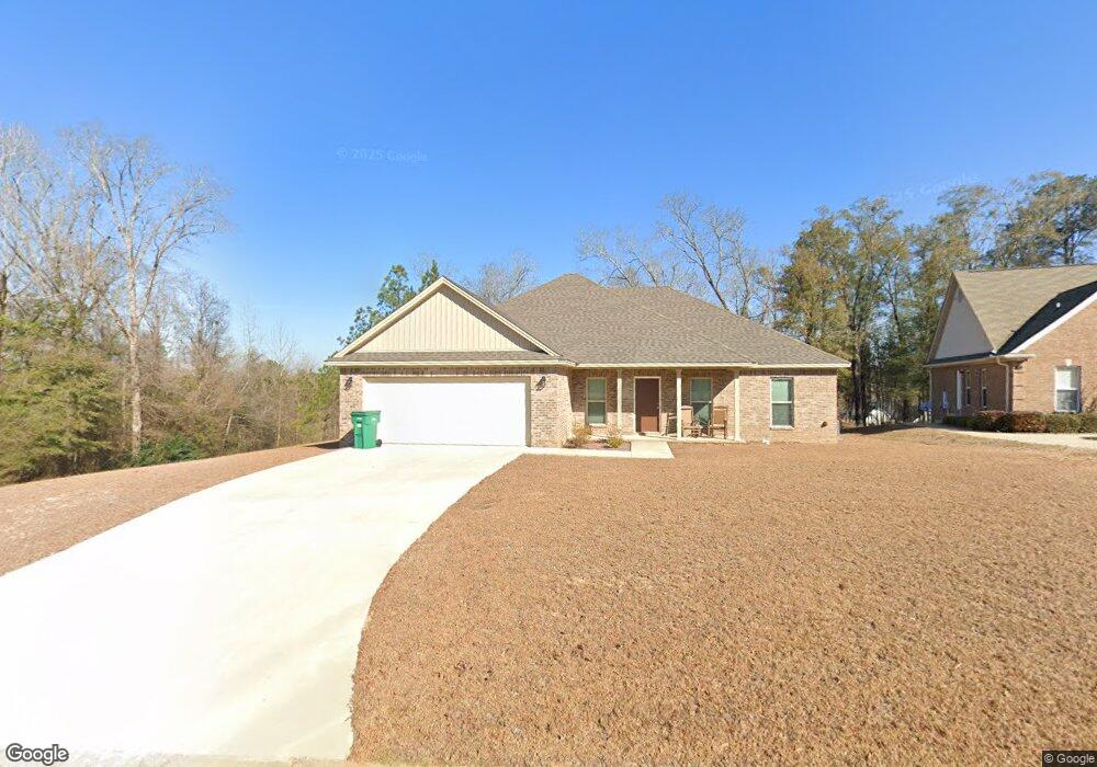
15 Brownstone Ct Elmore, AL 36025
Estimated Value: $275,000 - $286,000
Studio
--
Bath
1,920
Sq Ft
$146/Sq Ft
Est. Value
About This Home
This home is located at 15 Brownstone Ct, Elmore, AL 36025 and is currently estimated at $280,051, approximately $145 per square foot. 15 Brownstone Ct is a home located in Elmore County with nearby schools including Coosada Elementary School, Airport Road Intermediate School, and Millbrook Middle Junior High School.
Ownership History
Date
Name
Owned For
Owner Type
Purchase Details
Closed on
May 30, 2024
Sold by
Wilson Phyllis A and Wilson Edward Joseph
Bought by
Jensen Joshua Craig
Current Estimated Value
Home Financials for this Owner
Home Financials are based on the most recent Mortgage that was taken out on this home.
Original Mortgage
$252,000
Outstanding Balance
$247,486
Interest Rate
7.1%
Mortgage Type
VA
Estimated Equity
$32,565
Purchase Details
Closed on
Jan 15, 2021
Sold by
Dismukes Lee
Bought by
Wilson Phyllis A and Wilson Edward Joseph
Create a Home Valuation Report for This Property
The Home Valuation Report is an in-depth analysis detailing your home's value as well as a comparison with similar homes in the area
Home Values in the Area
Average Home Value in this Area
Purchase History
| Date | Buyer | Sale Price | Title Company |
|---|---|---|---|
| Jensen Joshua Craig | $252,000 | None Listed On Document | |
| Wilson Phyllis A | $209,900 | None Available |
Source: Public Records
Mortgage History
| Date | Status | Borrower | Loan Amount |
|---|---|---|---|
| Open | Jensen Joshua Craig | $252,000 |
Source: Public Records
Tax History
| Year | Tax Paid | Tax Assessment Tax Assessment Total Assessment is a certain percentage of the fair market value that is determined by local assessors to be the total taxable value of land and additions on the property. | Land | Improvement |
|---|---|---|---|---|
| 2025 | $903 | $29,860 | $0 | $0 |
| 2024 | $903 | $27,900 | $0 | $0 |
| 2023 | $689 | $278,900 | $30,000 | $248,900 |
| 2022 | $575 | $24,600 | $2,400 | $22,200 |
| 2021 | $144 | $4,800 | $4,800 | $0 |
| 2020 | $144 | $4,800 | $4,800 | $0 |
| 2019 | $144 | $4,800 | $4,800 | $0 |
| 2018 | $144 | $4,800 | $4,800 | $0 |
| 2017 | $144 | $4,800 | $4,800 | $0 |
| 2016 | $144 | $4,800 | $4,800 | $0 |
| 2014 | $144 | $24,000 | $24,000 | $0 |
Source: Public Records
Map
Nearby Homes
- 225 Brownstone Loop
- 246 Brownstone Loop
- 239 Brownstone Loop
- 274 Brownstone Loop
- 280 Brownstone Loop
- 245 Brownstone Loop
- 125 Brownstone Loop
- 145 Brownstone Loop
- 310 Brownstone Loop
- 105 Brownstone Loop
- 325 Brownstone Loop
- 40 Brownstone Way
- 6835 Sanders Dr
- 186 Lake Bend Cove
- 4980 Longview Rd
- 6735 Pineleaf Dr
- 4820 Alabama 14
- 6480 Pineleaf Dr
- 173 Brittany Dr S
- 115 Pine Meadows Cir
- 15 Brownstone Ct
- 210 Brownstone Loop
- 21 Brownstone Ct
- 0-Lot 21C Brownstone Ct
- 25 Brownstone Ct
- 176 Brownstone Loop
- 25 Brownstone Ct
- 16 Brownstone Ct
- 177 Brownstone Loop
- 35 Brownstone Ct
- 26 Brownstone Ct
- 36 Brownstone Ct
- 26 Brownstone Ct
- 158 Brownstone Loop
- 396 Brownstone Loop
- 416 Brownstone Loop
- 253 Brownstone Loop
- 386 Brownstone Loop
- 426 Brownstone Loop
- 261 Brownstone Loop
Your Personal Tour Guide
Ask me questions while you tour the home.