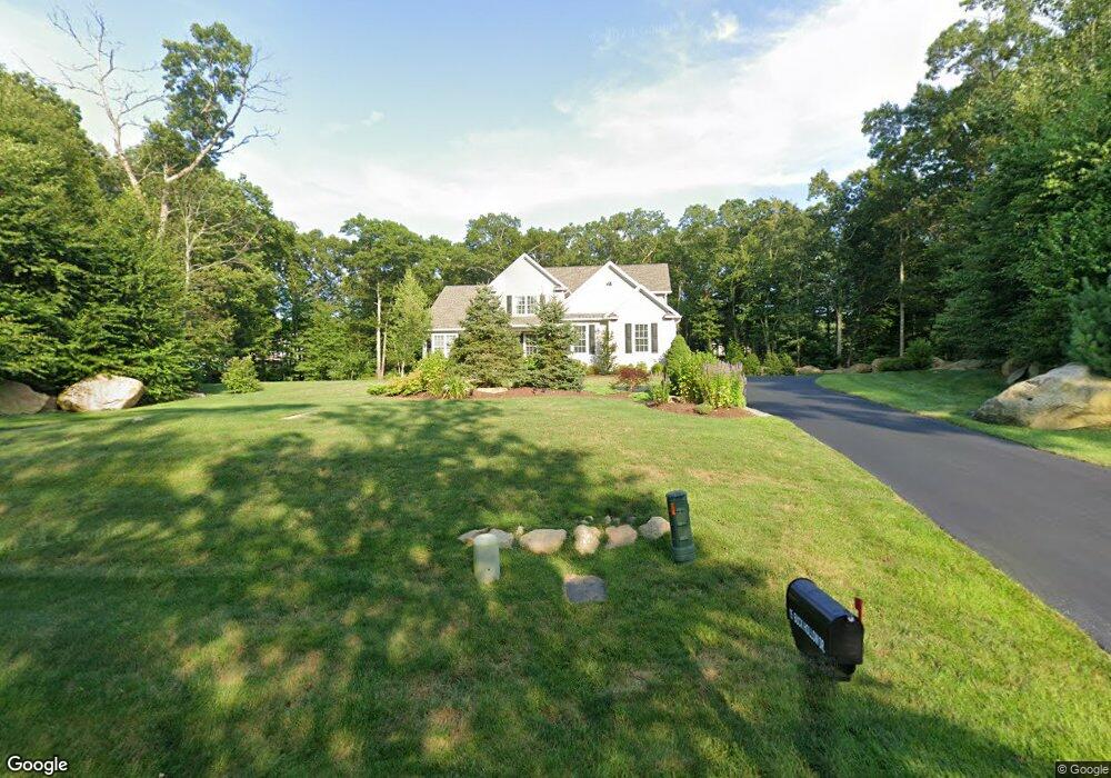
15 Buck Hollow Dr Unit 1111701 West Greenwich, RI 02817
Tillinghast NeighborhoodEstimated Value: $1,034,000 - $1,254,000
4
Beds
3
Baths
3,024
Sq Ft
$394/Sq Ft
Est. Value
About This Home
This home is located at 15 Buck Hollow Dr Unit 1111701, West Greenwich, RI 02817 and is currently estimated at $1,192,378, approximately $394 per square foot. 15 Buck Hollow Dr Unit 1111701 is a home located in Kent County with nearby schools including Mildred E. Lineham School, Metcalf School, and Wawaloam School.
Ownership History
Date
Name
Owned For
Owner Type
Purchase Details
Closed on
Aug 5, 2019
Sold by
Dre Investments Llc
Bought by
Calvo Kenneth H and Calvo Kelli A
Current Estimated Value
Home Financials for this Owner
Home Financials are based on the most recent Mortgage that was taken out on this home.
Original Mortgage
$743,894
Outstanding Balance
$652,848
Interest Rate
3.8%
Mortgage Type
Purchase Money Mortgage
Estimated Equity
$539,530
Create a Home Valuation Report for This Property
The Home Valuation Report is an in-depth analysis detailing your home's value as well as a comparison with similar homes in the area
Home Values in the Area
Average Home Value in this Area
Purchase History
| Date | Buyer | Sale Price | Title Company |
|---|---|---|---|
| Calvo Kenneth H | $783,048 | -- |
Source: Public Records
Mortgage History
| Date | Status | Borrower | Loan Amount |
|---|---|---|---|
| Open | Calvo Kenneth H | $743,894 |
Source: Public Records
Tax History Compared to Growth
Tax History
| Year | Tax Paid | Tax Assessment Tax Assessment Total Assessment is a certain percentage of the fair market value that is determined by local assessors to be the total taxable value of land and additions on the property. | Land | Improvement |
|---|---|---|---|---|
| 2024 | $14,963 | $935,200 | $288,800 | $646,400 |
| 2023 | $19,365 | $790,100 | $231,100 | $559,000 |
| 2022 | $19,365 | $790,100 | $231,100 | $559,000 |
| 2021 | $18,986 | $790,100 | $231,100 | $559,000 |
| 2020 | $18,796 | $790,100 | $231,100 | $559,000 |
| 2019 | $13,729 | $568,000 | $231,100 | $336,900 |
| 2018 | $3,903 | $231,100 | $231,100 | $0 |
| 2017 | $3,714 | $231,100 | $231,100 | $0 |
| 2016 | $2,783 | $173,200 | $173,200 | $0 |
| 2015 | $3,906 | $173,200 | $173,200 | $0 |
| 2013 | $3,389 | $150,300 | $150,300 | $0 |
Source: Public Records
Map
Nearby Homes
- 11 Cedar Ridge Ln
- 21 Cedar Ridge Ln
- 2 Corr Way
- 25 Westfield Dr
- 2500 Division Rd
- 1901 Village Green Cir
- 20 Mcpartland Way
- 1 Nichole Ln
- 18 Jade Rd
- 11 Cheyenne Trail
- 32 Wescott Way Unit 53
- 15 Hampton Rd Unit 20
- 19 Hampton Rd Unit 69
- 40 Wescott Way Unit 57
- 1 Hampton Rd Unit 27
- 1 Stephanie Dr
- 29 Enzo Dr
- 69 Bates Trail
- 199 Mishnock Rd
- 60 Pheasant Dr
- 15 Buck Hollow Dr
- 9 Buck Hollow Rd
- 9 Buck Hollow Dr
- 55 Deer Run Dr
- 0 Doe Place Unit 1042087
- 0 Doe Place Unit 1081374
- 26 Buck Hollow Dr
- 20 Buck Hollow Dr
- 20 Buck Hollow Dr
- 19 Buck Hollow Dr
- 6 Doe Place
- 5 Doe Place
- 11 Doe Place
- 16 Buck Hollow Dr
- 0 Tiffany Ln
- 0 - 17 Buck Hollow Dr Unit 1108373
- 0 - 19 Buck Hollow Dr Unit 1108369
- 0 Buck Hollow Dr
- 76 Deer Run Dr
- 54 Buck Hollow Dr