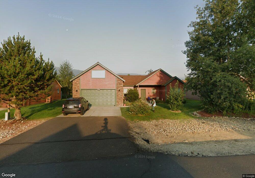
15 Buckskin Rd Donnelly, ID 83615
Estimated Value: $449,908 - $483,000
3
Beds
1
Bath
1,760
Sq Ft
$266/Sq Ft
Est. Value
About This Home
This home is located at 15 Buckskin Rd, Donnelly, ID 83615 and is currently estimated at $467,977, approximately $265 per square foot. 15 Buckskin Rd is a home located in Valley County with nearby schools including Donnelly Elementary School and McCall-Donnelly High School.
Ownership History
Date
Name
Owned For
Owner Type
Purchase Details
Closed on
May 24, 2019
Sold by
Hushman Shawn A and Hushman Deidre E
Bought by
Hushman Family Trust
Current Estimated Value
Purchase Details
Closed on
Jan 23, 2009
Sold by
U S Bank Na
Bought by
Hushman Shawn A and Hushman Deidre
Home Financials for this Owner
Home Financials are based on the most recent Mortgage that was taken out on this home.
Original Mortgage
$92,000
Outstanding Balance
$57,340
Interest Rate
4.92%
Mortgage Type
New Conventional
Estimated Equity
$410,637
Purchase Details
Closed on
Nov 24, 2008
Sold by
Delavoye Serge H and Delavoye Michelle T
Bought by
Us Bank Na
Home Financials for this Owner
Home Financials are based on the most recent Mortgage that was taken out on this home.
Original Mortgage
$92,000
Outstanding Balance
$57,340
Interest Rate
4.92%
Mortgage Type
New Conventional
Estimated Equity
$410,637
Purchase Details
Closed on
Aug 23, 2006
Sold by
Timberline Development Llc
Bought by
Delavoye Serge M and Delavoye Michelle T
Home Financials for this Owner
Home Financials are based on the most recent Mortgage that was taken out on this home.
Original Mortgage
$53,269
Interest Rate
6.67%
Mortgage Type
New Conventional
Create a Home Valuation Report for This Property
The Home Valuation Report is an in-depth analysis detailing your home's value as well as a comparison with similar homes in the area
Home Values in the Area
Average Home Value in this Area
Purchase History
| Date | Buyer | Sale Price | Title Company |
|---|---|---|---|
| Hushman Family Trust | -- | Amerititle Cascade | |
| Hushman Shawn A | -- | -- | |
| Us Bank Na | $190,760 | -- | |
| Delavoye Serge M | -- | -- |
Source: Public Records
Mortgage History
| Date | Status | Borrower | Loan Amount |
|---|---|---|---|
| Open | Hushman Shawn A | $92,000 | |
| Previous Owner | Delavoye Serge M | $53,269 |
Source: Public Records
Tax History Compared to Growth
Tax History
| Year | Tax Paid | Tax Assessment Tax Assessment Total Assessment is a certain percentage of the fair market value that is determined by local assessors to be the total taxable value of land and additions on the property. | Land | Improvement |
|---|---|---|---|---|
| 2025 | $1,202 | $430,732 | $26,600 | $404,132 |
| 2023 | $1,202 | $492,457 | $27,445 | $465,012 |
| 2022 | $1,343 | $441,758 | $27,445 | $414,313 |
| 2021 | $1,227 | $257,626 | $21,111 | $236,515 |
| 2020 | $1,184 | $207,562 | $26,207 | $181,355 |
| 2019 | $1,007 | $161,367 | $24,959 | $136,408 |
| 2018 | $986 | $149,179 | $23,408 | $125,771 |
| 2017 | $1,065 | $147,567 | $26,798 | $120,769 |
| 2016 | $1,034 | $141,231 | $33,000 | $108,231 |
| 2015 | $459 | $118,307 | $0 | $0 |
| 2013 | -- | $115,350 | $0 | $0 |
Source: Public Records
Map
Nearby Homes
- 16 Buckskin Dr
- 22 Charters Dr
- 13111 Cameron Dr
- 13078 Hill House Loop
- 13076 Hill House Loop
- 13091 Hill House Loop
- 13098 Hill House Loop
- Lot 4 Hideout Dr Unit 4
- Lot 6 Hideout Dr Unit 6
- 24 Mangum Cir Unit 1
- 20 #5 W Mangum Cir Unit 5
- 20 Mangum Cir Unit 8
- 24 Mangum Dr Unit # 1 Unit 1
- 106 Forest Place
- 35 1 Mangum Cir
- 35 Mangum Cir Unit 1
- 32 Mangum Cir Unit 3
- 32 Mangum Cir
- 120 Forest Place
- 34 Mangum Cir Unit 8
- 15 Buckskin Dr
- 13 Buckskin Dr
- 13 Buckskin Rd
- 17 Buckskin Rd
- 17 Buckskin Dr
- 14 Timberline Dr
- 18 Timberline Dr
- 17 Buckskin
- 19 Buckskin Rd
- 19 Buckskin Dr
- 14 Buckskin Rd
- 14 Buckskin Dr
- 12 Buckskin Dr
- 12 Buckskin Dr
- 16 Buckskin Rd
- 20 Timberline Dr
- 18 Buckskin Rd
- 18 Buckskin Dr
- 21 Buckskin Rd
- 21 Buckskin Dr