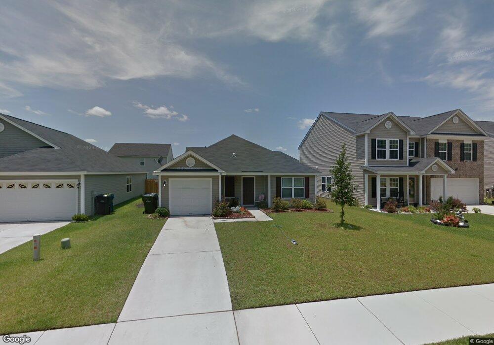
15 Burnt Oak Rd Port Wentworth, GA 31407
Estimated Value: $249,824 - $291,000
--
Bed
--
Bath
1,224
Sq Ft
$219/Sq Ft
Est. Value
About This Home
This home is located at 15 Burnt Oak Rd, Port Wentworth, GA 31407 and is currently estimated at $268,206, approximately $219 per square foot. 15 Burnt Oak Rd is a home located in Chatham County with nearby schools including Rice Creek K-8 School and Groves High School.
Ownership History
Date
Name
Owned For
Owner Type
Purchase Details
Closed on
Nov 4, 2009
Sold by
Millie Homes Inc
Bought by
Clay Darren C
Current Estimated Value
Home Financials for this Owner
Home Financials are based on the most recent Mortgage that was taken out on this home.
Original Mortgage
$128,469
Outstanding Balance
$83,541
Interest Rate
4.92%
Mortgage Type
New Conventional
Estimated Equity
$184,665
Purchase Details
Closed on
Sep 3, 2009
Sold by
Rice Creek Investments Llc
Bought by
Millie Homes Inc
Home Financials for this Owner
Home Financials are based on the most recent Mortgage that was taken out on this home.
Original Mortgage
$96,000
Interest Rate
5.15%
Mortgage Type
New Conventional
Purchase Details
Closed on
Aug 28, 2007
Sold by
Not Provided
Bought by
Clay Darren C
Create a Home Valuation Report for This Property
The Home Valuation Report is an in-depth analysis detailing your home's value as well as a comparison with similar homes in the area
Home Values in the Area
Average Home Value in this Area
Purchase History
| Date | Buyer | Sale Price | Title Company |
|---|---|---|---|
| Clay Darren C | $125,900 | -- | |
| Millie Homes Inc | $40,720 | -- | |
| Clay Darren C | -- | -- |
Source: Public Records
Mortgage History
| Date | Status | Borrower | Loan Amount |
|---|---|---|---|
| Open | Clay Darren C | $128,469 | |
| Previous Owner | Millie Homes Inc | $96,000 |
Source: Public Records
Tax History Compared to Growth
Tax History
| Year | Tax Paid | Tax Assessment Tax Assessment Total Assessment is a certain percentage of the fair market value that is determined by local assessors to be the total taxable value of land and additions on the property. | Land | Improvement |
|---|---|---|---|---|
| 2025 | $1,984 | $95,920 | $22,000 | $73,920 |
| 2024 | $1,984 | $85,240 | $12,000 | $73,240 |
| 2023 | $1,234 | $75,880 | $12,000 | $63,880 |
| 2022 | $1,716 | $69,600 | $12,000 | $57,600 |
| 2021 | $1,749 | $61,000 | $12,000 | $49,000 |
| 2020 | $1,565 | $55,120 | $12,000 | $43,120 |
| 2019 | $1,565 | $50,680 | $12,000 | $38,680 |
| 2018 | $1,544 | $49,160 | $12,000 | $37,160 |
| 2017 | $1,450 | $49,520 | $12,000 | $37,520 |
| 2016 | $1,433 | $49,000 | $12,000 | $37,000 |
| 2015 | $1,455 | $49,600 | $12,000 | $37,600 |
| 2014 | $2,158 | $50,240 | $0 | $0 |
Source: Public Records
Map
Nearby Homes
- 109 Miller Park Cir
- 66 Noble Jones Ct
- 7961 Ga Highway 21
- Dayton Plan at Brookline
- Spring Valley II Plan at Brookline
- Stillwater Plan at Brookline
- Grayson TR Plan at Rice Creek
- Richmond Plan at Brookline
- Spring Garden TR Plan at Rice Creek
- Crestview Plan at Brookline
- Spring Valley II TR Plan at Rice Creek
- Bismarck II TR Plan at Rice Creek
- Blue Ridge TR Plan at Rice Creek
- Crestview TR Plan at Rice Creek
- Pinehurst II Plan at Brookline
- Avery Plan at Brookline
- Brookline Plan at Brookline
- 108 Hasty Point Rd
- 110 Hasty Point Rd
- 112 Hasty Point Rd
- 13 Burnt Oak Rd
- 17 Burnt Oak Rd
- 11 Burnt Oak Rd
- 19 Burnt Oak Rd
- 70 Old Mill Rd
- 72 Old Mill Rd
- 68 Old Mill Rd
- 68 Old Mill Rd
- 66 Old Mill Rd
- 74 Old Mill Rd
- 74 Old Mill Rd
- 14 Burnt Oak Rd
- 16 Burnt Oak Rd
- 12 Burnt Oak Rd
- 18 Burnt Oak Rd
- 64 Old Mill Rd
- 64 Old Mill Rd
- 10 Burnt Oak Rd
- 20 Burnt Oak Rd
- 62 Old Mill Rd