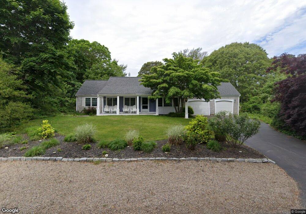
15 Camelot Rd Yarmouth Port, MA 02675
Yarmouth Port NeighborhoodEstimated Value: $812,848 - $989,000
3
Beds
3
Baths
2,108
Sq Ft
$426/Sq Ft
Est. Value
About This Home
This home is located at 15 Camelot Rd, Yarmouth Port, MA 02675 and is currently estimated at $897,212, approximately $425 per square foot. 15 Camelot Rd is a home located in Barnstable County with nearby schools including Dennis-Yarmouth Regional High School, St. Pius X. School, and Trinity Christian Academy of Cape Cod.
Ownership History
Date
Name
Owned For
Owner Type
Purchase Details
Closed on
Feb 13, 2018
Sold by
Twomey James
Bought by
Twomey Ft
Current Estimated Value
Purchase Details
Closed on
Dec 20, 2017
Sold by
Twomey James and Johnson Kristina
Bought by
Twomey James
Purchase Details
Closed on
Jan 12, 2009
Sold by
Twomey Edmund D
Bought by
Twomey Ft
Create a Home Valuation Report for This Property
The Home Valuation Report is an in-depth analysis detailing your home's value as well as a comparison with similar homes in the area
Home Values in the Area
Average Home Value in this Area
Purchase History
| Date | Buyer | Sale Price | Title Company |
|---|---|---|---|
| Twomey Ft | -- | -- | |
| Twomey James | $188,000 | -- | |
| Twomey James | -- | -- | |
| Twomey Ft | -- | -- |
Source: Public Records
Tax History Compared to Growth
Tax History
| Year | Tax Paid | Tax Assessment Tax Assessment Total Assessment is a certain percentage of the fair market value that is determined by local assessors to be the total taxable value of land and additions on the property. | Land | Improvement |
|---|---|---|---|---|
| 2025 | $5,797 | $818,800 | $253,000 | $565,800 |
| 2024 | $5,531 | $749,400 | $242,100 | $507,300 |
| 2023 | $5,533 | $682,300 | $220,000 | $462,300 |
| 2022 | $4,810 | $524,000 | $175,700 | $348,300 |
| 2021 | $4,854 | $507,700 | $189,000 | $318,700 |
| 2020 | $4,818 | $481,800 | $201,800 | $280,000 |
| 2019 | $4,355 | $431,200 | $201,800 | $229,400 |
| 2018 | $4,345 | $422,300 | $192,900 | $229,400 |
| 2017 | $4,231 | $422,300 | $192,900 | $229,400 |
| 2016 | $4,215 | $422,300 | $192,900 | $229,400 |
| 2015 | $4,107 | $409,100 | $192,900 | $216,200 |
Source: Public Records
Map
Nearby Homes
- 23 Dauphine Dr
- 24 Minnetuxet Way
- 371 Route 6a
- 2 Pine Grove
- 933-935 W Yarmouth Rd
- 25 Oak Glen
- 25 Oak Glen Village Unit 25
- 30 W Woods Cir Unit 30
- 30 W Woods
- 7 Forest Gate Unit 7
- 1 Barnacle Rd
- 882 W Yarmouth Rd
- 34 Ridgewood Dr
- 186 Route 6a
- 68 Seminole Dr
- 43 Canterbury Rd
- 17 Kates Path Unit A
- 228 Kates Path
- 86 Pompano Rd
- 162 Route 6a