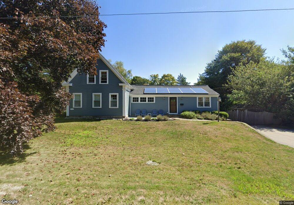
15 Captain Pierce Rd Scituate, MA 02066
Estimated Value: $884,000 - $1,011,000
4
Beds
2
Baths
1,800
Sq Ft
$525/Sq Ft
Est. Value
About This Home
This home is located at 15 Captain Pierce Rd, Scituate, MA 02066 and is currently estimated at $944,990, approximately $524 per square foot. 15 Captain Pierce Rd is a home located in Plymouth County with nearby schools including Hatherly Elementary School, Lester J. Gates Middle School, and Scituate High School.
Ownership History
Date
Name
Owned For
Owner Type
Purchase Details
Closed on
Aug 4, 1997
Sold by
Westerman Jewell G
Bought by
Mckain Joshua and Mckain Amy W
Current Estimated Value
Purchase Details
Closed on
Apr 2, 1997
Sold by
Safford Holly
Bought by
Westerman Jewell G
Create a Home Valuation Report for This Property
The Home Valuation Report is an in-depth analysis detailing your home's value as well as a comparison with similar homes in the area
Home Values in the Area
Average Home Value in this Area
Purchase History
| Date | Buyer | Sale Price | Title Company |
|---|---|---|---|
| Mckain Joshua | $257,000 | -- | |
| Westerman Jewell G | $248,800 | -- |
Source: Public Records
Mortgage History
| Date | Status | Borrower | Loan Amount |
|---|---|---|---|
| Open | Westerman Jewell G | $375,000 | |
| Closed | Westerman Jewell G | $161,000 |
Source: Public Records
Tax History Compared to Growth
Tax History
| Year | Tax Paid | Tax Assessment Tax Assessment Total Assessment is a certain percentage of the fair market value that is determined by local assessors to be the total taxable value of land and additions on the property. | Land | Improvement |
|---|---|---|---|---|
| 2025 | $7,542 | $755,000 | $393,800 | $361,200 |
| 2024 | $7,379 | $712,300 | $358,000 | $354,300 |
| 2023 | $7,335 | $659,000 | $343,500 | $315,500 |
| 2022 | $6,222 | $493,000 | $316,000 | $177,000 |
| 2021 | $6,092 | $457,000 | $301,000 | $156,000 |
| 2020 | $5,994 | $444,000 | $289,400 | $154,600 |
| 2019 | $5,981 | $435,300 | $283,700 | $151,600 |
| 2018 | $6,105 | $437,600 | $293,200 | $144,400 |
| 2017 | $6,000 | $425,800 | $281,400 | $144,400 |
| 2016 | $5,615 | $397,100 | $258,000 | $139,100 |
| 2015 | $5,047 | $385,300 | $246,200 | $139,100 |
Source: Public Records
Map
Nearby Homes
- 1 Hillside Rd
- 59 Captain Peirce Rd
- 2 Windward Ln
- 54 Woodland Rd
- 378 Tilden Rd
- 22 Kings Way
- 355 Tilden Rd
- 46 Marys Ln
- 7 Borden Rd
- 30 Irving Rd
- 14 Aberdeen Dr
- 112 Hollett St
- 55 Seaside Rd
- 13 Hornbeam Rd
- 209 Hatherly Rd
- 290 Beaver Dam Rd
- 16 3 Ring Rd
- 18 James Way
- 29 Country Club Cir
- 23 Lois Ann Ct Unit 23
- 15 Captain Peirce Rd
- 9 Captain Pierce Rd
- 12 Captain Pierce Rd
- 21 Captain Pierce Rd
- 18 Captain Peirce Rd
- 11 Cairnslea Ln
- 1 Captain Pierce Rd
- 2 Captain Pierce Rd
- 453 Tilden Rd
- 27 Captain Pierce Rd
- 22 Captain Peirce Rd
- 12 Cairnslea Ln
- 458 Tilden Rd
- 17 Cairnslea Ln
- 49 Rosas Ln
- 445 Tilden Rd
- 10 Ann Vinal Rd
- 6 Ann Vinal Rd
- 5 Mann Hill Rd
- 15 Ann Vinal Rd