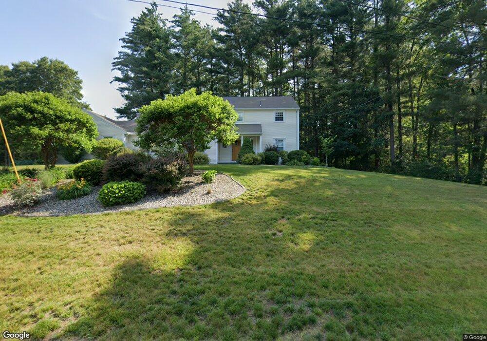
15 Captain Rd Wilbraham, MA 01095
Estimated Value: $570,963 - $723,000
4
Beds
3
Baths
2,827
Sq Ft
$223/Sq Ft
Est. Value
About This Home
This home is located at 15 Captain Rd, Wilbraham, MA 01095 and is currently estimated at $630,991, approximately $223 per square foot. 15 Captain Rd is a home located in Hampden County with nearby schools including Minnechaug Regional High School, Springfield International Charter School, and Wilbraham & Monson Academy.
Ownership History
Date
Name
Owned For
Owner Type
Purchase Details
Closed on
Jun 30, 2011
Sold by
Murner Robert L and Murner Christine
Bought by
Pelletier Brian and Pelletier Brian G
Current Estimated Value
Home Financials for this Owner
Home Financials are based on the most recent Mortgage that was taken out on this home.
Original Mortgage
$337,725
Outstanding Balance
$233,548
Interest Rate
4.62%
Estimated Equity
$397,443
Purchase Details
Closed on
Aug 21, 2002
Sold by
Rosenthal Thomas G and Rosenthal Deborah R
Bought by
Murner Robert L and Murner Christine
Home Financials for this Owner
Home Financials are based on the most recent Mortgage that was taken out on this home.
Original Mortgage
$210,000
Interest Rate
6.57%
Mortgage Type
Purchase Money Mortgage
Create a Home Valuation Report for This Property
The Home Valuation Report is an in-depth analysis detailing your home's value as well as a comparison with similar homes in the area
Home Values in the Area
Average Home Value in this Area
Purchase History
| Date | Buyer | Sale Price | Title Company |
|---|---|---|---|
| Pelletier Brian | $355,500 | -- | |
| Murner Robert L | $263,000 | -- |
Source: Public Records
Mortgage History
| Date | Status | Borrower | Loan Amount |
|---|---|---|---|
| Open | Pelletier Brian | $337,725 | |
| Previous Owner | Murner Robert L | $210,000 | |
| Previous Owner | Murner Robert L | $66,000 | |
| Previous Owner | Murner Robert L | $50,000 |
Source: Public Records
Tax History
| Year | Tax Paid | Tax Assessment Tax Assessment Total Assessment is a certain percentage of the fair market value that is determined by local assessors to be the total taxable value of land and additions on the property. | Land | Improvement |
|---|---|---|---|---|
| 2025 | $8,727 | $488,100 | $105,200 | $382,900 |
| 2024 | $9,313 | $503,400 | $105,200 | $398,200 |
| 2023 | $8,454 | $455,000 | $105,200 | $349,800 |
| 2022 | $8,454 | $412,600 | $105,200 | $307,400 |
| 2021 | $7,983 | $347,700 | $111,600 | $236,100 |
| 2020 | $7,782 | $347,700 | $111,600 | $236,100 |
| 2019 | $7,582 | $347,800 | $111,600 | $236,200 |
| 2018 | $7,559 | $333,900 | $111,600 | $222,300 |
| 2017 | $7,346 | $333,900 | $111,600 | $222,300 |
| 2016 | $6,841 | $316,700 | $124,000 | $192,700 |
| 2015 | $6,613 | $316,700 | $124,000 | $192,700 |
Source: Public Records
Map
Nearby Homes
- 104 High Pine Cir
- 35 Lake Dr
- 1 Aspen Dr
- 4 Hillcrest Dr
- 46 Washington Rd
- 8 Patriot Ridge Ln
- 20 Old Orchard Rd
- 6 Teak Terrace Unit 24
- 3 Mohawk St
- 103 Sandalwood Dr Unit site 00
- 57 Sandalwood Dr Unit site 61
- 111 Sandalwood Dr Unit site 00
- 84 Sandalwood Dr Unit site 00
- 16 Maple St
- 22 Brainard Rd
- 36 Maple St
- 26 Sandalwood Dr
- 474 Mountain Rd
- 474-480 Mountain Rd
- 24 Lodge Ln Unit 24
- 11 Captain Rd
- 6 Marilyn Dr
- 5 Marilyn Dr
- 10 Captain Rd
- 3 Blueberry Hill Rd
- 7 Marilyn Dr
- 9 Captain Rd
- 3 Marilyn Dr
- 4 Blueberry Hill Rd
- 8 Marilyn Dr
- 9 Marilyn Dr
- 5 Blueberry Hill Rd
- 2 Marilyn Dr
- 6 Blueberry Hill Rd
- 10 Marilyn Dr
- 7 Blueberry Hill Rd
- 5 Captain Rd
- 8 Blueberry Hill Rd
- 27 Leemond St
- 3 Captain Rd
Your Personal Tour Guide
Ask me questions while you tour the home.