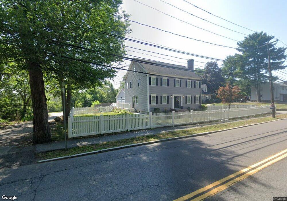
15 Carlin Rd Waltham, MA 02451
North Waltham NeighborhoodEstimated Value: $1,022,000 - $1,095,000
4
Beds
3
Baths
2,500
Sq Ft
$419/Sq Ft
Est. Value
About This Home
This home is located at 15 Carlin Rd, Waltham, MA 02451 and is currently estimated at $1,047,071, approximately $418 per square foot. 15 Carlin Rd is a home located in Middlesex County with nearby schools including Douglas Macarthur Elementary School, John F Kennedy Middle School, and Waltham Sr High School.
Ownership History
Date
Name
Owned For
Owner Type
Purchase Details
Closed on
Nov 2, 2018
Sold by
Farhadi Darvin
Bought by
Qian Dazhi
Current Estimated Value
Purchase Details
Closed on
Jun 11, 2018
Sold by
Petrarca Michelle
Bought by
Farhadi Darvin
Home Financials for this Owner
Home Financials are based on the most recent Mortgage that was taken out on this home.
Original Mortgage
$544,000
Interest Rate
4.5%
Mortgage Type
New Conventional
Purchase Details
Closed on
May 2, 1997
Sold by
Strait Linda A
Bought by
Farhadi Darvin and Farhadi Shervin
Create a Home Valuation Report for This Property
The Home Valuation Report is an in-depth analysis detailing your home's value as well as a comparison with similar homes in the area
Home Values in the Area
Average Home Value in this Area
Purchase History
| Date | Buyer | Sale Price | Title Company |
|---|---|---|---|
| Qian Dazhi | $730,000 | -- | |
| Farhadi Darvin | -- | -- | |
| Farhadi Darvin | -- | -- | |
| Farhadi Darvin | -- | -- | |
| Farhadi Darvin | $260,000 | -- |
Source: Public Records
Mortgage History
| Date | Status | Borrower | Loan Amount |
|---|---|---|---|
| Previous Owner | Farhadi Darvin | $544,000 | |
| Previous Owner | Farhadi Darvin | $283,200 |
Source: Public Records
Tax History Compared to Growth
Tax History
| Year | Tax Paid | Tax Assessment Tax Assessment Total Assessment is a certain percentage of the fair market value that is determined by local assessors to be the total taxable value of land and additions on the property. | Land | Improvement |
|---|---|---|---|---|
| 2025 | $9,123 | $929,000 | $504,400 | $424,600 |
| 2024 | $8,263 | $857,200 | $482,000 | $375,200 |
| 2023 | $8,026 | $777,700 | $437,400 | $340,300 |
| 2022 | $8,046 | $722,300 | $392,800 | $329,500 |
| 2021 | $6,169 | $702,600 | $392,800 | $309,800 |
| 2020 | $6,190 | $672,400 | $366,000 | $306,400 |
| 2019 | $7,799 | $616,000 | $361,500 | $254,500 |
| 2018 | $7,181 | $569,500 | $334,700 | $234,800 |
| 2017 | $6,874 | $538,300 | $303,500 | $234,800 |
| 2016 | $6,371 | $520,500 | $285,700 | $234,800 |
| 2015 | $6,298 | $479,700 | $249,900 | $229,800 |
Source: Public Records
Map
Nearby Homes
- 14 Benjamin Rd
- 28 Goldencrest Ave
- 15 Kings Way Unit 25
- 98 Seminole Ave
- 249 Lake St
- 234 Lake St
- 463 Lincoln St
- 102 Milner St
- 92 Milner St
- 11 Autumn Ln
- 30 Wampum Ave
- 129 Lake St
- 1105 Lexington St Unit 102
- 28 Hillcrest St
- 30 Jacqueline Rd Unit C
- 5 April Ln Unit 12
- 65 Montclair Ave
- 14 Piedmont Ave
- 311 Concord Ave
- 15 Cedarcroft Ln