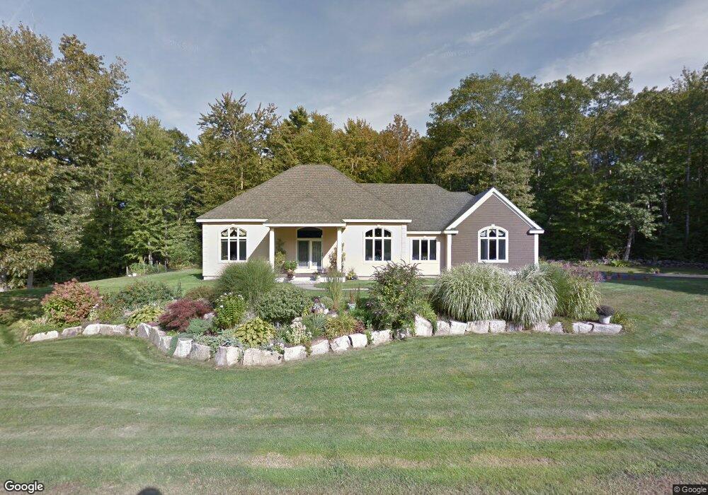
15 Carrie Lynn Ln York, ME 03909
York NeighborhoodEstimated Value: $1,012,708 - $1,335,000
4
Beds
4
Baths
3,237
Sq Ft
$353/Sq Ft
Est. Value
About This Home
This home is located at 15 Carrie Lynn Ln, York, ME 03909 and is currently estimated at $1,142,927, approximately $353 per square foot. 15 Carrie Lynn Ln is a home located in York County with nearby schools including Village Elementary School, Coastal Ridge Elementary School, and York Middle School.
Ownership History
Date
Name
Owned For
Owner Type
Purchase Details
Closed on
Aug 13, 2010
Sold by
Gleason Timothy and Gleason Barbara
Bought by
Murch Richard H
Current Estimated Value
Home Financials for this Owner
Home Financials are based on the most recent Mortgage that was taken out on this home.
Original Mortgage
$396,000
Outstanding Balance
$262,983
Interest Rate
4.63%
Mortgage Type
Purchase Money Mortgage
Estimated Equity
$879,944
Create a Home Valuation Report for This Property
The Home Valuation Report is an in-depth analysis detailing your home's value as well as a comparison with similar homes in the area
Home Values in the Area
Average Home Value in this Area
Purchase History
| Date | Buyer | Sale Price | Title Company |
|---|---|---|---|
| Murch Richard H | -- | -- |
Source: Public Records
Mortgage History
| Date | Status | Borrower | Loan Amount |
|---|---|---|---|
| Open | Murch Richard H | $396,000 |
Source: Public Records
Tax History Compared to Growth
Tax History
| Year | Tax Paid | Tax Assessment Tax Assessment Total Assessment is a certain percentage of the fair market value that is determined by local assessors to be the total taxable value of land and additions on the property. | Land | Improvement |
|---|---|---|---|---|
| 2024 | $6,457 | $768,700 | $333,700 | $435,000 |
| 2023 | $5,836 | $690,700 | $255,700 | $435,000 |
| 2022 | $5,702 | $666,900 | $222,300 | $444,600 |
| 2021 | $5,495 | $552,300 | $180,000 | $372,300 |
| 2020 | $5,297 | $477,200 | $180,000 | $297,200 |
| 2019 | $5,230 | $469,100 | $174,700 | $294,400 |
| 2018 | $5,112 | $458,500 | $164,100 | $294,400 |
| 2017 | $4,973 | $454,200 | $164,100 | $290,100 |
| 2016 | $5,064 | $454,200 | $164,100 | $290,100 |
| 2015 | $4,871 | $442,800 | $164,100 | $278,700 |
| 2014 | $4,738 | $442,800 | $164,100 | $278,700 |
| 2013 | $4,618 | $442,800 | $164,100 | $278,700 |
Source: Public Records
Map
Nearby Homes
- 18 Woodside Meadow Rd Unit 4
- 2 Woodside Meadow Rd
- 3 Long Cove Rd
- 9 Jeffrey Dr
- 75 Caincrest Rd
- 109 Bartlett Rd
- 357 Southside Rd
- 13 Washburn Farm Ln Unit 7
- 8 Old Seabury Rd
- 301 Route 103
- 11 Chestnut Ln
- 12 Washburn Farm Ln Unit 3
- 8 Ash Ln
- 18 Washburn Farm Ln Unit 4
- 20 Washburn Farm Ln Unit 5
- 16 Orchard Farm Rd
- 11 Orchard Farm Rd
- 2 Washburn Farm Ln Unit 1
- 7 Washburn Farm Ln Unit 9
- 25 Brave Boat Harbor Rd
- 14 Carrie Lynn Ln
- 17 Carrie Lynn Ln
- 16 Carrie Lynn Ln
- 68 Woodside Meadow Rd
- 15 Pine Ridge Loop Rd
- 7 Pine Ridge Loop Rd
- 64 Woodside Meadow Rd
- 58 Woodside Meadow Rd
- 10 Carrie Lynn Ln
- 54 Woodside Meadow Rd
- 84 Woodside Meadow Rd
- 11 Carrie Lynn Ln
- 71 Woodside Meadow Rd
- 21 Carrie Lynn Ln
- 50 Woodside Meadow Rd
- 63 Woodside Meadow Rd
- 63 Woodside Meadow Rd
- 44 Carrie Lynn Ln
- 0 Woodside Meadow Rd
- 83 Woodside Meadow Rd