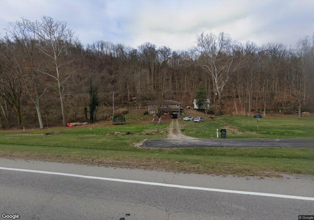
15 Carson Rd New Matamoras, OH 45767
Estimated Value: $76,000 - $133,000
3
Beds
2
Baths
1,008
Sq Ft
$96/Sq Ft
Est. Value
About This Home
This home is located at 15 Carson Rd, New Matamoras, OH 45767 and is currently estimated at $96,977, approximately $96 per square foot. 15 Carson Rd is a home located in Washington County.
Ownership History
Date
Name
Owned For
Owner Type
Purchase Details
Closed on
Sep 5, 2025
Sold by
Riffle Andrew M and Riffle Miriah L
Bought by
Riffle Jordan
Current Estimated Value
Home Financials for this Owner
Home Financials are based on the most recent Mortgage that was taken out on this home.
Original Mortgage
$76,000
Outstanding Balance
$76,000
Interest Rate
6.74%
Mortgage Type
New Conventional
Estimated Equity
$20,977
Purchase Details
Closed on
Apr 24, 2019
Bought by
Riffle Andrew M and Riffle Miriah L
Home Financials for this Owner
Home Financials are based on the most recent Mortgage that was taken out on this home.
Interest Rate
4.17%
Purchase Details
Closed on
May 15, 2015
Sold by
Kinsey Matthew D and Kinsey Megan M
Bought by
Curtis Brittany J and Harman Tracy
Purchase Details
Closed on
Feb 23, 2015
Sold by
Amos Mary M and Amos Thomas G
Bought by
Kinsey Matthew D and Kinsey Megan M
Purchase Details
Closed on
Jun 8, 2012
Sold by
Amos Thomas G and Amos Mary M
Bought by
Kinsey Matthew D and Kinsey Megan M
Home Financials for this Owner
Home Financials are based on the most recent Mortgage that was taken out on this home.
Original Mortgage
$41,600
Interest Rate
3.07%
Mortgage Type
New Conventional
Purchase Details
Closed on
Dec 29, 2011
Sold by
Amos Thomas G
Bought by
Kinsey Matthew D
Purchase Details
Closed on
Dec 17, 2011
Sold by
Kinsey Jane A
Bought by
Kinsey Matthew D
Purchase Details
Closed on
Jul 13, 2006
Sold by
Amos Thomas G and Amos Mary M
Bought by
Amos Thomas G and Amos Mary M
Purchase Details
Closed on
Jan 27, 2004
Bought by
Amos Thomas G
Purchase Details
Closed on
May 9, 2002
Bought by
Amos Thomas G
Purchase Details
Closed on
Apr 26, 2001
Bought by
Amos Jack S
Create a Home Valuation Report for This Property
The Home Valuation Report is an in-depth analysis detailing your home's value as well as a comparison with similar homes in the area
Home Values in the Area
Average Home Value in this Area
Purchase History
| Date | Buyer | Sale Price | Title Company |
|---|---|---|---|
| Riffle Jordan | $100,000 | None Listed On Document | |
| Riffle Jordan | $100,000 | None Listed On Document | |
| Riffle Andrew M | $54,750 | -- | |
| Curtis Brittany J | $48,000 | Attorney | |
| Kinsey Matthew D | -- | Attorney | |
| Kinsey Matthew D | $37,000 | None Available | |
| Kinsey Matthew D | -- | Attorney | |
| Kinsey Matthew D | -- | None Available | |
| Amos Thomas G | -- | None Available | |
| Amos Thomas G | $30,000 | -- | |
| Amos Thomas G | -- | -- | |
| Amos Jack S | -- | -- |
Source: Public Records
Mortgage History
| Date | Status | Borrower | Loan Amount |
|---|---|---|---|
| Open | Riffle Jordan | $76,000 | |
| Closed | Riffle Jordan | $76,000 | |
| Previous Owner | Riffle Andrew M | -- | |
| Previous Owner | Kinsey Matthew D | $41,600 |
Source: Public Records
Tax History Compared to Growth
Tax History
| Year | Tax Paid | Tax Assessment Tax Assessment Total Assessment is a certain percentage of the fair market value that is determined by local assessors to be the total taxable value of land and additions on the property. | Land | Improvement |
|---|---|---|---|---|
| 2024 | $775 | $22,930 | $5,150 | $17,780 |
| 2023 | $775 | $22,930 | $5,150 | $17,780 |
| 2022 | $726 | $22,930 | $5,150 | $17,780 |
| 2021 | $542 | $16,320 | $4,850 | $11,470 |
| 2020 | $555 | $16,320 | $4,850 | $11,470 |
| 2019 | $555 | $16,320 | $4,850 | $11,470 |
| 2018 | $534 | $15,260 | $4,850 | $10,410 |
| 2017 | $532 | $15,260 | $4,850 | $10,410 |
| 2016 | $804 | $15,260 | $4,850 | $10,410 |
| 2015 | $792 | $22,360 | $4,540 | $17,820 |
| 2014 | $1,181 | $22,360 | $4,540 | $17,820 |
| 2013 | $798 | $22,360 | $4,540 | $17,820 |
Source: Public Records
Map
Nearby Homes
- 325 N Fork Rd
- 702 2nd St
- 716 Front St
- 907 Park Ave
- 911 Grandview Ave
- Lots 1, 2, & 3 Friendly Landings
- 0 Locust Ln Unit 139720
- 934 Maple Ln
- 254 S Chelsea St
- 1846 Friendly Hill Rd
- 821 Main St
- 845 Smith Ridge Rd
- NA Ohio 800
- 0 Dyes Ridge Rd Unit 23254231
- 0 Dyes Ridge Rd Unit 11478951
- 0 Z Hill Rd Unit 5158339
- 35045 Ohio 800
- 42842 Trail Run Rd
- 34920 Township Road 570
- 34625 State Route 7
- 75 Carson Rd
- 105 Carson Rd
- 317 Hutchison Rd
- 175 Carson Rd
- 40 Hutchison Rd
- 215 Carson Rd
- 53915 State Route 7
- 53925 State Route 7
- 53945 State Route 7
- 7497 Energy Hwy
- 6219 Energy Hwy
- 6231 Energy Hwy
- 995 Hutchison Rd
- 10 N Fork Rd
- 6573 Energy Hwy
- 0 Northfork Rd (Parcel 1) Unit M229412
- 10 Northfork Rd
- 6233 Energy Hwy
- 0 N Fork Rd
- 92 Rr 2