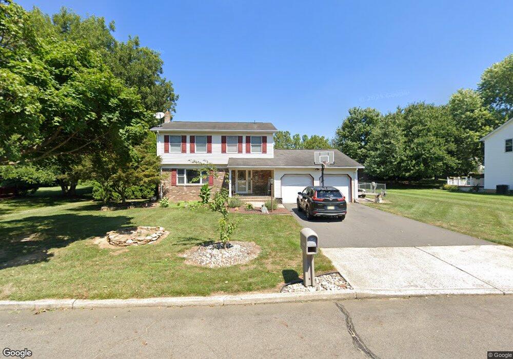
15 Carty Dr Bordentown, NJ 08505
Estimated Value: $550,000 - $580,000
--
Bed
--
Bath
1,902
Sq Ft
$296/Sq Ft
Est. Value
About This Home
This home is located at 15 Carty Dr, Bordentown, NJ 08505 and is currently estimated at $563,468, approximately $296 per square foot. 15 Carty Dr is a home located in Burlington County with nearby schools including Riverfront Middle School, Number 5, Roebling Elementary School, and Florence Twp Mem High School.
Ownership History
Date
Name
Owned For
Owner Type
Purchase Details
Closed on
Jul 29, 2005
Sold by
Tompkins Richard Michael and Tompkins Joanne
Bought by
Jardine Thomas M and Alton Andrea L
Current Estimated Value
Home Financials for this Owner
Home Financials are based on the most recent Mortgage that was taken out on this home.
Original Mortgage
$285,000
Outstanding Balance
$149,714
Interest Rate
5.66%
Mortgage Type
Fannie Mae Freddie Mac
Estimated Equity
$413,754
Purchase Details
Closed on
Feb 28, 2001
Sold by
Caterson Cynthia
Bought by
Tompkins Richard Michael
Home Financials for this Owner
Home Financials are based on the most recent Mortgage that was taken out on this home.
Original Mortgage
$161,000
Interest Rate
7.15%
Mortgage Type
FHA
Create a Home Valuation Report for This Property
The Home Valuation Report is an in-depth analysis detailing your home's value as well as a comparison with similar homes in the area
Home Values in the Area
Average Home Value in this Area
Purchase History
| Date | Buyer | Sale Price | Title Company |
|---|---|---|---|
| Jardine Thomas M | $400,000 | Fidelity National Title | |
| Tompkins Richard Michael | $178,000 | -- |
Source: Public Records
Mortgage History
| Date | Status | Borrower | Loan Amount |
|---|---|---|---|
| Open | Jardine Thomas M | $285,000 | |
| Previous Owner | Tompkins Richard Michael | $161,000 |
Source: Public Records
Tax History Compared to Growth
Tax History
| Year | Tax Paid | Tax Assessment Tax Assessment Total Assessment is a certain percentage of the fair market value that is determined by local assessors to be the total taxable value of land and additions on the property. | Land | Improvement |
|---|---|---|---|---|
| 2025 | $8,910 | $319,700 | $90,000 | $229,700 |
| 2024 | $8,530 | $319,700 | $90,000 | $229,700 |
| 2023 | $8,530 | $319,700 | $90,000 | $229,700 |
| 2022 | $8,347 | $319,700 | $90,000 | $229,700 |
| 2021 | $8,274 | $319,700 | $90,000 | $229,700 |
| 2020 | $8,242 | $319,700 | $90,000 | $229,700 |
| 2019 | $8,168 | $319,700 | $90,000 | $229,700 |
| 2018 | $8,098 | $319,700 | $90,000 | $229,700 |
| 2017 | $7,999 | $319,700 | $90,000 | $229,700 |
| 2016 | $7,845 | $319,700 | $90,000 | $229,700 |
| 2015 | $7,686 | $319,700 | $90,000 | $229,700 |
| 2014 | $7,471 | $319,700 | $90,000 | $229,700 |
Source: Public Records
Map
Nearby Homes
- 12 Brookside Dr
- 67 Ridgway Dr
- 124 Ridgway Dr
- 85 Creekwood Dr
- 74 Creekwood Dr
- 12 Ridgway Dr
- 1036 Potts Mill Rd
- 1031 Potts Mill Rd
- 406 Arnold Dr
- 606 Archibald Ln
- 26 Creekwood Dr
- 1007 Potts Mill Rd
- 19 Magnolia Ct
- 0 Monika Way Unit NJBL2096290
- 0 Monika Way Unit NJBL2071070
- 71 Amboy Ave
- 15 Railroad Ave
- 234 Birch Hollow Dr
- 2000 Cedar Lane Extension
- 2100 Old York Rd