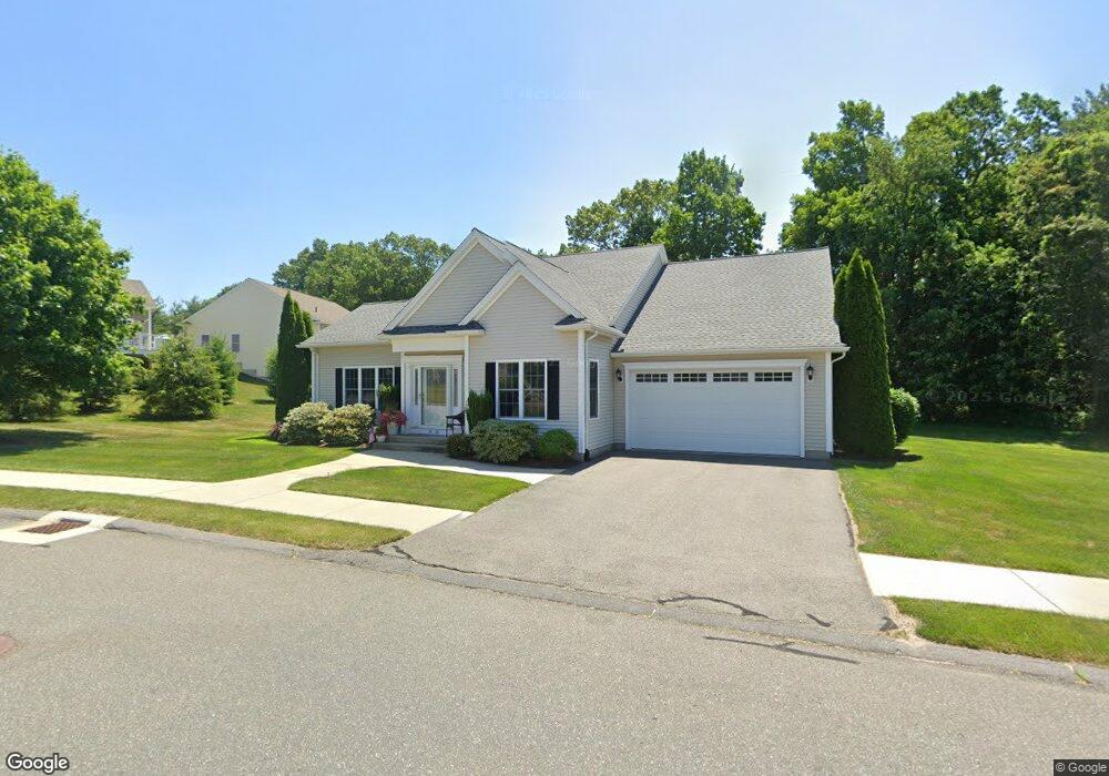
15 Cedar Ridge Dr Unit 15 Wilbraham, MA 01095
Estimated Value: $682,868 - $759,000
3
Beds
2
Baths
1,990
Sq Ft
$355/Sq Ft
Est. Value
About This Home
This home is located at 15 Cedar Ridge Dr Unit 15, Wilbraham, MA 01095 and is currently estimated at $707,217, approximately $355 per square foot. 15 Cedar Ridge Dr Unit 15 is a home located in Hampden County with nearby schools including Minnechaug Regional High School, St. John the Baptist School, and Wilbraham & Monson Academy.
Ownership History
Date
Name
Owned For
Owner Type
Purchase Details
Closed on
Oct 20, 2017
Sold by
Cedar Ridge Investment
Bought by
Catuogno Raymond F and Catuogno Denise L
Current Estimated Value
Purchase Details
Closed on
Jun 17, 2013
Sold by
Mile Oak Land Hldgs Ll
Bought by
Pereira Richard A and Pereira Jacqueline L
Home Financials for this Owner
Home Financials are based on the most recent Mortgage that was taken out on this home.
Original Mortgage
$235,000
Interest Rate
3.39%
Mortgage Type
New Conventional
Create a Home Valuation Report for This Property
The Home Valuation Report is an in-depth analysis detailing your home's value as well as a comparison with similar homes in the area
Home Values in the Area
Average Home Value in this Area
Purchase History
| Date | Buyer | Sale Price | Title Company |
|---|---|---|---|
| Catuogno Raymond F | $465,000 | -- | |
| Pereira Richard A | $1,349,000 | -- | |
| Pereira Richard A | $1,349,000 | -- |
Source: Public Records
Mortgage History
| Date | Status | Borrower | Loan Amount |
|---|---|---|---|
| Previous Owner | Pereira Richard A | $235,000 |
Source: Public Records
Tax History Compared to Growth
Tax History
| Year | Tax Paid | Tax Assessment Tax Assessment Total Assessment is a certain percentage of the fair market value that is determined by local assessors to be the total taxable value of land and additions on the property. | Land | Improvement |
|---|---|---|---|---|
| 2025 | $11,910 | $666,100 | $0 | $666,100 |
| 2024 | $10,771 | $582,200 | $0 | $582,200 |
| 2023 | $10,362 | $517,800 | $0 | $517,800 |
| 2022 | $10,362 | $505,700 | $0 | $505,700 |
| 2021 | $10,608 | $462,000 | $0 | $462,000 |
| 2020 | $10,340 | $462,000 | $0 | $462,000 |
| 2019 | $10,072 | $462,000 | $0 | $462,000 |
| 2018 | $9,181 | $405,500 | $0 | $405,500 |
| 2017 | $8,899 | $404,500 | $0 | $404,500 |
| 2016 | $8,489 | $393,000 | $0 | $393,000 |
| 2015 | $8,185 | $392,000 | $0 | $392,000 |
Source: Public Records
Map
Nearby Homes
- 15 Sandalwood Dr Unit site 00
- 26 Sandalwood Dr
- 111 Sandalwood Dr Unit site 00
- 57 Sandalwood Dr Unit site 61
- 103 Sandalwood Dr Unit site 00
- 99 Sandalwood Dr Unit site 00
- 11 Hickory Hill Dr
- 344 Stony Hill Rd
- 10 Forest Glade Dr
- 6V Melikian Dr
- 8 Glenn Dr
- 4 Lance Ln
- 11 Wellfleet Dr
- 34 Blacksmith Rd
- 32 Lodge Ln Unit 32
- 24 Lodge Ln Unit 24
- 116 Cherry Dr Unit 116
- 19 Linwood Dr
- 2205 Boston Rd Unit I 82
- 88 Manchonis Rd
- 6 Woodsley Rd
- 4 Woodsley Rd
- 14 Cedar Ridge Dr Unit 14
- 14 Cedar Ridge Dr
- 11 Cypress Ln
- 11 Cypress Ln Unit 11
- 15 Oaks Farm Ln
- 15 Oaks Farm Ln Unit 15
- 15 Oaks Farm Ln Unit 15300
- 5 Sandalwood Dr Unit 104
- 8 Woodsley Rd
- 2 Woodsley Rd
- 17 Oaks Farm Ln
- 7 Oaks Farm Ln
- 7 Oaks Farm Ln Unit 7
- 14 Sandalwood Dr Unit 14
- 21 Cypress Ln
- 19 Cypress Ln
- 17 Cypress Ln
- 21 Cypress Ln Unit 21