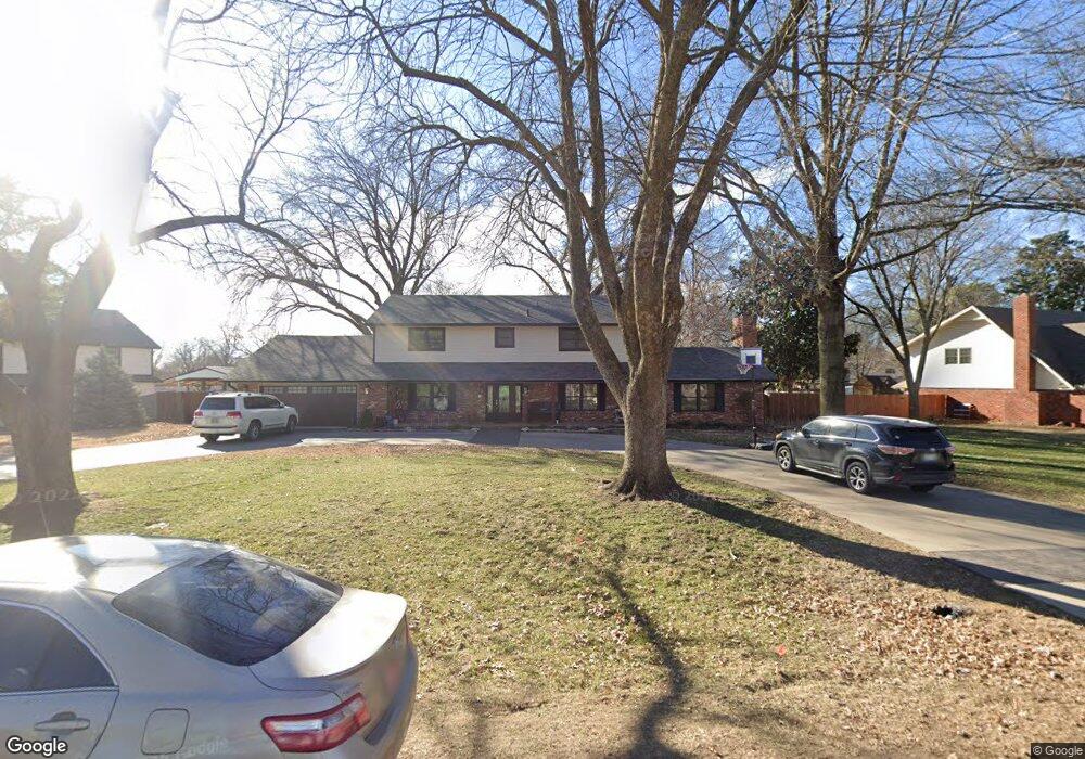
15 Cedar Ridge Rd Broken Arrow, OK 74011
Cedar Ridge NeighborhoodEstimated Value: $438,153 - $555,000
4
Beds
3
Baths
3,273
Sq Ft
$150/Sq Ft
Est. Value
About This Home
This home is located at 15 Cedar Ridge Rd, Broken Arrow, OK 74011 and is currently estimated at $490,788, approximately $149 per square foot. 15 Cedar Ridge Rd is a home located in Tulsa County with nearby schools including Cedar Ridge Elementary School, Union 8th Grade Center, and Union 6th-7th Grade Center.
Ownership History
Date
Name
Owned For
Owner Type
Purchase Details
Closed on
Jan 15, 2014
Sold by
Greenwell Karen Mchugh
Bought by
Kelly Roger L and Kelly Margaret Joan
Current Estimated Value
Home Financials for this Owner
Home Financials are based on the most recent Mortgage that was taken out on this home.
Original Mortgage
$182,700
Outstanding Balance
$49,338
Interest Rate
4.47%
Mortgage Type
New Conventional
Estimated Equity
$441,450
Purchase Details
Closed on
Mar 17, 1999
Sold by
Mchugh James R
Bought by
Mchugh James R
Create a Home Valuation Report for This Property
The Home Valuation Report is an in-depth analysis detailing your home's value as well as a comparison with similar homes in the area
Home Values in the Area
Average Home Value in this Area
Purchase History
| Date | Buyer | Sale Price | Title Company |
|---|---|---|---|
| Kelly Roger L | $183,000 | Tulsa Abstract & Title Co | |
| Mchugh James R | -- | -- |
Source: Public Records
Mortgage History
| Date | Status | Borrower | Loan Amount |
|---|---|---|---|
| Open | Kelly Roger L | $182,700 |
Source: Public Records
Tax History
| Year | Tax Paid | Tax Assessment Tax Assessment Total Assessment is a certain percentage of the fair market value that is determined by local assessors to be the total taxable value of land and additions on the property. | Land | Improvement |
|---|---|---|---|---|
| 2025 | $3,356 | $25,563 | $3,269 | $22,294 |
| 2024 | $3,102 | $24,789 | $3,093 | $21,696 |
| 2023 | $3,102 | $25,038 | $3,044 | $21,994 |
| 2022 | $3,033 | $23,309 | $5,497 | $17,812 |
| 2021 | $2,951 | $22,601 | $5,330 | $17,271 |
| 2020 | $2,970 | $22,601 | $5,330 | $17,271 |
| 2019 | $2,965 | $22,601 | $5,330 | $17,271 |
| 2018 | $2,956 | $22,601 | $5,330 | $17,271 |
| 2017 | $3,109 | $23,458 | $5,532 | $17,926 |
| 2016 | $2,922 | $22,341 | $5,566 | $16,775 |
| 2015 | $2,924 | $22,341 | $5,566 | $16,775 |
| 2014 | $2,776 | $22,341 | $5,566 | $16,775 |
Source: Public Records
Map
Nearby Homes
- 4309 S Mimosa Ave
- 5716 W Austin St
- 4609 W Charleston St
- 10628 E 100th St
- 11106 S 108th East Place
- 5904 W Orlando Cir
- 6009 W Utica Cir
- 3259 E 169th St S
- 3276 E 169th St S
- 3227 E 169th St S
- 3243 E 169th St S
- 2416 W Birmingham St
- 4529 S Retana Ave
- 6101 W Birmingham Cir
- 3816 S Yellow Pine Ave
- 4607 S Retana Place
- 4401 S Yellow Pine Ave
- 11309 S 107th East Ave
- 4705 S Retana Ave
- 11310 S 106th East Ave
- 19 Cedar Ridge Rd
- 6 St Andrews Cir
- 14 Cedar Ridge Rd
- 10 Cedar Ridge Rd
- 58 St Andrews Cir
- 18 Cedar Ridge Rd
- 54 St Andrews Cir
- 22 Cedar Ridge Rd
- 10 St Andrews Cir
- 10 Saint Andrews Cir
- 1 St Andrews Cir
- 5 St Andrews Cir
- 6 Cedar Ridge Rd
- 26 Cedar Ridge Rd
- 9 Saint Andrews Cir
- 9 St Andrews Cir
- 14 St Andrews Cir
- 50 St Andrews Cir
- 30 Cedar Ridge Rd
- 2 Cedar Ridge Rd
