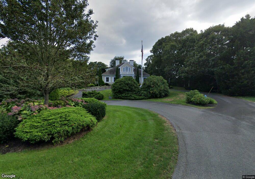
15 Channel Hill Harwich Port, MA 02646
Harwich Port NeighborhoodEstimated Value: $1,912,000 - $2,696,332
4
Beds
5
Baths
3,350
Sq Ft
$655/Sq Ft
Est. Value
About This Home
This home is located at 15 Channel Hill, Harwich Port, MA 02646 and is currently estimated at $2,193,083, approximately $654 per square foot. 15 Channel Hill is a home located in Barnstable County with nearby schools including Harwich Elementary School, Chatham Elementary School, and Monomoy Regional Middle School.
Ownership History
Date
Name
Owned For
Owner Type
Purchase Details
Closed on
Aug 20, 2010
Sold by
Spalt Marilyn and Spalt James G
Bought by
Perkins William and Perkins Priscilla
Current Estimated Value
Home Financials for this Owner
Home Financials are based on the most recent Mortgage that was taken out on this home.
Original Mortgage
$788,000
Outstanding Balance
$523,309
Interest Rate
4.63%
Mortgage Type
Purchase Money Mortgage
Estimated Equity
$1,669,774
Purchase Details
Closed on
Jan 24, 2008
Sold by
10 21 Nt and Spalt George
Bought by
Hopple Patricia and Hopple Richard
Purchase Details
Closed on
Sep 25, 2007
Sold by
Spalt George and Spalt Marilyn T
Bought by
10-21 Nt and Spalt George
Purchase Details
Closed on
Mar 29, 2007
Sold by
Spalt Marilyn T and Spalt Peter
Bought by
Spalt George and Spalt Marilyn T
Create a Home Valuation Report for This Property
The Home Valuation Report is an in-depth analysis detailing your home's value as well as a comparison with similar homes in the area
Home Values in the Area
Average Home Value in this Area
Purchase History
| Date | Buyer | Sale Price | Title Company |
|---|---|---|---|
| Perkins William | $985,000 | -- | |
| Hopple Patricia | -- | -- | |
| 10-21 Nt | -- | -- | |
| Spalt George | -- | -- |
Source: Public Records
Mortgage History
| Date | Status | Borrower | Loan Amount |
|---|---|---|---|
| Open | Perkins William | $788,000 |
Source: Public Records
Tax History Compared to Growth
Tax History
| Year | Tax Paid | Tax Assessment Tax Assessment Total Assessment is a certain percentage of the fair market value that is determined by local assessors to be the total taxable value of land and additions on the property. | Land | Improvement |
|---|---|---|---|---|
| 2025 | $11,899 | $2,013,300 | $593,200 | $1,420,100 |
| 2024 | $11,010 | $1,825,800 | $559,600 | $1,266,200 |
| 2023 | $10,609 | $1,597,700 | $508,700 | $1,089,000 |
| 2022 | $10,325 | $1,273,100 | $442,400 | $830,700 |
| 2021 | $10,637 | $1,236,900 | $402,200 | $834,700 |
| 2020 | $10,347 | $1,185,200 | $374,300 | $810,900 |
| 2019 | $9,701 | $1,118,900 | $359,700 | $759,200 |
| 2018 | $9,631 | $1,062,600 | $327,000 | $735,600 |
| 2017 | $9,316 | $1,038,600 | $304,900 | $733,700 |
| 2016 | $9,060 | $998,900 | $304,900 | $694,000 |
| 2015 | $8,794 | $980,400 | $298,900 | $681,500 |
| 2014 | $8,415 | $959,500 | $290,100 | $669,400 |
Source: Public Records
Map
Nearby Homes
- 53 Freeman St
- 9 Jason Ln
- 820 Massachusetts 28
- 15 Pleasant St Unit W24
- 8 Old Wharf Rd
- 515 Massachusetts 28
- 515 Route 28
- 15 Shannon Rd
- 28 Dale Rd
- 252 Chatham Rd
- 23 Zylpha Rd
- 303 Bank St
- 106 Chatham Rd
- 8 Wyndemere Bluffs Rd
- 405 Lower County Rd Unit 21
- 405 Lower County Rd Unit 23
- 44 Beriah Brooks Rd
- 21 Princes St
- 27 Quaker Ln
- 116 Parallel St
- 10 Wychmere Harbor Dr
- 14 Wychmere Harbor Dr
- 10 Channel Hill
- 71 Hoyt Rd
- 3 Kales Way
- 18 Wychmere Harbor Dr
- 8 Wychmere Harbor Dr
- 678 Massachusetts 28
- 678 Route 28
- 682 Route 28
- 686 Route 28
- 59 Hoyt Rd
- 24 Wychmere Harbor Dr
- 14 Towhee Ln
- 690 Route 28
- 51 Hoyt Rd
- 1 Kales Way
- 18 Towhee Ln
- 10 Towhee Ln
- 85 Hoyt Rd