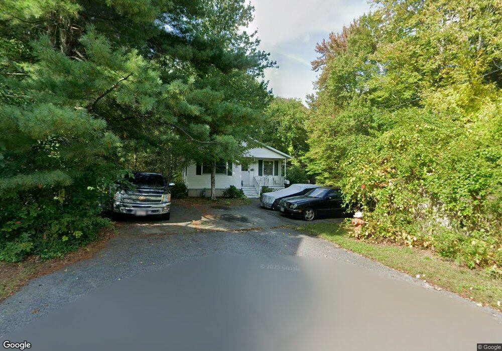
15 Clark Ave Taunton, MA 02780
Whittenton NeighborhoodEstimated Value: $397,000 - $483,000
4
Beds
2
Baths
1,092
Sq Ft
$406/Sq Ft
Est. Value
About This Home
This home is located at 15 Clark Ave, Taunton, MA 02780 and is currently estimated at $443,552, approximately $406 per square foot. 15 Clark Ave is a home located in Bristol County with nearby schools including Benjamin Friedman Middle School, Joseph C. Chamberlain Elementary School, and Taunton High School.
Ownership History
Date
Name
Owned For
Owner Type
Purchase Details
Closed on
Jun 17, 2011
Sold by
Srong Rhonda
Bought by
Srong Rhonda and Strong Ronnie
Current Estimated Value
Home Financials for this Owner
Home Financials are based on the most recent Mortgage that was taken out on this home.
Original Mortgage
$199,705
Outstanding Balance
$138,381
Interest Rate
4.74%
Mortgage Type
Purchase Money Mortgage
Estimated Equity
$305,171
Purchase Details
Closed on
Jun 15, 2011
Sold by
Ale Rt and Bairos
Bought by
Stroug Rhonda
Home Financials for this Owner
Home Financials are based on the most recent Mortgage that was taken out on this home.
Original Mortgage
$199,705
Outstanding Balance
$138,381
Interest Rate
4.74%
Mortgage Type
Purchase Money Mortgage
Estimated Equity
$305,171
Purchase Details
Closed on
Apr 15, 2011
Sold by
Bairos Antonio S
Bought by
Ale Rt and Bairos
Purchase Details
Closed on
Oct 25, 2010
Sold by
Wells Fargo Bk
Bought by
Department Of Housing & Urban Dev
Purchase Details
Closed on
Jul 15, 2010
Sold by
Depina Fatuca M and Wells Fargo Bk
Bought by
Wells Fargo Bk
Purchase Details
Closed on
Oct 1, 2007
Sold by
Mcmahon Christina M and Mcmahon Kevin P
Bought by
Depina Fatuca M
Home Financials for this Owner
Home Financials are based on the most recent Mortgage that was taken out on this home.
Original Mortgage
$238,000
Interest Rate
6.65%
Mortgage Type
Purchase Money Mortgage
Purchase Details
Closed on
Feb 28, 2001
Sold by
Dapointe Emanuel M and Radevicz Paula
Bought by
Mcmahon Kevin P and Lamarche Christopher M
Home Financials for this Owner
Home Financials are based on the most recent Mortgage that was taken out on this home.
Original Mortgage
$143,910
Interest Rate
7%
Mortgage Type
Purchase Money Mortgage
Purchase Details
Closed on
Sep 10, 1987
Sold by
Martin Priscilla A
Bought by
Daponte Emanuel
Create a Home Valuation Report for This Property
The Home Valuation Report is an in-depth analysis detailing your home's value as well as a comparison with similar homes in the area
Home Values in the Area
Average Home Value in this Area
Purchase History
| Date | Buyer | Sale Price | Title Company |
|---|---|---|---|
| Srong Rhonda | -- | -- | |
| Stroug Rhonda | $204,900 | -- | |
| Ale Rt | -- | -- | |
| Bairos Antonio S | $125,000 | -- | |
| Department Of Housing & Urban Dev | -- | -- | |
| Wells Fargo Bk | $256,388 | -- | |
| Depina Fatuca M | $258,000 | -- | |
| Mcmahon Kevin P | $159,900 | -- | |
| Daponte Emanuel | $120,000 | -- |
Source: Public Records
Mortgage History
| Date | Status | Borrower | Loan Amount |
|---|---|---|---|
| Open | Stroug Rhonda | $199,705 | |
| Previous Owner | Depina Fatuca M | $238,000 | |
| Previous Owner | Daponte Emanuel | $143,910 | |
| Previous Owner | Daponte Emanuel | $102,000 | |
| Previous Owner | Daponte Emanuel | $15,755 |
Source: Public Records
Tax History Compared to Growth
Tax History
| Year | Tax Paid | Tax Assessment Tax Assessment Total Assessment is a certain percentage of the fair market value that is determined by local assessors to be the total taxable value of land and additions on the property. | Land | Improvement |
|---|---|---|---|---|
| 2025 | $4,240 | $387,600 | $94,900 | $292,700 |
| 2024 | $3,921 | $350,400 | $94,900 | $255,500 |
| 2023 | $3,802 | $315,500 | $94,900 | $220,600 |
| 2022 | $3,643 | $276,400 | $79,100 | $197,300 |
| 2021 | $3,532 | $248,700 | $71,900 | $176,800 |
| 2020 | $3,491 | $234,900 | $71,900 | $163,000 |
| 2019 | $3,513 | $222,900 | $71,900 | $151,000 |
| 2018 | $3,223 | $205,000 | $71,600 | $133,400 |
| 2017 | $3,109 | $197,900 | $67,900 | $130,000 |
| 2016 | $2,995 | $191,000 | $65,900 | $125,100 |
| 2015 | $2,889 | $192,500 | $66,700 | $125,800 |
| 2014 | $2,719 | $186,100 | $63,700 | $122,400 |
Source: Public Records
Map
Nearby Homes
- 6 Clark Ave
- 0 Eldridge St Unit 73454842
- 71 Eldridge St
- 110 Eldridge St Unit B
- 96 Danforth St Unit 49
- 99 Tremont St
- 13 Stanley Ave
- 108 Tremont St
- 79 Fremont St
- 214 Eldridge St
- 137 Tremont St
- 54 Adams St
- 51 Shores St
- 193 Tremont St Unit 124
- 193 Tremont St Unit 115
- 9 Bradford St
- 16 Kilton St
- 48 Oak St
- 9 Jefferson St
- 26 Kilmer Ave
- 10 Clark Ave
- 8 Clark Ave
- 56 Danforth St
- 64 Danforth St
- 52 Danforth St
- 60 Danforth St Unit 60B
- 60 Danforth St Unit B
- 60 Danforth St Unit B
- 60 Danforth St Unit A
- 43 Perry Ave
- 66 Danforth St
- 36 Perry Ave
- 36 Perry Ave Unit 36
- 4 Perry Ave
- 35 Perry Ave
- 33 Perry Ave
- 12 Eldridge St
- 0 Eldridge St Unit 70733194
- 48 Danforth St
- 46 Danforth St