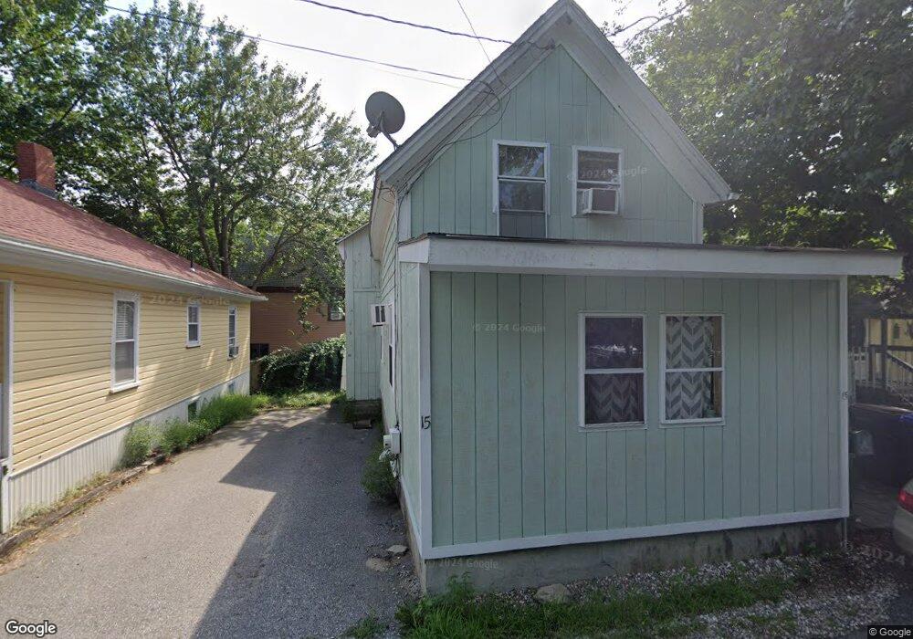
15 Cliff Ave Old Orchard Beach, ME 04064
Estimated Value: $411,365 - $473,000
3
Beds
2
Baths
981
Sq Ft
$453/Sq Ft
Est. Value
About This Home
This home is located at 15 Cliff Ave, Old Orchard Beach, ME 04064 and is currently estimated at $444,841, approximately $453 per square foot. 15 Cliff Ave is a home located in York County with nearby schools including Jameson Elementary School, Loranger Memorial School, and Old Orchard Beach High School.
Ownership History
Date
Name
Owned For
Owner Type
Purchase Details
Closed on
Apr 11, 2008
Sold by
Crosby Shirley A
Bought by
Bizimana Joseph D and Bizimana Josephine M
Current Estimated Value
Home Financials for this Owner
Home Financials are based on the most recent Mortgage that was taken out on this home.
Original Mortgage
$10,000
Outstanding Balance
$6,443
Interest Rate
6.3%
Mortgage Type
Unknown
Estimated Equity
$438,398
Create a Home Valuation Report for This Property
The Home Valuation Report is an in-depth analysis detailing your home's value as well as a comparison with similar homes in the area
Home Values in the Area
Average Home Value in this Area
Purchase History
| Date | Buyer | Sale Price | Title Company |
|---|---|---|---|
| Bizimana Joseph D | -- | -- | |
| Crosby Shirley A | -- | -- |
Source: Public Records
Mortgage History
| Date | Status | Borrower | Loan Amount |
|---|---|---|---|
| Open | Crosby Shirley A | $10,000 | |
| Open | Crosby Shirley A | $173,000 | |
| Previous Owner | Crosby Shirley A | $25,000 |
Source: Public Records
Tax History Compared to Growth
Tax History
| Year | Tax Paid | Tax Assessment Tax Assessment Total Assessment is a certain percentage of the fair market value that is determined by local assessors to be the total taxable value of land and additions on the property. | Land | Improvement |
|---|---|---|---|---|
| 2024 | $3,151 | $289,600 | $108,000 | $181,600 |
| 2023 | $2,820 | $247,400 | $90,300 | $157,100 |
| 2022 | $2,591 | $211,700 | $69,100 | $142,600 |
| 2021 | $2,424 | $171,200 | $55,500 | $115,700 |
| 2020 | $2,469 | $160,100 | $48,200 | $111,900 |
| 2019 | $2,482 | $160,100 | $48,200 | $111,900 |
| 2018 | $2,434 | $159,100 | $48,200 | $110,900 |
| 2017 | $2,173 | $138,400 | $42,100 | $96,300 |
| 2016 | $2,109 | $136,400 | $40,700 | $95,700 |
| 2015 | $2,071 | $136,400 | $40,700 | $95,700 |
| 2014 | $2,030 | $136,400 | $40,700 | $95,700 |
| 2013 | $1,882 | $136,400 | $40,700 | $95,700 |
Source: Public Records
Map
Nearby Homes
- 34 School St
- 43 Grove Ave
- 88 Saco Ave Unit 1
- 3 Arbutus Ave
- 7 Heath St Unit 22
- 113-115 Saco Ave
- 2 Wintergreen St
- 29 15th St
- 5 Carll Ave
- 39 W Grand Ave Unit 410
- 39 W Grand Ave Unit 510
- 39 W Grand Ave Unit 23
- 5 4th Ave
- 1 E Grand Ave Unit 503
- 21 Milliken St
- 88 Union Ave Unit 301
- 2 Foote St Unit 1
- 2 Foote St Unit 9
- 105 Union Ave
- 3 Central Ave