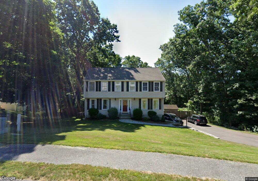
15 Coachman Ln Natick, MA 01760
Estimated Value: $1,116,811 - $1,305,000
4
Beds
3
Baths
2,195
Sq Ft
$547/Sq Ft
Est. Value
About This Home
This home is located at 15 Coachman Ln, Natick, MA 01760 and is currently estimated at $1,199,703, approximately $546 per square foot. 15 Coachman Ln is a home located in Middlesex County with nearby schools including Natick High School, J F Kennedy Middle School, and Brown Elementary School.
Ownership History
Date
Name
Owned For
Owner Type
Purchase Details
Closed on
Mar 26, 2024
Sold by
Davis Matthew E and Pittman Michele M
Bought by
Med Lt and Davis
Current Estimated Value
Purchase Details
Closed on
Apr 16, 2004
Sold by
Adams Pamela K and Adams Mark R
Bought by
Davis Matthew E and Pittman Michele M
Purchase Details
Closed on
Aug 28, 1998
Sold by
Levin Alan R and Levin Marla F
Bought by
Adams R Mark and Adams Pamela K
Create a Home Valuation Report for This Property
The Home Valuation Report is an in-depth analysis detailing your home's value as well as a comparison with similar homes in the area
Home Values in the Area
Average Home Value in this Area
Purchase History
| Date | Buyer | Sale Price | Title Company |
|---|---|---|---|
| Med Lt | -- | None Available | |
| Davis Matthew E | $600,000 | -- | |
| Adams R Mark | $356,000 | -- | |
| Adams R Mark R | $356,000 | -- |
Source: Public Records
Mortgage History
| Date | Status | Borrower | Loan Amount |
|---|---|---|---|
| Previous Owner | Adams R Mark R | $417,000 | |
| Previous Owner | Adams R Mark R | $40,000 |
Source: Public Records
Tax History Compared to Growth
Tax History
| Year | Tax Paid | Tax Assessment Tax Assessment Total Assessment is a certain percentage of the fair market value that is determined by local assessors to be the total taxable value of land and additions on the property. | Land | Improvement |
|---|---|---|---|---|
| 2025 | $13,004 | $1,087,300 | $553,900 | $533,400 |
| 2024 | $12,563 | $1,024,700 | $523,100 | $501,600 |
| 2023 | $12,327 | $975,200 | $523,300 | $451,900 |
| 2022 | $11,471 | $859,900 | $432,200 | $427,700 |
| 2021 | $10,997 | $808,000 | $408,500 | $399,500 |
| 2020 | $10,756 | $790,300 | $390,800 | $399,500 |
| 2019 | $10,045 | $790,300 | $390,800 | $399,500 |
| 2018 | $9,990 | $765,500 | $356,000 | $409,500 |
| 2017 | $9,203 | $682,200 | $325,000 | $357,200 |
| 2016 | $8,930 | $658,100 | $304,000 | $354,100 |
| 2015 | $8,682 | $628,200 | $304,000 | $324,200 |
Source: Public Records
Map
Nearby Homes
- 204 Hartford St
- 143 Howe St
- 369 Grant St
- 369 Grant St Unit 1
- 369 Grant St Unit 2
- 369 Grant St Unit 3
- 8 Vernon Rd
- 31 Palmer Rd
- 29 Aberdeen Rd
- 126 Bishop Dr
- 101 Bishop Dr Unit 101
- 155 Bishop Dr
- 38 Ranger Rd
- 287 W Central St
- 26 Willis St Unit 33
- 92 Old Connecticut Path
- 159 Bishop St
- 6 Clarks Hill Ln Unit 6
- 8 Old Conn Path
- 88 Pond St Unit 88
- 17 Coachman Ln
- 16 Coachman Ln
- 13 Coachman Ln
- 163 1/2 Hartford St
- 163 Hartford St
- 19 Coachman Ln
- 14 Coachman Ln
- 18 Coachman Ln
- 30 Coachman Ln
- 11 Coachman Ln
- 21 Coachman Ln
- 20 Coachman Ln
- 28 Coachman Ln
- 10 Blueberry Hill Rd
- 10 Blueberry Hill Rd Unit B
- 10 Blueberry Hill Rd Unit A
- 24 Coachman Ln
- 10 Coachman Ln
- 9 Coachman Ln
- 9 Blueberry Hill Rd