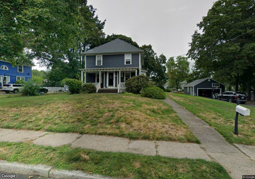
15 Colburn St North Attleboro, MA 02760
North Attleboro NeighborhoodEstimated Value: $572,000 - $628,892
4
Beds
2
Baths
1,841
Sq Ft
$322/Sq Ft
Est. Value
About This Home
This home is located at 15 Colburn St, North Attleboro, MA 02760 and is currently estimated at $591,973, approximately $321 per square foot. 15 Colburn St is a home located in Bristol County with nearby schools including North Attleboro High School, Cadence Academy Preschool - North Attleborough, and Bishop Feehan High School.
Ownership History
Date
Name
Owned For
Owner Type
Purchase Details
Closed on
Jul 2, 2014
Sold by
Atwood Michael J and Atwood Melanie A
Bought by
Rushlow Christopher and Sullivan Maura
Current Estimated Value
Home Financials for this Owner
Home Financials are based on the most recent Mortgage that was taken out on this home.
Original Mortgage
$277,875
Outstanding Balance
$211,658
Interest Rate
4.16%
Mortgage Type
New Conventional
Estimated Equity
$380,315
Purchase Details
Closed on
Aug 2, 2006
Sold by
Atwood John B
Bought by
Atwood Melanie A and Atwood Michael J
Home Financials for this Owner
Home Financials are based on the most recent Mortgage that was taken out on this home.
Original Mortgage
$256,800
Interest Rate
6.7%
Mortgage Type
Purchase Money Mortgage
Create a Home Valuation Report for This Property
The Home Valuation Report is an in-depth analysis detailing your home's value as well as a comparison with similar homes in the area
Home Values in the Area
Average Home Value in this Area
Purchase History
| Date | Buyer | Sale Price | Title Company |
|---|---|---|---|
| Rushlow Christopher | $292,500 | -- | |
| Atwood Melanie A | $321,000 | -- |
Source: Public Records
Mortgage History
| Date | Status | Borrower | Loan Amount |
|---|---|---|---|
| Open | Rushlow Christopher | $277,875 | |
| Previous Owner | Atwood Melanie A | $256,800 |
Source: Public Records
Tax History Compared to Growth
Tax History
| Year | Tax Paid | Tax Assessment Tax Assessment Total Assessment is a certain percentage of the fair market value that is determined by local assessors to be the total taxable value of land and additions on the property. | Land | Improvement |
|---|---|---|---|---|
| 2025 | $6,181 | $524,300 | $151,500 | $372,800 |
| 2024 | $5,898 | $511,100 | $151,500 | $359,600 |
| 2023 | $5,937 | $464,200 | $158,100 | $306,100 |
| 2022 | $5,823 | $418,000 | $151,500 | $266,500 |
| 2021 | $0 | $381,600 | $151,500 | $230,100 |
| 2020 | $5,398 | $376,200 | $151,500 | $224,700 |
| 2019 | $5,035 | $353,600 | $137,800 | $215,800 |
| 2018 | $4,477 | $335,600 | $137,800 | $197,800 |
| 2017 | $4,200 | $317,700 | $137,800 | $179,900 |
| 2016 | $4,088 | $309,200 | $159,800 | $149,400 |
| 2015 | $4,129 | $314,200 | $166,400 | $147,800 |
| 2014 | $3,902 | $294,700 | $146,000 | $148,700 |
Source: Public Records
Map
Nearby Homes
- 50 Metcalf Rd
- 80 Broadway Unit 9
- 130 E Washington St Unit 57
- 130 E Washington St Unit 71
- 130 E Washington St Unit 36
- 130 E Washington St Unit 9
- 300 E Washington St Unit 54R
- 160 Crescent Ave
- 137 Sumner St
- 93 Bank St
- 0 Anawan Rd
- 16 Richards Ave Unit 106
- 121 E Washington St Unit 8
- 121 E Washington St Unit 12
- 121 E Washington St Unit 6
- 121 E Washington St Unit 13
- 121 E Washington St Unit 11
- 40 Roosevelt Ave
- 30 Sperry Ln Unit Lot 15
- 90 Walnut Rd
- 25 Colburn St
- 28 Ash St Unit 30
- 28 Ash St Unit 2
- 28/30 Ash St Unit Garage
- 28/30 Ash St
- 33 Colburn St
- 20 Ash St
- 18 Colburn St
- 12 Ash St
- 26 Colburn St
- 36 Ash St
- 211 S Washington St
- 205 S Washington St
- 39 Colburn St
- 221 S Washington St
- 36 Colburn St
- 36 Colburn St Unit 1
- 195 S Washington St
- 44 Ash St
- 44 Colburn St