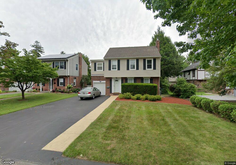
15 Colonial Pkwy Dumont, NJ 07628
Estimated Value: $615,000 - $723,000
3
Beds
3
Baths
1,352
Sq Ft
$497/Sq Ft
Est. Value
About This Home
This home is located at 15 Colonial Pkwy, Dumont, NJ 07628 and is currently estimated at $671,786, approximately $496 per square foot. 15 Colonial Pkwy is a home located in Bergen County with nearby schools including Dumont High School.
Ownership History
Date
Name
Owned For
Owner Type
Purchase Details
Closed on
Jul 3, 2018
Sold by
Hsu Philip Y and Morel-Hsu Mildred Z
Bought by
Spiropoulos Laura
Current Estimated Value
Purchase Details
Closed on
Mar 25, 2008
Sold by
Rode Raymond and Rode Pamela
Bought by
Hsu Philip Y and Hsu Mildred Z Morel
Home Financials for this Owner
Home Financials are based on the most recent Mortgage that was taken out on this home.
Original Mortgage
$403,750
Interest Rate
6.1%
Mortgage Type
New Conventional
Purchase Details
Closed on
Jan 19, 2005
Sold by
Dodds William
Bought by
Rode Raymond and Rode Pamela
Home Financials for this Owner
Home Financials are based on the most recent Mortgage that was taken out on this home.
Original Mortgage
$348,000
Interest Rate
5.71%
Purchase Details
Closed on
Feb 25, 2000
Sold by
Higgins Keith C and Higgins Heather B
Bought by
Dodds William G and Dodds Katherine M
Home Financials for this Owner
Home Financials are based on the most recent Mortgage that was taken out on this home.
Original Mortgage
$156,000
Interest Rate
7.62%
Create a Home Valuation Report for This Property
The Home Valuation Report is an in-depth analysis detailing your home's value as well as a comparison with similar homes in the area
Home Values in the Area
Average Home Value in this Area
Purchase History
| Date | Buyer | Sale Price | Title Company |
|---|---|---|---|
| Spiropoulos Laura | $418,000 | -- | |
| Hsu Philip Y | $425,000 | -- | |
| Rode Raymond | $435,000 | -- | |
| Dodds William G | $186,000 | -- |
Source: Public Records
Mortgage History
| Date | Status | Borrower | Loan Amount |
|---|---|---|---|
| Previous Owner | Hsu Philip Y | $403,750 | |
| Previous Owner | Rode Raymond | $348,000 | |
| Previous Owner | Dodds William G | $156,000 |
Source: Public Records
Tax History Compared to Growth
Tax History
| Year | Tax Paid | Tax Assessment Tax Assessment Total Assessment is a certain percentage of the fair market value that is determined by local assessors to be the total taxable value of land and additions on the property. | Land | Improvement |
|---|---|---|---|---|
| 2025 | $14,195 | $537,600 | $286,200 | $251,400 |
| 2024 | $13,846 | $349,200 | $161,000 | $188,200 |
| 2023 | $13,559 | $349,200 | $161,000 | $188,200 |
| 2022 | $13,559 | $349,200 | $161,000 | $188,200 |
| 2021 | $13,493 | $349,200 | $161,000 | $188,200 |
| 2020 | $13,126 | $349,200 | $161,000 | $188,200 |
| 2019 | $12,812 | $349,200 | $161,000 | $188,200 |
| 2018 | $12,550 | $349,200 | $161,000 | $188,200 |
| 2017 | $12,309 | $349,200 | $161,000 | $188,200 |
| 2016 | $12,023 | $349,200 | $161,000 | $188,200 |
| 2015 | $11,747 | $349,200 | $161,000 | $188,200 |
| 2014 | $11,517 | $349,200 | $161,000 | $188,200 |
Source: Public Records
Map
Nearby Homes
- 35 Wolcott Rd
- 48 Colonial Pkwy
- 41 Monument Place
- 136 Elm St
- 254 Concord St
- 139 Stonegate Trail
- 119 Stonegate Trail
- 23 Cherry Ct
- 5 Campi Ct
- 72 Roosevelt St
- 156 E Linden Ave
- 279 Jefferson Ave
- 15 Burns Place
- 203 New York Ave
- 79 Blauvelt Ave
- 21 Cedar St
- 15 Laurel Ave
- 40 Depew St
- 61 Jefferson Ave
- 181 5th St
- 11 Colonial Pkwy
- 19 Colonial Pkwy
- 16 Wolcott Rd
- 23 Colonial Pkwy
- 12 Wolcott Rd
- 20 Wolcott Rd
- 370 E Madison Ave
- 376 E Madison Ave
- 24 Wolcott Rd
- 16 Colonial Pkwy
- 20 Colonial Pkwy
- 27 Colonial Pkwy
- 12 Colonial Pkwy
- 380 E Madison Ave
- 24 Colonial Pkwy
- 28 Wolcott Rd
- 31 Colonial Pkwy
- 28 Colonial Pkwy
- 32 Wolcott Rd
- 354 E Madison Ave