Estimated Value: $500,640 - $769,000
5
Beds
3
Baths
1,809
Sq Ft
$335/Sq Ft
Est. Value
About This Home
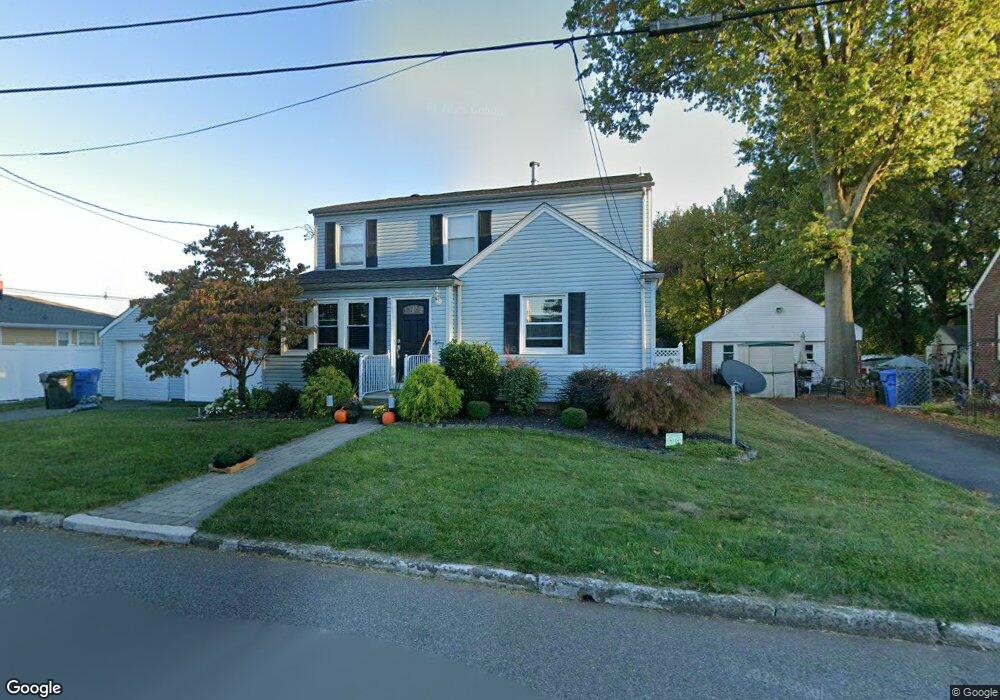
This home is located at 15 Corey St, Fords, NJ 08863 and is currently estimated at $606,910, approximately $335 per square foot. 15 Corey St is a home located in Middlesex County with nearby schools including Menlo Park Terrace School, Fords Middle School, and Woodbridge High School.
Ownership History
Date
Name
Owned For
Owner Type
Purchase Details
Closed on
Aug 10, 2012
Sold by
Giovatto Michael and Giovatto Lisa
Bought by
Adams Robert and Adams Dayna
Current Estimated Value
Home Financials for this Owner
Home Financials are based on the most recent Mortgage that was taken out on this home.
Original Mortgage
$283,246
Outstanding Balance
$195,665
Interest Rate
3.61%
Mortgage Type
FHA
Estimated Equity
$411,245
Purchase Details
Closed on
Dec 29, 2005
Sold by
Quinones Edwin
Bought by
Giovatto Michael and Giovatto Lisa
Home Financials for this Owner
Home Financials are based on the most recent Mortgage that was taken out on this home.
Original Mortgage
$300,000
Interest Rate
6.33%
Mortgage Type
Purchase Money Mortgage
Purchase Details
Closed on
Nov 3, 1999
Sold by
Kovak Cynthia
Bought by
Quinones Edwin
Home Financials for this Owner
Home Financials are based on the most recent Mortgage that was taken out on this home.
Original Mortgage
$123,364
Interest Rate
7.71%
Mortgage Type
FHA
Create a Home Valuation Report for This Property
The Home Valuation Report is an in-depth analysis detailing your home's value as well as a comparison with similar homes in the area
Home Values in the Area
Average Home Value in this Area
Purchase History
| Date | Buyer | Sale Price | Title Company |
|---|---|---|---|
| Adams Robert | $327,500 | Vested Title | |
| Giovatto Michael | $375,000 | -- | |
| Quinones Edwin | $127,000 | -- |
Source: Public Records
Mortgage History
| Date | Status | Borrower | Loan Amount |
|---|---|---|---|
| Open | Adams Robert | $283,246 | |
| Previous Owner | Giovatto Michael | $300,000 | |
| Previous Owner | Quinones Edwin | $123,364 |
Source: Public Records
Tax History Compared to Growth
Tax History
| Year | Tax Paid | Tax Assessment Tax Assessment Total Assessment is a certain percentage of the fair market value that is determined by local assessors to be the total taxable value of land and additions on the property. | Land | Improvement |
|---|---|---|---|---|
| 2025 | $11,402 | $90,300 | $27,500 | $62,800 |
| 2024 | $10,788 | $90,300 | $27,500 | $62,800 |
| 2023 | $10,788 | $88,000 | $27,500 | $60,500 |
| 2022 | $10,498 | $88,000 | $27,500 | $60,500 |
| 2021 | $10,389 | $88,000 | $27,500 | $60,500 |
| 2020 | $10,051 | $88,000 | $27,500 | $60,500 |
| 2019 | $9,793 | $88,000 | $27,500 | $60,500 |
| 2018 | $9,599 | $88,000 | $27,500 | $60,500 |
| 2017 | $9,344 | $87,200 | $27,500 | $59,700 |
| 2016 | $9,268 | $87,200 | $27,500 | $59,700 |
| 2015 | $9,087 | $87,200 | $27,500 | $59,700 |
| 2014 | $8,889 | $87,200 | $27,500 | $59,700 |
Source: Public Records
Map
Nearby Homes
- 450 Crows Mill Rd
- 1 Olive St
- 179 Liberty St
- 91 Corey St
- 12 Liberty St
- 163 Winchester Rd
- 99 Crestview Rd
- 636 King Georges Rd
- 111 Longview Cir
- 21 Douglas St
- 10 Mary Ave
- 59 Douglas St
- 29 S Columbus Ave
- 805 King Georges Rd
- 40 Ling St
- 805 King George Rd
- 164 Pennsylvania Ave
- 133 Howard St
- 46 3rd St
- 71 Pennsylvania Ave