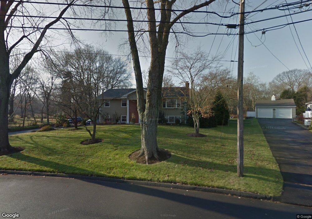
15 Cottontail Rd Norwalk, CT 06854
Brookside NeighborhoodEstimated Value: $772,000 - $1,098,000
4
Beds
3
Baths
1,400
Sq Ft
$649/Sq Ft
Est. Value
About This Home
This home is located at 15 Cottontail Rd, Norwalk, CT 06854 and is currently estimated at $909,041, approximately $649 per square foot. 15 Cottontail Rd is a home located in Fairfield County with nearby schools including Brookside Elementary School, Roton Middle School, and Brien Mcmahon High School.
Ownership History
Date
Name
Owned For
Owner Type
Purchase Details
Closed on
Aug 15, 2002
Sold by
Azpe Jorge D and Azpe Arelli
Bought by
Allen Brian J
Current Estimated Value
Purchase Details
Closed on
Sep 18, 2000
Sold by
Swanson Holly
Bought by
Azpe Jorge D and Azpe Arelli
Purchase Details
Closed on
Mar 5, 1998
Sold by
Schneidermeyer P J and Schneidermeyer Karen M
Bought by
Swanson Marc G and Swanson Holly H
Purchase Details
Closed on
Jun 26, 1995
Sold by
Ottersen William and Ottersen Margaret
Bought by
Schneidermeyer Philip and Schneidermeyer Karen
Create a Home Valuation Report for This Property
The Home Valuation Report is an in-depth analysis detailing your home's value as well as a comparison with similar homes in the area
Home Values in the Area
Average Home Value in this Area
Purchase History
| Date | Buyer | Sale Price | Title Company |
|---|---|---|---|
| Allen Brian J | $490,000 | -- | |
| Allen Brian J | $490,000 | -- | |
| Azpe Jorge D | $403,000 | -- | |
| Azpe Jorge D | $403,000 | -- | |
| Swanson Marc G | $290,000 | -- | |
| Swanson Marc G | $290,000 | -- | |
| Schneidermeyer Philip | $273,000 | -- | |
| Schneidermeyer Philip | $273,000 | -- |
Source: Public Records
Mortgage History
| Date | Status | Borrower | Loan Amount |
|---|---|---|---|
| Open | Schneidermeyer Philip | $281,400 | |
| Closed | Schneidermeyer Philip | $211,100 |
Source: Public Records
Tax History
| Year | Tax Paid | Tax Assessment Tax Assessment Total Assessment is a certain percentage of the fair market value that is determined by local assessors to be the total taxable value of land and additions on the property. | Land | Improvement |
|---|---|---|---|---|
| 2025 | $12,172 | $508,320 | $284,040 | $224,280 |
| 2024 | $11,992 | $508,320 | $284,040 | $224,280 |
| 2023 | $10,516 | $417,940 | $240,340 | $177,600 |
| 2022 | $10,321 | $418,000 | $240,400 | $177,600 |
| 2021 | $10,051 | $417,940 | $240,340 | $177,600 |
| 2020 | $10,046 | $417,940 | $240,340 | $177,600 |
| 2019 | $9,765 | $417,940 | $240,340 | $177,600 |
| 2018 | $10,586 | $397,030 | $249,230 | $147,800 |
| 2017 | $10,222 | $397,030 | $249,230 | $147,800 |
| 2016 | $10,124 | $397,030 | $249,230 | $147,800 |
| 2015 | $10,096 | $397,030 | $249,230 | $147,800 |
| 2014 | $9,965 | $397,030 | $249,230 | $147,800 |
Source: Public Records
Map
Nearby Homes
- 5 Topping Ln
- 6 Acorn Ln
- 9 Hollow Spring Rd
- 9 Arnold Ln
- 29 Richmond Dr
- 40 Arnold Ln
- 18 Oakhill Ave
- 105 Richards Ave Unit 1407
- 97 Richards Ave Unit B10
- 97 Richards Ave Unit E12
- 2 Rochelle Rd
- 18 Auburn St
- 8 Michael St
- 3 Edgewood St
- 6 Ward Ln Unit 6
- 5 Little Brook Rd
- 176 Bouton St
- 14 5 Mile River Rd
- 24 Scribner Ave
- 12 Arbor Ct
- 11 Cottontail Rd
- 17 Cottontail Rd
- 17 Pheasant Ln
- 19 Pheasant Ln
- 9 Cottontail Rd
- 16 Cottontail Rd
- 15 Pheasant Ln
- 7 Cottontail Rd
- 10 Cottontail Rd
- 18 Pheasant Ln
- 20 Cottontail Rd
- 13 Pheasant Ln
- 25 Pheasant Ln
- 5 Cottontail Rd
- 530 Flax Hill Rd
- 25 Cottontail Rd
- 15 Musket Ln
- 6 Cottontail Rd
- 11 Pheasant Ln
- 3 Cottontail Rd
Your Personal Tour Guide
Ask me questions while you tour the home.