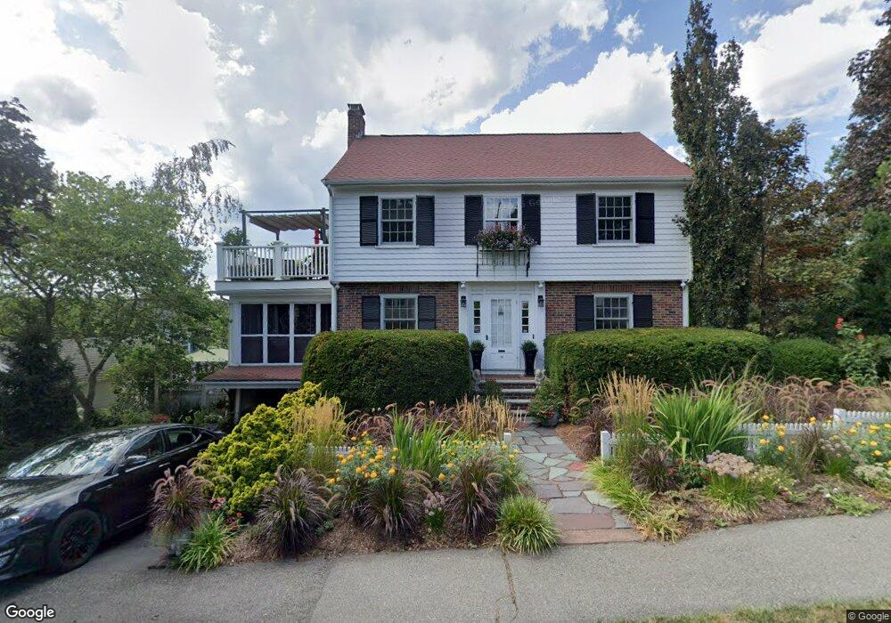
15 Crest St Quincy, MA 02169
South Quincy NeighborhoodEstimated Value: $764,111 - $783,000
3
Beds
2
Baths
1,656
Sq Ft
$467/Sq Ft
Est. Value
About This Home
This home is located at 15 Crest St, Quincy, MA 02169 and is currently estimated at $774,028, approximately $467 per square foot. 15 Crest St is a home located in Norfolk County with nearby schools including Lincoln-Hancock Community School, South West Middle School, and Quincy High School.
Create a Home Valuation Report for This Property
The Home Valuation Report is an in-depth analysis detailing your home's value as well as a comparison with similar homes in the area
Home Values in the Area
Average Home Value in this Area
Tax History
| Year | Tax Paid | Tax Assessment Tax Assessment Total Assessment is a certain percentage of the fair market value that is determined by local assessors to be the total taxable value of land and additions on the property. | Land | Improvement |
|---|---|---|---|---|
| 2025 | $7,705 | $668,300 | $307,300 | $361,000 |
| 2024 | $7,285 | $646,400 | $292,700 | $353,700 |
| 2023 | $6,622 | $595,000 | $266,100 | $328,900 |
| 2022 | $6,348 | $529,900 | $221,700 | $308,200 |
| 2021 | $6,296 | $518,600 | $221,700 | $296,900 |
| 2020 | $6,200 | $498,800 | $221,700 | $277,100 |
| 2019 | $5,932 | $472,700 | $209,200 | $263,500 |
| 2018 | $5,838 | $437,600 | $193,700 | $243,900 |
| 2017 | $5,743 | $405,300 | $184,500 | $220,800 |
| 2016 | $5,257 | $366,100 | $160,400 | $205,700 |
| 2015 | $5,094 | $348,900 | $160,400 | $188,500 |
| 2014 | $4,944 | $332,700 | $160,400 | $172,300 |
Source: Public Records
Map
Nearby Homes
- 150 Madison Ave
- 202 Kendrick Ave
- 155 Kendrick Ave Unit 502
- 56 Penn St Unit 4
- 87 Franklin St Unit 105
- 11 Pearl St
- 9 Independence Ave Unit 102
- 150 Quincy Ave Unit 3A
- 21 Spaulding St
- 8 Jackson St Unit B1
- 8 Jackson St Unit B4
- 200 Falls Blvd Unit E101
- 200 Falls Blvd Unit B208
- 200 Falls Blvd Unit B305
- 33 Elm St
- 44 Elm St
- 21 Totman St Unit 205
- 21 Totman St Unit 403
- 21 Totman St Unit 301
- 21 Totman St Unit 204
Your Personal Tour Guide
Ask me questions while you tour the home.