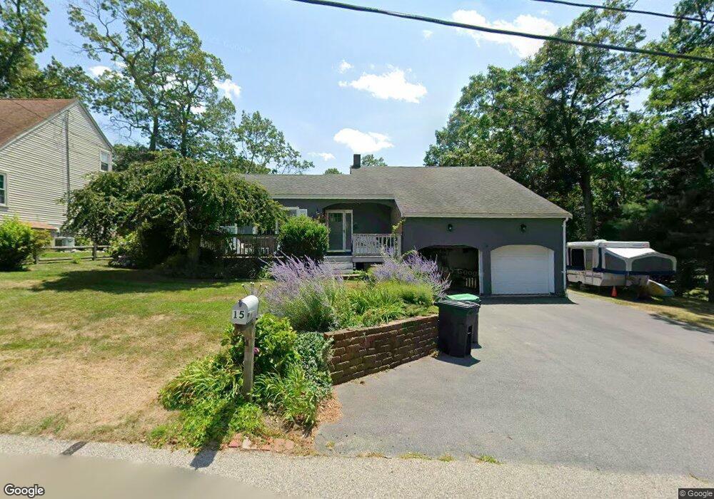
15 Crestwood Ave Marshfield, MA 02050
Ocean Bluff-Brant Rock NeighborhoodEstimated Value: $772,000 - $984,000
4
Beds
3
Baths
1,612
Sq Ft
$543/Sq Ft
Est. Value
About This Home
This home is located at 15 Crestwood Ave, Marshfield, MA 02050 and is currently estimated at $876,057, approximately $543 per square foot. 15 Crestwood Ave is a home located in Plymouth County with nearby schools including Daniel Webster, Furnace Brook Middle School, and Marshfield High School.
Ownership History
Date
Name
Owned For
Owner Type
Purchase Details
Closed on
Aug 7, 2013
Sold by
Saunders Robert H and Saunders Maureen C
Bought by
Saunders Ft and Omara
Current Estimated Value
Purchase Details
Closed on
Apr 29, 1999
Sold by
Doyle John D and Doyle Lynn A
Bought by
Saunders Robert H and Saunders Maureen C
Home Financials for this Owner
Home Financials are based on the most recent Mortgage that was taken out on this home.
Original Mortgage
$50,000
Interest Rate
6.95%
Mortgage Type
Purchase Money Mortgage
Purchase Details
Closed on
Jul 24, 1992
Sold by
Fleet Bk Of Ma Na
Bought by
Doyle John D and Doyle Lynn A
Purchase Details
Closed on
Jul 23, 1992
Sold by
Fleet Bank Of Mass Na
Bought by
Doyle John D and Doyle Lynn A
Purchase Details
Closed on
Apr 16, 1992
Sold by
Carcio Frank A
Bought by
Fleet Bank Of Ma Na
Purchase Details
Closed on
Apr 15, 1992
Sold by
Carcio Frank A
Bought by
Fleet Bk Ma Na
Purchase Details
Closed on
Jun 16, 1988
Sold by
Carcio Frank A
Bought by
Belmont Enterprises
Create a Home Valuation Report for This Property
The Home Valuation Report is an in-depth analysis detailing your home's value as well as a comparison with similar homes in the area
Home Values in the Area
Average Home Value in this Area
Purchase History
| Date | Buyer | Sale Price | Title Company |
|---|---|---|---|
| Saunders Ft | -- | -- | |
| Saunders Ft | -- | -- | |
| Saunders Robert H | $224,900 | -- | |
| Saunders Robert H | $224,900 | -- | |
| Doyle John D | $134,000 | -- | |
| Doyle John D | $134,000 | -- | |
| Fleet Bank Of Ma Na | $111,500 | -- | |
| Fleet Bk Ma Na | $111,500 | -- | |
| Belmont Enterprises | $60,000 | -- |
Source: Public Records
Mortgage History
| Date | Status | Borrower | Loan Amount |
|---|---|---|---|
| Previous Owner | Belmont Enterprises | $50,000 |
Source: Public Records
Tax History Compared to Growth
Tax History
| Year | Tax Paid | Tax Assessment Tax Assessment Total Assessment is a certain percentage of the fair market value that is determined by local assessors to be the total taxable value of land and additions on the property. | Land | Improvement |
|---|---|---|---|---|
| 2025 | $7,386 | $746,100 | $321,600 | $424,500 |
| 2024 | $6,979 | $671,700 | $301,500 | $370,200 |
| 2023 | $6,374 | $603,800 | $271,400 | $332,400 |
| 2022 | $6,374 | $492,200 | $231,200 | $261,000 |
| 2021 | $6,121 | $464,100 | $221,100 | $243,000 |
| 2020 | $5,636 | $422,800 | $191,000 | $231,800 |
| 2019 | $5,657 | $422,800 | $191,000 | $231,800 |
| 2018 | $5,653 | $422,800 | $191,000 | $231,800 |
| 2017 | $5,175 | $377,200 | $180,900 | $196,300 |
| 2016 | $4,844 | $349,000 | $170,900 | $178,100 |
| 2015 | $4,638 | $349,000 | $170,900 | $178,100 |
| 2014 | $4,330 | $325,800 | $170,900 | $154,900 |
Source: Public Records
Map
Nearby Homes
- 9 Crestwood Ave
- 72 Sheridan Dr
- 76 Sheridan Dr
- 27 Crestwood Ave
- 68 Sheridan Dr
- 16 Crestwood Ave
- 33 Meadowview St
- 10 Crestwood Ave
- 82 Sheridan Dr
- 64 Sheridan Dr
- 26 Crestwood Ave
- 60 Sheridan Dr
- 41 Meadowview St
- 77 Sheridan Dr
- 69 Sheridan Dr
- 94 Sheridan Dr
- 17 Winston Rd
- 5 Winston Rd
- 65 Sheridan Dr
- 38 Meadowview St