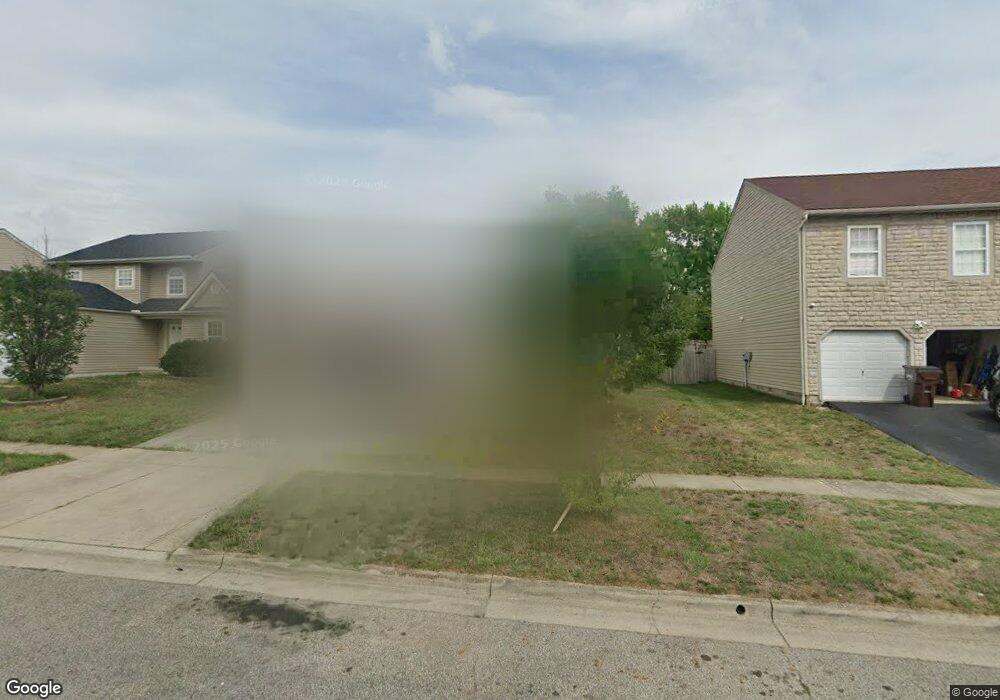
15 Danielson Cir South Bloomfield, OH 43103
Estimated Value: $281,874 - $319,000
3
Beds
2
Baths
1,500
Sq Ft
$201/Sq Ft
Est. Value
About This Home
This home is located at 15 Danielson Cir, South Bloomfield, OH 43103 and is currently estimated at $301,719, approximately $201 per square foot. 15 Danielson Cir is a home located in Pickaway County.
Ownership History
Date
Name
Owned For
Owner Type
Purchase Details
Closed on
Nov 6, 2015
Sold by
Lawson Julia L and Williams Julia L
Bought by
Williams Julia L
Current Estimated Value
Home Financials for this Owner
Home Financials are based on the most recent Mortgage that was taken out on this home.
Original Mortgage
$111,911
Outstanding Balance
$88,440
Interest Rate
3.93%
Mortgage Type
FHA
Estimated Equity
$213,279
Purchase Details
Closed on
Apr 8, 2008
Sold by
Maronda Homes Inc Of Ohio
Bought by
Lawson Julia L
Home Financials for this Owner
Home Financials are based on the most recent Mortgage that was taken out on this home.
Original Mortgage
$127,302
Interest Rate
5.88%
Mortgage Type
FHA
Create a Home Valuation Report for This Property
The Home Valuation Report is an in-depth analysis detailing your home's value as well as a comparison with similar homes in the area
Home Values in the Area
Average Home Value in this Area
Purchase History
| Date | Buyer | Sale Price | Title Company |
|---|---|---|---|
| Williams Julia L | -- | Clt | |
| Lawson Julia L | $129,300 | Stewart Title Of Columbus |
Source: Public Records
Mortgage History
| Date | Status | Borrower | Loan Amount |
|---|---|---|---|
| Open | Williams Julia L | $111,911 | |
| Closed | Lawson Julia L | $127,302 |
Source: Public Records
Tax History Compared to Growth
Tax History
| Year | Tax Paid | Tax Assessment Tax Assessment Total Assessment is a certain percentage of the fair market value that is determined by local assessors to be the total taxable value of land and additions on the property. | Land | Improvement |
|---|---|---|---|---|
| 2024 | -- | $80,170 | $5,380 | $74,790 |
| 2023 | $3,074 | $80,170 | $5,380 | $74,790 |
| 2022 | $2,430 | $58,390 | $4,520 | $53,870 |
| 2021 | $2,301 | $58,390 | $4,520 | $53,870 |
| 2020 | $2,307 | $58,390 | $4,520 | $53,870 |
| 2019 | $2,004 | $49,410 | $4,520 | $44,890 |
| 2018 | $2,037 | $49,410 | $4,520 | $44,890 |
| 2017 | $2,090 | $49,410 | $4,520 | $44,890 |
| 2016 | $1,723 | $40,550 | $4,490 | $36,060 |
| 2015 | $1,723 | $40,550 | $4,490 | $36,060 |
| 2014 | $1,724 | $40,550 | $4,490 | $36,060 |
| 2013 | $1,785 | $40,550 | $4,490 | $36,060 |
Source: Public Records
Map
Nearby Homes
- The Daffodil Plan at Riverbend at Scioto Landing
- The Daisy Plan at Riverbend at Scioto Landing
- The Avalon Plan at Riverbend at Scioto Landing
- The Aster Plan at Riverbend at Scioto Landing
- 0 U S 23
- 51 Henderson Ln
- 5050 S Walnut St
- 127 Boutot St
- Longwood Plan at Walker Pointe
- Birmingham Plan at Walker Pointe
- Sanibel Plan at Walker Pointe
- Carlisle Plan at Walker Pointe
- Somerset Plan at Walker Pointe
- Chattanooga Plan at Walker Pointe
- Rockford Plan at Walker Pointe
- Hoover Plan at Walker Pointe
- Sedona Plan at Walker Pointe
- Truman Plan at Walker Pointe
- Miramar Plan at Walker Pointe
- 5332 Karst Cir
- 15 Danielson Cir Unit 41
- 13 Danielson Cir
- 13 Danielson Cir Unit 40
- 17 Danielson Cir
- 11 Danielson Cir
- 19 Danielson Cir
- 5019 West St
- 5023 West St
- 21 Danielson Cir
- 9 Danielson Cir
- 9 Danielson Cir Unit 38
- 16 Danielson Cir
- 16 Danielson Cir Unit 8
- 14 Danielson Cir
- 5015 West St
- 18 Danielson Cir
- 18 Danielson Cir Unit 9
- 12 Danielson Cir
- 7 Danielson Cir
- 7 Danielson Cir Unit 37
