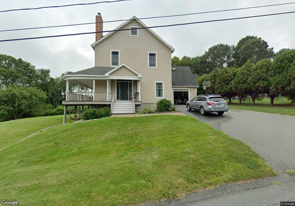
15 David Rd Westport, MA 02790
Westport Point NeighborhoodEstimated Value: $941,000 - $1,292,000
1
Bed
2
Baths
2,464
Sq Ft
$476/Sq Ft
Est. Value
About This Home
This home is located at 15 David Rd, Westport, MA 02790 and is currently estimated at $1,172,998, approximately $476 per square foot. 15 David Rd is a home located in Bristol County with nearby schools including Alice A. Macomber Primary School, Westport Elementary School, and Westport Middle-High School.
Ownership History
Date
Name
Owned For
Owner Type
Purchase Details
Closed on
Jul 23, 2024
Sold by
Harrington Nancy S and Harrington Daniel C
Bought by
Nancy S Harrington 2024 T S and Nancy Harrington
Current Estimated Value
Purchase Details
Closed on
Jul 31, 2006
Sold by
Harrington Nancy S and Kitchen Nancy S
Bought by
Harrington Daniel C and Harrington Nancy S
Home Financials for this Owner
Home Financials are based on the most recent Mortgage that was taken out on this home.
Original Mortgage
$130,000
Interest Rate
6.67%
Mortgage Type
Purchase Money Mortgage
Purchase Details
Closed on
Jan 26, 1996
Sold by
Roy Roger
Bought by
Kitchen Nancy S
Home Financials for this Owner
Home Financials are based on the most recent Mortgage that was taken out on this home.
Original Mortgage
$120,000
Interest Rate
7.13%
Mortgage Type
Purchase Money Mortgage
Purchase Details
Closed on
Dec 15, 1989
Sold by
Kennedy Lois A Est
Bought by
Southard Peter
Create a Home Valuation Report for This Property
The Home Valuation Report is an in-depth analysis detailing your home's value as well as a comparison with similar homes in the area
Home Values in the Area
Average Home Value in this Area
Purchase History
| Date | Buyer | Sale Price | Title Company |
|---|---|---|---|
| Nancy S Harrington 2024 T S | -- | None Available | |
| Nancy S Harrington 2024 T S | -- | None Available | |
| Harrington Daniel C | -- | -- | |
| Kitchen Nancy S | $130,000 | -- | |
| Harrington Daniel C | -- | -- | |
| Kitchen Nancy S | $130,000 | -- | |
| Southard Peter | $138,000 | -- |
Source: Public Records
Mortgage History
| Date | Status | Borrower | Loan Amount |
|---|---|---|---|
| Previous Owner | Southard Peter | $130,000 | |
| Previous Owner | Southard Peter | $110,000 | |
| Previous Owner | Southard Peter | $120,000 |
Source: Public Records
Tax History Compared to Growth
Tax History
| Year | Tax Paid | Tax Assessment Tax Assessment Total Assessment is a certain percentage of the fair market value that is determined by local assessors to be the total taxable value of land and additions on the property. | Land | Improvement |
|---|---|---|---|---|
| 2025 | $6,910 | $927,500 | $481,900 | $445,600 |
| 2024 | $6,820 | $882,300 | $446,500 | $435,800 |
| 2023 | $6,789 | $832,000 | $425,200 | $406,800 |
| 2022 | $6,680 | $787,700 | $425,200 | $362,500 |
| 2021 | $6,003 | $696,400 | $352,500 | $343,900 |
| 2020 | $5,752 | $682,300 | $338,400 | $343,900 |
| 2019 | $5,561 | $672,400 | $338,400 | $334,000 |
| 2018 | $5,162 | $631,800 | $305,200 | $326,600 |
| 2017 | $5,063 | $635,300 | $305,200 | $330,100 |
| 2016 | $4,792 | $605,800 | $311,000 | $294,800 |
| 2015 | $4,737 | $597,400 | $311,000 | $286,400 |
Source: Public Records
Map
Nearby Homes
- 99 Sylvia Ln
- 1702J Drift Rd
- 1702 Drift Rd
- 1580 Main Rd
- 1346 Main Rd Unit B
- 225 Hixbridge Rd
- 1881 Main Rd
- 920 Drift Rd
- 332 Division Rd
- 101 Adamsville Rd
- 837 Main Road & Lot 2
- 837 Main Rd
- 0 Reed Rd (Ss)
- 2 Slades Farm Ln
- Lot 2 Horseneck Rd
- 8 Village Way
- 7 Village Way
- 15 Village Way
- Lot 2E Horseneck Rd
- 17 Quail Trail
- 14 David Rd
- 21 David Rd
- 1476A Drift Rd
- 13 David Rd
- 24 David Rd
- 1476 Drift Rd
- 1476D Drift Rd Unit Winter
- 1476D Drift Rd Unit Weekly
- 1476G Drift Rd
- 1476 Drift Rd
- 1476 Drift Rd
- 1476 Drift Rd Unit F
- 1476 Drift Rd Unit B
- 1476 Drift Rd
- 1476 Drift Rd Unit C
- 1476D Drift Rd
- 1476 Drift Rd Unit D
- 1476 Drift Rd
- 1476 Drift Rd
- 1476D Drift Rd Unit WINTER RENT