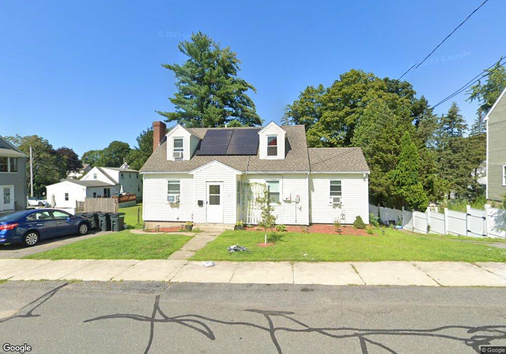
15 Dean St Stoneham, MA 02180
Nobility Hill NeighborhoodEstimated Value: $568,000 - $721,000
3
Beds
1
Bath
1,190
Sq Ft
$537/Sq Ft
Est. Value
About This Home
This home is located at 15 Dean St, Stoneham, MA 02180 and is currently estimated at $639,516, approximately $537 per square foot. 15 Dean St is a home located in Middlesex County with nearby schools including Stoneham High School, St. Patrick Elementary School, and Greater Boston Academy.
Ownership History
Date
Name
Owned For
Owner Type
Purchase Details
Closed on
May 2, 2022
Sold by
Petrillo
Bought by
James Sandra L and James Todd A
Current Estimated Value
Home Financials for this Owner
Home Financials are based on the most recent Mortgage that was taken out on this home.
Original Mortgage
$393,855
Outstanding Balance
$367,049
Interest Rate
4.16%
Mortgage Type
Purchase Money Mortgage
Estimated Equity
$272,467
Purchase Details
Closed on
Nov 29, 2018
Sold by
Petrillo Mary A and Desano Heatha A
Bought by
F & M Petrillo Rt
Purchase Details
Closed on
May 18, 2005
Sold by
Powers Mary C
Bought by
Desano Heatha A and Petrillo Mary A
Home Financials for this Owner
Home Financials are based on the most recent Mortgage that was taken out on this home.
Original Mortgage
$292,000
Interest Rate
5.95%
Mortgage Type
Purchase Money Mortgage
Purchase Details
Closed on
Jun 20, 1968
Bought by
Powers Robert and Powers Mary C
Create a Home Valuation Report for This Property
The Home Valuation Report is an in-depth analysis detailing your home's value as well as a comparison with similar homes in the area
Home Values in the Area
Average Home Value in this Area
Purchase History
| Date | Buyer | Sale Price | Title Company |
|---|---|---|---|
| James Sandra L | $385,000 | None Available | |
| F & M Petrillo Rt | -- | None Available | |
| Desano Heatha A | $365,000 | -- | |
| Desano Heatha A | $365,000 | -- | |
| Powers Robert | $365,000 | -- |
Source: Public Records
Mortgage History
| Date | Status | Borrower | Loan Amount |
|---|---|---|---|
| Open | James Sandra L | $393,855 | |
| Previous Owner | Desano Heatha A | $292,000 |
Source: Public Records
Tax History
| Year | Tax Paid | Tax Assessment Tax Assessment Total Assessment is a certain percentage of the fair market value that is determined by local assessors to be the total taxable value of land and additions on the property. | Land | Improvement |
|---|---|---|---|---|
| 2025 | $5,533 | $540,900 | $363,400 | $177,500 |
| 2024 | $5,289 | $499,400 | $334,700 | $164,700 |
| 2023 | $5,112 | $460,500 | $306,000 | $154,500 |
| 2022 | $4,397 | $422,400 | $277,300 | $145,100 |
| 2021 | $4,353 | $402,300 | $258,200 | $144,100 |
| 2020 | $4,193 | $388,600 | $246,400 | $142,200 |
| 2019 | $4,032 | $359,400 | $220,000 | $139,400 |
| 2018 | $3,880 | $331,300 | $198,000 | $133,300 |
| 2017 | $4,173 | $336,800 | $185,500 | $151,300 |
| 2016 | $3,904 | $307,400 | $185,500 | $121,900 |
| 2015 | $3,612 | $278,700 | $167,900 | $110,800 |
| 2014 | $3,644 | $270,100 | $141,400 | $128,700 |
Source: Public Records
Map
Nearby Homes
- 57 Park St
- 6 Everett St
- 8 Common St Unit 3
- 200 Ledgewood Dr Unit 601
- 10 Pomeworth St Unit A
- 6 Stratton Dr Unit 307
- 6 Stratton Dr Unit 208
- 6 Stratton Dr Unit 303
- 2 Mason Way Unit 6524
- 6 Mason Way Unit 6324
- 137 Franklin St Unit 102
- 17 Franklin St
- 1 Tremont St
- 21 Tremont St Unit B
- 21 Tremont St Unit A
- 35 Tremont St
- 4 Garfield Ave
- 159 Franklin St Unit D2
- 159 Franklin St Unit C2
- 159 Franklin St Unit E6
Your Personal Tour Guide
Ask me questions while you tour the home.