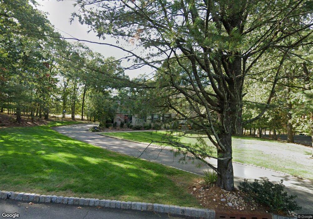
15 Deer Path Cir Green Brook, NJ 08812
Estimated Value: $1,185,000 - $1,421,000
Studio
--
Bath
4,302
Sq Ft
$294/Sq Ft
Est. Value
About This Home
This home is located at 15 Deer Path Cir, Green Brook, NJ 08812 and is currently estimated at $1,266,161, approximately $294 per square foot. 15 Deer Path Cir is a home located in Somerset County with nearby schools including Irene E. Feldkirchner Elementary School, Green Brook Middle School, and Watchung Hills Regional High School.
Ownership History
Date
Name
Owned For
Owner Type
Purchase Details
Closed on
Dec 31, 1992
Sold by
Coyle Sandra and Coyle Walter H
Bought by
Mcquilkin George E and Mcquilkin Rita
Current Estimated Value
Purchase Details
Closed on
Mar 31, 1989
Sold by
I A Building Corp
Bought by
Coyle Sandra A and Coyle Kittredge W
Create a Home Valuation Report for This Property
The Home Valuation Report is an in-depth analysis detailing your home's value as well as a comparison with similar homes in the area
Home Values in the Area
Average Home Value in this Area
Purchase History
| Date | Buyer | Sale Price | Title Company |
|---|---|---|---|
| Mcquilkin George E | $565,000 | -- | |
| Coyle Sandra A | $505,000 | -- |
Source: Public Records
Tax History
| Year | Tax Paid | Tax Assessment Tax Assessment Total Assessment is a certain percentage of the fair market value that is determined by local assessors to be the total taxable value of land and additions on the property. | Land | Improvement |
|---|---|---|---|---|
| 2025 | $16,627 | $990,200 | $292,400 | $697,800 |
| 2024 | $16,627 | $751,000 | $315,800 | $435,200 |
| 2023 | $19,111 | $830,900 | $315,800 | $515,100 |
| 2022 | $19,551 | $830,900 | $315,800 | $515,100 |
| 2021 | $18,408 | $752,300 | $315,800 | $436,500 |
| 2020 | $18,493 | $705,300 | $315,800 | $389,500 |
| 2019 | $18,408 | $705,300 | $315,800 | $389,500 |
| 2018 | $18,288 | $705,300 | $315,800 | $389,500 |
| 2017 | $17,879 | $705,300 | $315,800 | $389,500 |
| 2016 | $17,597 | $705,300 | $315,800 | $389,500 |
| 2015 | $18,402 | $722,800 | $345,500 | $377,300 |
| 2014 | $19,001 | $746,000 | $345,500 | $400,500 |
Source: Public Records
Map
Nearby Homes
- 13 Deer Path Cir
- 1121 N Washington Ave
- 26 Robin Glen Rd
- 31 Blue Ridge Ave
- 302 Tiffany Way Unit 302
- 9 Apple Tree Ln
- 1300 Rock Ave
- 1300 Rock Ave Unit F3
- 1300 Rock Ave Unit F1
- 314 Tremont Ave
- 295 Tremont Ave
- 17 Helen St
- 13 Park Ave Unit 15
- 13 Sycamore Way
- 7 Sycamore Way
- 729 Mountain Blvd
- 283 Arnold Ave
- 2 Gold St
- 122 Greenbrook Rd
- 225 Lawrence Ave
- 17 Deer Path Cir
- 16 Deer Path Cir
- 36 Swanson Ln
- 12 Deer Path Cir
- 19 Deer Path Cir
- 20 Deer Path Cir
- 11 Deer Path Cir
- 32 Deer Path Cir
- 21 Deer Path Cir
- 32 Swanson Ln
- 28 Deer Path Cir
- 24 Deer Path Cir
- 35 Deer Path Cir
- 33 Deer Path Cir
- 1 Pheasant Run
- 9 Deer Path
- 28 Swanson Ln
- 31 Deer Path Cir
- 2 Pheasant Run
- 29 Deer Path Cir
Your Personal Tour Guide
Ask me questions while you tour the home.