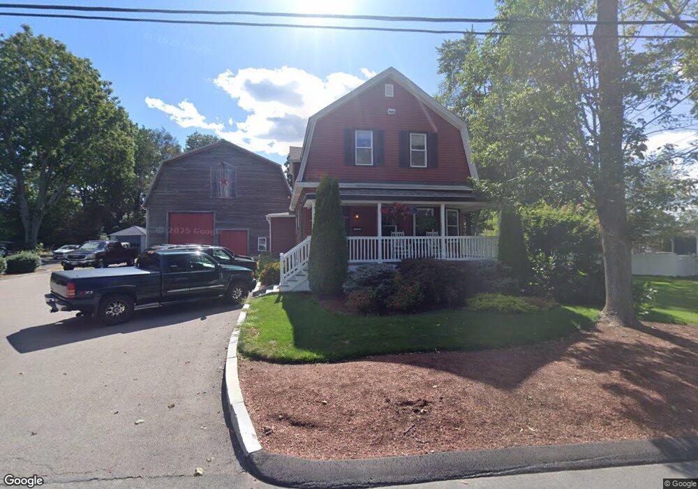
15 Dighton Ave Taunton, MA 02780
Estimated Value: $480,000 - $624,000
3
Beds
2
Baths
1,400
Sq Ft
$389/Sq Ft
Est. Value
About This Home
This home is located at 15 Dighton Ave, Taunton, MA 02780 and is currently estimated at $544,120, approximately $388 per square foot. 15 Dighton Ave is a home located in Bristol County with nearby schools including Mulcahey Elementary School, Taunton High School, and Joseph H. Martin.
Ownership History
Date
Name
Owned For
Owner Type
Purchase Details
Closed on
Mar 1, 2021
Sold by
Andrade Joshua and Andrade Lori D
Bought by
Andrade Joshua and Andrade Lori D
Current Estimated Value
Home Financials for this Owner
Home Financials are based on the most recent Mortgage that was taken out on this home.
Original Mortgage
$200,000
Outstanding Balance
$146,203
Interest Rate
2.7%
Mortgage Type
Credit Line Revolving
Estimated Equity
$397,917
Purchase Details
Closed on
Nov 16, 2000
Sold by
Balelo James
Bought by
Andrade Joshua and Dennen Loria
Home Financials for this Owner
Home Financials are based on the most recent Mortgage that was taken out on this home.
Original Mortgage
$159,919
Interest Rate
7.78%
Mortgage Type
Purchase Money Mortgage
Create a Home Valuation Report for This Property
The Home Valuation Report is an in-depth analysis detailing your home's value as well as a comparison with similar homes in the area
Home Values in the Area
Average Home Value in this Area
Purchase History
| Date | Buyer | Sale Price | Title Company |
|---|---|---|---|
| Andrade Joshua | -- | None Available | |
| Andrade Joshua | $160,000 | -- |
Source: Public Records
Mortgage History
| Date | Status | Borrower | Loan Amount |
|---|---|---|---|
| Open | Andrade Joshua | $200,000 | |
| Closed | Andrade Joshua | $120,000 | |
| Previous Owner | Andrade Joshua | $159,919 |
Source: Public Records
Tax History
| Year | Tax Paid | Tax Assessment Tax Assessment Total Assessment is a certain percentage of the fair market value that is determined by local assessors to be the total taxable value of land and additions on the property. | Land | Improvement |
|---|---|---|---|---|
| 2025 | $5,727 | $523,500 | $145,200 | $378,300 |
| 2024 | $4,658 | $416,300 | $145,200 | $271,100 |
| 2023 | $4,726 | $392,200 | $151,800 | $240,400 |
| 2022 | $4,431 | $336,200 | $117,700 | $218,500 |
| 2021 | $4,311 | $303,600 | $107,000 | $196,600 |
| 2020 | $4,208 | $283,200 | $107,000 | $176,200 |
| 2019 | $3,403 | $266,700 | $112,400 | $154,300 |
| 2018 | $4,142 | $263,500 | $113,400 | $150,100 |
| 2017 | $3,807 | $242,300 | $108,100 | $134,200 |
| 2016 | $3,650 | $232,800 | $104,900 | $127,900 |
| 2015 | $3,535 | $235,500 | $104,900 | $130,600 |
| 2014 | $3,306 | $226,300 | $104,900 | $121,400 |
Source: Public Records
Map
Nearby Homes
- 115 Davenport St
- 321 Winthrop St Unit 106
- 170 Highland St Unit 115
- 50 Highland St Unit 74
- 2 Winthrop Ave
- 140 N Walker St Unit 511
- 6 Marvel St
- 852 Somerset Ave
- 24 Couch St
- 23 Couch St Unit RIGHT side
- 52 General Cobb St
- 21 Briggs St
- 6 W Weir St
- 303 Cohannet St
- 450 Somerset Ave Unit 3-7
- 99 Winthrop St
- 278 Cohannet St
- 233-R Summer St
- 24 1st St
- 4 Walnut St
- 3 Dighton Ave
- 29 Dighton Ave
- 324 Warner Blvd
- 1006 Cohannet St
- 1 Dighton Ave
- 980 Cohannet St
- 35 Dighton Ave
- 0 Dighton Ave
- 989 Cohannet St
- 307 Warner Blvd
- 344 Warner Blvd
- 321 Warner Blvd
- 1005 Cohannet St
- 38 Dighton Ave
- 975 Cohannet St
- 999 Cohannet St
- 47 Dighton Ave
- 280 Warner Blvd
- 354 Warner Blvd
- 962 Cohannet St
Your Personal Tour Guide
Ask me questions while you tour the home.