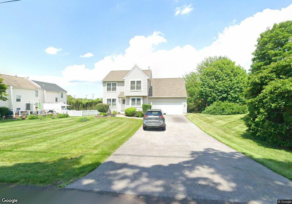
15 Dorothy Ave Doylestown, PA 18901
Estimated Value: $495,000 - $579,027
3
Beds
3
Baths
1,480
Sq Ft
$361/Sq Ft
Est. Value
About This Home
This home is located at 15 Dorothy Ave, Doylestown, PA 18901 and is currently estimated at $534,257, approximately $360 per square foot. 15 Dorothy Ave is a home located in Bucks County with nearby schools including Linden El School, Lenape Middle School, and Central Bucks High School-West.
Ownership History
Date
Name
Owned For
Owner Type
Purchase Details
Closed on
Sep 21, 2006
Sold by
Mobley Steven B
Bought by
Mobley Steven B and Baitzel Lisa
Current Estimated Value
Home Financials for this Owner
Home Financials are based on the most recent Mortgage that was taken out on this home.
Original Mortgage
$104,000
Outstanding Balance
$8,775
Interest Rate
6.18%
Mortgage Type
New Conventional
Estimated Equity
$525,482
Purchase Details
Closed on
Oct 4, 1996
Sold by
Lord Sterling Associates Lp
Bought by
Mobley Steven
Home Financials for this Owner
Home Financials are based on the most recent Mortgage that was taken out on this home.
Original Mortgage
$130,000
Interest Rate
8.06%
Create a Home Valuation Report for This Property
The Home Valuation Report is an in-depth analysis detailing your home's value as well as a comparison with similar homes in the area
Home Values in the Area
Average Home Value in this Area
Purchase History
| Date | Buyer | Sale Price | Title Company |
|---|---|---|---|
| Mobley Steven B | -- | Credit Lenders Title Agency | |
| Mobley Steven | $166,850 | -- |
Source: Public Records
Mortgage History
| Date | Status | Borrower | Loan Amount |
|---|---|---|---|
| Open | Mobley Steven B | $104,000 | |
| Closed | Mobley Steven | $130,000 |
Source: Public Records
Tax History Compared to Growth
Tax History
| Year | Tax Paid | Tax Assessment Tax Assessment Total Assessment is a certain percentage of the fair market value that is determined by local assessors to be the total taxable value of land and additions on the property. | Land | Improvement |
|---|---|---|---|---|
| 2025 | $5,790 | $32,720 | $4,840 | $27,880 |
| 2024 | $5,790 | $32,720 | $4,840 | $27,880 |
| 2023 | $5,521 | $32,720 | $4,840 | $27,880 |
| 2022 | $5,460 | $32,720 | $4,840 | $27,880 |
| 2021 | $5,347 | $32,720 | $4,840 | $27,880 |
| 2020 | $5,323 | $32,720 | $4,840 | $27,880 |
| 2019 | $5,265 | $32,720 | $4,840 | $27,880 |
| 2018 | $5,249 | $32,720 | $4,840 | $27,880 |
| 2017 | $5,208 | $32,720 | $4,840 | $27,880 |
| 2016 | $5,175 | $32,720 | $4,840 | $27,880 |
| 2015 | -- | $32,720 | $4,840 | $27,880 |
| 2014 | -- | $32,720 | $4,840 | $27,880 |
Source: Public Records
Map
Nearby Homes
- 114 Blackfriars Cir
- 194 Victoria Ct Unit 143
- 100 Bishops Gate Ln Unit 67
- 90 Chapman Ave
- 5437 Rinker Cir Unit 283
- 418 North St
- 301 Windy Run Rd
- 3867 Charter Club Dr
- 3723 William Daves Rd
- 3765 William Daves Rd
- 4748 Bishop Cir
- 143 Myers Dr
- 3711 Jacob Stout Rd Unit 5
- 121 Cottage St
- 5 Belmont Square
- 0 Myers Dr
- 104 Kreutz Ave
- 3838 Jacob Stout Rd
- 146 N Church St
- 169 N Main St
- 31 Campbell Ave
- 33 Campbell Ave
- 17 Dorothy Ave
- 90 E Swamp Rd
- 51 Campbell Ave
- 18 Dorothy Ave
- 19 Dorothy Ave
- 44 Campbell Ave
- 32 Campbell Ave
- 20 Dorothy Ave
- 65 Campbell Ave
- 56 Campbell Ave
- 15 Catherine Ave
- 52 Swamp Rd
- 19 Catherine Ave
- 91 W Swamp Rd
- 68 Campbell Ave
- 8 Catherine Ave
- 12 Catherine Ave
- 16 Catherine Ave