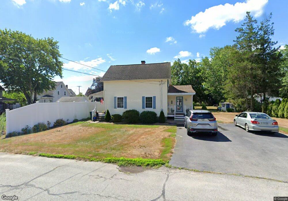
15 Dudley Ave Whitinsville, MA 01588
Estimated Value: $383,000 - $532,000
3
Beds
2
Baths
1,280
Sq Ft
$343/Sq Ft
Est. Value
About This Home
This home is located at 15 Dudley Ave, Whitinsville, MA 01588 and is currently estimated at $438,809, approximately $342 per square foot. 15 Dudley Ave is a home located in Worcester County with nearby schools including Northbridge Elementary School, Northbridge Middle School, and Northbridge High School.
Ownership History
Date
Name
Owned For
Owner Type
Purchase Details
Closed on
Nov 22, 1999
Sold by
Schotanus Peter
Bought by
Zaidel Kimberly P
Current Estimated Value
Purchase Details
Closed on
May 11, 1999
Sold by
Smith Ross
Bought by
Schotanus Peter
Create a Home Valuation Report for This Property
The Home Valuation Report is an in-depth analysis detailing your home's value as well as a comparison with similar homes in the area
Home Values in the Area
Average Home Value in this Area
Purchase History
| Date | Buyer | Sale Price | Title Company |
|---|---|---|---|
| Zaidel Kimberly P | $146,700 | -- | |
| Zaidel Kimberly P | $146,700 | -- | |
| Schotanus Peter | $61,000 | -- | |
| Smith Ross | $45,100 | -- | |
| Smith Ross | $45,100 | -- |
Source: Public Records
Mortgage History
| Date | Status | Borrower | Loan Amount |
|---|---|---|---|
| Open | Smith Ross | $175,000 | |
| Closed | Smith Ross | $132,900 |
Source: Public Records
Tax History Compared to Growth
Tax History
| Year | Tax Paid | Tax Assessment Tax Assessment Total Assessment is a certain percentage of the fair market value that is determined by local assessors to be the total taxable value of land and additions on the property. | Land | Improvement |
|---|---|---|---|---|
| 2025 | $3,749 | $318,000 | $134,600 | $183,400 |
| 2024 | $3,663 | $303,000 | $134,600 | $168,400 |
| 2023 | $3,705 | $285,900 | $127,500 | $158,400 |
| 2022 | $3,287 | $238,700 | $98,100 | $140,600 |
| 2021 | $3,117 | $215,100 | $93,400 | $121,700 |
| 2020 | $2,905 | $209,900 | $93,400 | $116,500 |
| 2019 | $1,260 | $203,400 | $93,400 | $110,000 |
| 2018 | $1,215 | $193,700 | $88,900 | $104,800 |
| 2017 | $4,528 | $185,900 | $88,900 | $97,000 |
| 2016 | $2,309 | $167,900 | $76,300 | $91,600 |
| 2015 | $2,247 | $167,900 | $76,300 | $91,600 |
| 2014 | $2,226 | $167,900 | $76,300 | $91,600 |
Source: Public Records
Map
Nearby Homes
- 157 Rolling Ridge Dr Unit 84
- 1052 Providence Rd
- 140 Rolling Ridge Dr Unit 78
- 708 Marston Rd
- 169 Rolling Ridge Dr Unit 97
- 0 Puddon St
- 159 Rolling Ridge Dr Unit 85
- 894 Marston Rd
- 33 Crestwood Cir Unit 45
- 39 Crestwood Cir Unit 42
- 135 Windstone Dr
- 1880 Providence Rd
- 5 Summit St
- 831 Providence Rd Unit 837
- 90 Nathaniel Dr
- 192 Rebecca Rd
- 21 Granite St
- 1825 Quaker St
- 86 Kingsnorth St
- 121 East St Unit 121
- 1361 Providence Rd
- 16 Dudley Ave
- 27 Dudley Ave
- 1355 Providence Rd
- 1371 Providence Rd
- 1347 Providence Rd
- 26 Dudley Ave
- 41 Dudley Ave
- 1339 Providence Rd
- 34 Dudley Ave
- 1385 Providence Rd
- 1383 Providence Rd
- 1383 Providence Rd Unit 1
- 1385 Providence Rd Unit 1385
- 1385 Providence Rd Unit B
- 1395 Providence Rd
- 1395 Providence Rd Unit 1395
- 1327 Providence Rd
- 16 Roy St
- 1399 Providence Rd