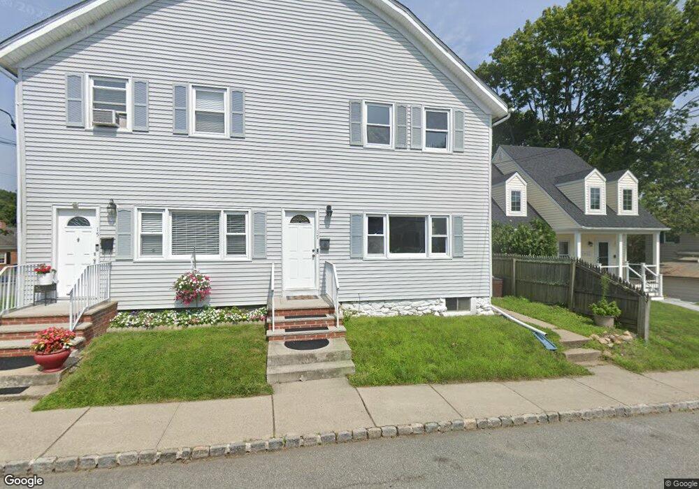
15 E Thomas St Unit 17 Wharton, NJ 07885
Estimated Value: $429,000 - $535,000
--
Bed
--
Bath
2,324
Sq Ft
$213/Sq Ft
Est. Value
About This Home
This home is located at 15 E Thomas St Unit 17, Wharton, NJ 07885 and is currently estimated at $494,136, approximately $212 per square foot. 15 E Thomas St Unit 17 is a home located in Morris County with nearby schools including Marie V. Duffy Elementary School and A C Mac Kinnon Middle School.
Ownership History
Date
Name
Owned For
Owner Type
Purchase Details
Closed on
Nov 2, 2022
Sold by
Rhead William J and Rhead Mary Ann
Bought by
Larusso William Anthony
Current Estimated Value
Home Financials for this Owner
Home Financials are based on the most recent Mortgage that was taken out on this home.
Original Mortgage
$345,000
Outstanding Balance
$333,803
Interest Rate
6.7%
Mortgage Type
Seller Take Back
Estimated Equity
$160,333
Create a Home Valuation Report for This Property
The Home Valuation Report is an in-depth analysis detailing your home's value as well as a comparison with similar homes in the area
Home Values in the Area
Average Home Value in this Area
Purchase History
| Date | Buyer | Sale Price | Title Company |
|---|---|---|---|
| Larusso William Anthony | $345,000 | -- | |
| Redacted Upon Request | $345,000 | None Listed On Document |
Source: Public Records
Mortgage History
| Date | Status | Borrower | Loan Amount |
|---|---|---|---|
| Open | Redacted Upon Request | $345,000 | |
| Closed | Redacted Upon Request | $345,000 |
Source: Public Records
Tax History Compared to Growth
Tax History
| Year | Tax Paid | Tax Assessment Tax Assessment Total Assessment is a certain percentage of the fair market value that is determined by local assessors to be the total taxable value of land and additions on the property. | Land | Improvement |
|---|---|---|---|---|
| 2025 | $11,336 | $413,000 | $103,300 | $309,700 |
| 2024 | $10,228 | $383,100 | $98,300 | $284,800 |
| 2023 | $10,228 | $341,600 | $93,300 | $248,300 |
| 2022 | $9,180 | $322,400 | $93,300 | $229,100 |
| 2021 | $9,180 | $300,900 | $93,300 | $207,600 |
| 2020 | $8,889 | $285,900 | $88,300 | $197,600 |
| 2019 | $8,681 | $281,500 | $88,300 | $193,200 |
| 2018 | $8,241 | $272,700 | $88,300 | $184,400 |
| 2017 | $8,194 | $268,200 | $88,300 | $179,900 |
| 2016 | $7,382 | $259,300 | $83,300 | $176,000 |
| 2015 | $7,754 | $256,400 | $83,300 | $173,100 |
| 2014 | $7,750 | $253,500 | $83,300 | $170,200 |
Source: Public Records
Map
Nearby Homes
- 8 Baker Ave
- 42 Fern Ave
- 10 Fernandez Ln
- 17 Anderson Rd
- 18 Wabash Ave
- 37 Garden Ave
- 19123 Westview Unit 19123
- 18116 Westview Unit 116E
- 18116 Westview
- 8 N Elk Ave
- 417 W Black Well St Ab
- 3 Sickle St
- 22145 Westview
- 29 Drake Ave
- 62 U S 46
- 301 W Blackwell St Unit 2
- 399 N Main St
- 70 Davis Ave Ab
- 0 U S 46
- 75 White St
- 21 E Thomas St
- 56 S Main St
- 58 S Main St
- 24 E Thomas St
- 38 E Central Ave
- 36 S Main St
- 30 E Thomas St
- 62 S Main St
- 9 Baker Ave
- 32 S Main St
- 32 S Main St Unit 1
- 6 Baker Ave
- 6 Baker Ave Unit THOMAS-4
- 56 E Central Ave
- 11 Baker Ave
- 9-11 Baker Ave
- 64 S Main St
- 32 E Central Ave Unit 34
- 13 Baker Ave Unit 15
- 58 E Central Ave Unit 1 Bedroom APT in 2 Family