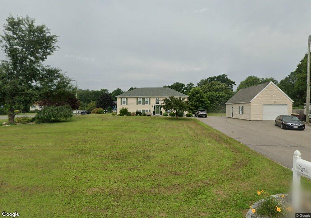
15 Earl St Acushnet, MA 02743
Sherwood Forest NeighborhoodEstimated Value: $609,223 - $692,000
3
Beds
2
Baths
2,380
Sq Ft
$274/Sq Ft
Est. Value
About This Home
This home is located at 15 Earl St, Acushnet, MA 02743 and is currently estimated at $652,056, approximately $273 per square foot. 15 Earl St is a home located in Bristol County with nearby schools including Acushnet Elementary School, Albert F Ford Middle School, and All Saints Catholic School.
Ownership History
Date
Name
Owned For
Owner Type
Purchase Details
Closed on
May 16, 2025
Sold by
Santos Michelle and Santos Peter M
Bought by
Santos Ft and Santos
Current Estimated Value
Purchase Details
Closed on
Feb 28, 2005
Sold by
Baker Kathleen M
Bought by
Santos Michelle and Santos Peter M
Home Financials for this Owner
Home Financials are based on the most recent Mortgage that was taken out on this home.
Original Mortgage
$245,000
Interest Rate
5.73%
Mortgage Type
Purchase Money Mortgage
Purchase Details
Closed on
Jun 15, 2004
Sold by
Baker Jeffrey W and Baker Kathleen M
Bought by
Baker Kathleen M
Purchase Details
Closed on
Apr 24, 1998
Sold by
Modern Continental Con
Bought by
Baker Jeffrey W and Baker Kathleen M
Home Financials for this Owner
Home Financials are based on the most recent Mortgage that was taken out on this home.
Original Mortgage
$134,900
Interest Rate
7.11%
Mortgage Type
Purchase Money Mortgage
Create a Home Valuation Report for This Property
The Home Valuation Report is an in-depth analysis detailing your home's value as well as a comparison with similar homes in the area
Home Values in the Area
Average Home Value in this Area
Purchase History
| Date | Buyer | Sale Price | Title Company |
|---|---|---|---|
| Santos Ft | -- | None Available | |
| Santos Michelle | $365,000 | -- | |
| Santos Michelle | $365,000 | -- | |
| Baker Kathleen M | -- | -- | |
| Baker Kathleen M | -- | -- | |
| Baker Jeffrey W | $149,900 | -- |
Source: Public Records
Mortgage History
| Date | Status | Borrower | Loan Amount |
|---|---|---|---|
| Previous Owner | Santos Michelle | $245,000 | |
| Previous Owner | Baker Jeffrey W | $134,900 |
Source: Public Records
Tax History Compared to Growth
Tax History
| Year | Tax Paid | Tax Assessment Tax Assessment Total Assessment is a certain percentage of the fair market value that is determined by local assessors to be the total taxable value of land and additions on the property. | Land | Improvement |
|---|---|---|---|---|
| 2025 | $6,051 | $560,800 | $156,100 | $404,700 |
| 2024 | $5,828 | $510,800 | $147,900 | $362,900 |
| 2023 | $5,748 | $479,000 | $134,200 | $344,800 |
| 2022 | $5,191 | $391,200 | $125,900 | $265,300 |
| 2021 | $0 | $380,900 | $125,900 | $255,000 |
| 2020 | $0 | $372,700 | $117,700 | $255,000 |
| 2019 | $5,146 | $362,900 | $112,300 | $250,600 |
| 2018 | $4,979 | $345,300 | $112,300 | $233,000 |
| 2017 | $2,342 | $333,700 | $112,300 | $221,400 |
| 2016 | $4,575 | $314,900 | $112,300 | $202,600 |
| 2015 | $4,208 | $294,700 | $112,300 | $182,400 |
Source: Public Records
Map
Nearby Homes
- 5 Fairway Dr
- 13 Fairway Dr
- 26 Rounseville St
- 16 Morses Ln
- ES Acushnet Ave
- 1045 Forbes St
- 67 Morses Ln
- 847 Terry Ln
- 850 Terry Ln
- 1269 Bartlett St
- 2992 Acushnet Ave
- 2981 Acushnet Ave
- 957 Glen St
- 1023 Bowles St
- 1044 Phillips Rd Unit 20
- 1044 Phillips Rd Unit 24
- 9 Middlefield Place
- 6 Middlefield Place
- 1044 Victoria St Unit B-29
- 0 Church Dutton & Chaffee Unit 73371719