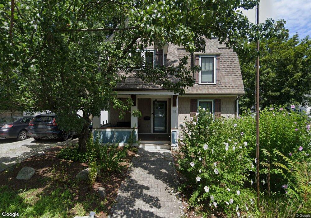
15 Elliot St Braintree, MA 02184
Weymouth Landing NeighborhoodEstimated Value: $753,025 - $827,000
4
Beds
2
Baths
1,734
Sq Ft
$455/Sq Ft
Est. Value
About This Home
This home is located at 15 Elliot St, Braintree, MA 02184 and is currently estimated at $789,756, approximately $455 per square foot. 15 Elliot St is a home located in Norfolk County with nearby schools including South Shore Christian Academy and Sacred Heart Elementary School.
Ownership History
Date
Name
Owned For
Owner Type
Purchase Details
Closed on
Feb 15, 2021
Sold by
Bosse Maryann and Bosse Douglas P
Bought by
Caplan Hannah L and Kissane Daniel J
Current Estimated Value
Home Financials for this Owner
Home Financials are based on the most recent Mortgage that was taken out on this home.
Original Mortgage
$520,000
Outstanding Balance
$462,539
Interest Rate
2.65%
Mortgage Type
Purchase Money Mortgage
Estimated Equity
$327,217
Purchase Details
Closed on
Jan 31, 2020
Sold by
Maryann Bosse
Bought by
Maryann Bosse and Maryann Douglas P
Home Financials for this Owner
Home Financials are based on the most recent Mortgage that was taken out on this home.
Original Mortgage
$319,000
Interest Rate
3.72%
Mortgage Type
New Conventional
Purchase Details
Closed on
Sep 1, 2015
Sold by
Francis Mary A
Bought by
Bosse Maryanne
Home Financials for this Owner
Home Financials are based on the most recent Mortgage that was taken out on this home.
Original Mortgage
$200,000
Interest Rate
4.09%
Mortgage Type
New Conventional
Purchase Details
Closed on
Feb 7, 2005
Sold by
Murphy Robert L
Bought by
Francis Mary A
Purchase Details
Closed on
Mar 30, 2000
Sold by
Cimino Matthew J and Cimino Sandra F
Bought by
Murphy Mary A and Murphy Robert L
Home Financials for this Owner
Home Financials are based on the most recent Mortgage that was taken out on this home.
Original Mortgage
$123,000
Interest Rate
8.4%
Mortgage Type
Purchase Money Mortgage
Purchase Details
Closed on
Dec 31, 1997
Sold by
Morgan Charles E and Morgan Geraldine E
Bought by
Cimino Matthew J and Cimino Sandra F
Home Financials for this Owner
Home Financials are based on the most recent Mortgage that was taken out on this home.
Original Mortgage
$75,000
Interest Rate
7.11%
Mortgage Type
Purchase Money Mortgage
Purchase Details
Closed on
Jul 6, 1990
Sold by
Bank Of New England
Bought by
Morgan Geraldine E
Create a Home Valuation Report for This Property
The Home Valuation Report is an in-depth analysis detailing your home's value as well as a comparison with similar homes in the area
Home Values in the Area
Average Home Value in this Area
Purchase History
| Date | Buyer | Sale Price | Title Company |
|---|---|---|---|
| Caplan Hannah L | $650,000 | None Available | |
| Maryann Bosse | -- | None Available | |
| Bosse Maryanne | $250,000 | -- | |
| Francis Mary A | -- | -- | |
| Francis Mary A | -- | -- | |
| Murphy Mary A | $205,000 | -- | |
| Cimino Matthew J | $165,000 | -- | |
| Cimino Matthew J | $165,000 | -- | |
| Morgan Geraldine E | $110,000 | -- | |
| Morgan Geraldine E | $110,000 | -- |
Source: Public Records
Mortgage History
| Date | Status | Borrower | Loan Amount |
|---|---|---|---|
| Open | Caplan Hannah L | $520,000 | |
| Previous Owner | Maryann Bosse | $319,000 | |
| Previous Owner | Bosse Maryanne | $200,000 | |
| Previous Owner | Morgan Geraldine E | $123,000 | |
| Previous Owner | Morgan Geraldine E | $75,000 |
Source: Public Records
Tax History Compared to Growth
Tax History
| Year | Tax Paid | Tax Assessment Tax Assessment Total Assessment is a certain percentage of the fair market value that is determined by local assessors to be the total taxable value of land and additions on the property. | Land | Improvement |
|---|---|---|---|---|
| 2025 | $7,030 | $704,400 | $314,600 | $389,800 |
| 2024 | $6,451 | $680,500 | $293,400 | $387,100 |
| 2023 | $6,136 | $628,700 | $263,600 | $365,100 |
| 2022 | $4,936 | $496,100 | $238,100 | $258,000 |
| 2021 | $4,553 | $457,600 | $215,100 | $242,500 |
| 2020 | $4,213 | $427,300 | $195,600 | $231,700 |
| 2019 | $4,073 | $403,700 | $187,100 | $216,600 |
| 2018 | $3,841 | $364,400 | $170,100 | $194,300 |
| 2017 | $3,698 | $344,300 | $161,600 | $182,700 |
| 2016 | $3,413 | $310,800 | $136,100 | $174,700 |
| 2015 | $3,350 | $302,600 | $134,400 | $168,200 |
| 2014 | $3,170 | $277,600 | $122,500 | $155,100 |
Source: Public Records
Map
Nearby Homes
- 36 Brookside Rd
- 122 Washington St Unit 22
- 11 Richmond St
- 37 Lantern Ln
- 15 Summer St
- 23-25 Lindbergh Ave
- 16 Lindbergh Ave
- 141 Commercial St Unit 9
- 51 Faxon St
- 114 Broad St Unit D
- 114 Broad St Unit C
- 76 Kingman St
- 19 Vine St Unit 3
- 19 Vine St Unit 1
- 97 Liberty St
- 685 Union St
- 33 Congress St
- 294 Commercial St
- 48 Apple Tree Ln
- 230 Lisle St