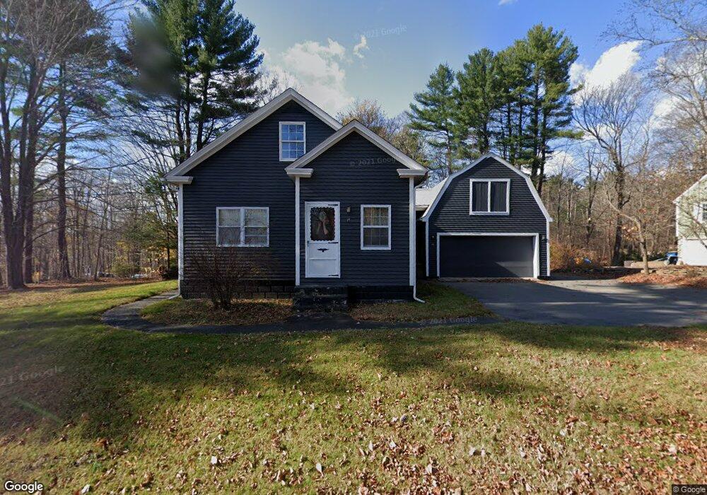
15 Fiske Hill Rd Sturbridge, MA 01566
Estimated Value: $347,000 - $387,000
2
Beds
1
Bath
1,108
Sq Ft
$324/Sq Ft
Est. Value
About This Home
This home is located at 15 Fiske Hill Rd, Sturbridge, MA 01566 and is currently estimated at $359,516, approximately $324 per square foot. 15 Fiske Hill Rd is a home located in Worcester County with nearby schools including Burgess Elementary School, Tantasqua Regional Junior High School, and Tantasqua Regional High School.
Ownership History
Date
Name
Owned For
Owner Type
Purchase Details
Closed on
Feb 27, 1998
Sold by
Fhlmc
Bought by
Brogan John J and Brogan Richard E
Current Estimated Value
Purchase Details
Closed on
Nov 19, 1997
Sold by
Brogan John J and Fleet Mtg Corp
Bought by
Fhlmc
Purchase Details
Closed on
May 27, 1988
Sold by
Michalik Richard
Bought by
Brogan J J
Create a Home Valuation Report for This Property
The Home Valuation Report is an in-depth analysis detailing your home's value as well as a comparison with similar homes in the area
Home Values in the Area
Average Home Value in this Area
Purchase History
| Date | Buyer | Sale Price | Title Company |
|---|---|---|---|
| Brogan John J | $104,345 | -- | |
| Fhlmc | $100,188 | -- | |
| Brogan J J | $123,500 | -- |
Source: Public Records
Mortgage History
| Date | Status | Borrower | Loan Amount |
|---|---|---|---|
| Previous Owner | Brogan J J | $98,800 |
Source: Public Records
Tax History Compared to Growth
Tax History
| Year | Tax Paid | Tax Assessment Tax Assessment Total Assessment is a certain percentage of the fair market value that is determined by local assessors to be the total taxable value of land and additions on the property. | Land | Improvement |
|---|---|---|---|---|
| 2025 | $4,765 | $299,100 | $81,500 | $217,600 |
| 2024 | $4,576 | $277,500 | $80,000 | $197,500 |
| 2023 | $4,317 | $238,900 | $69,800 | $169,100 |
| 2022 | $4,163 | $217,400 | $63,600 | $153,800 |
| 2021 | $3,884 | $204,200 | $60,600 | $143,600 |
| 2020 | $3,884 | $204,200 | $60,600 | $143,600 |
| 2019 | $3,587 | $187,300 | $62,400 | $124,900 |
| 2018 | $3,449 | $177,400 | $59,400 | $118,000 |
| 2017 | $3,286 | $169,400 | $57,100 | $112,300 |
| 2016 | $3,158 | $164,400 | $55,500 | $108,900 |
| 2015 | $3,051 | $158,600 | $55,500 | $103,100 |
Source: Public Records
Map
Nearby Homes
- Lot 1 Berry Farms Road-2 Acre
- 6 Berry Farms Rd Unit 63
- 6 Berry Farms Rd Unit 6
- 6 Berry Farms Rd Unit 64
- 6 Berry Farms Rd Unit 3
- 5 Fairview Park Rd Unit A10
- 3 Berry Farms Road - Jv
- 38 Glenwood Ave
- 77 Westwood Pkwy
- 111 Plimpton St
- 8 Shepard Place
- 6 Walcott St
- 134 Pleasant St
- 6 Mcgilpin Rd
- 8 Blueberry Ln
- 6 Hillside Dr
- 170 Shepard Rd
- 29 Fiske St
- 8 Hillside Dr
- 72 High St
- 13 Fiske Hill Rd
- 13 Fiske Hill Rd
- 17 Fiske Hill Rd
- 16 Fiske Hill Rd
- 11 Fiske Hill Rd
- 19 Fiske Hill Rd
- 12 Fiske Hill Rd
- 18 Fiske Hill Rd
- 9 Fiske Hill Rd
- 34 Plimpton Ave
- 21 Fiske Hill Rd
- 8 Fiske Hill Rd
- 8 Fiske Hill Rd
- 32 Plimpton Ave
- 7 Fiske Hill Rd
- 24 Fiske Hill Rd
- 18 Old Fiske Hill Rd
- 8 Eagle Ave
- 31 Plimpton Ave
- 5 Pinehaven Rd