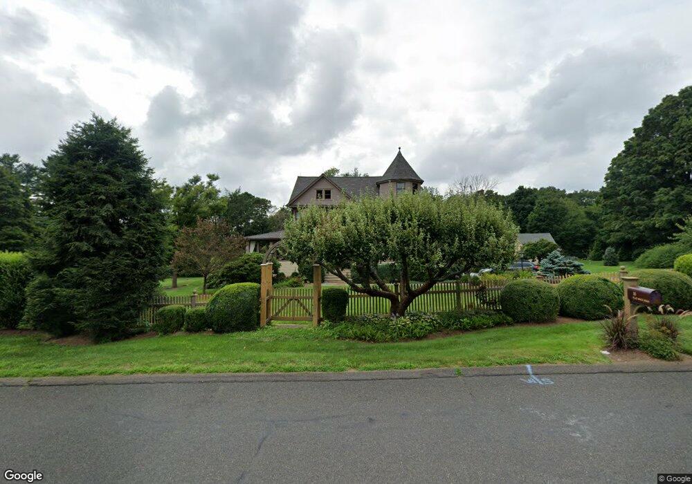
15 Flat Rock Rd Easton, CT 06612
Estimated Value: $945,000 - $1,240,874
4
Beds
4
Baths
3,948
Sq Ft
$281/Sq Ft
Est. Value
About This Home
This home is located at 15 Flat Rock Rd, Easton, CT 06612 and is currently estimated at $1,108,719, approximately $280 per square foot. 15 Flat Rock Rd is a home located in Fairfield County with nearby schools including Samuel Staples Elementary School, Helen Keller Middle School, and Joel Barlow High School.
Ownership History
Date
Name
Owned For
Owner Type
Purchase Details
Closed on
Dec 22, 2010
Sold by
Auray Deapaoletta
Bought by
Auray Thomas and Auray Deapaoletta
Current Estimated Value
Home Financials for this Owner
Home Financials are based on the most recent Mortgage that was taken out on this home.
Original Mortgage
$575,000
Interest Rate
4.17%
Purchase Details
Closed on
Jan 7, 1998
Sold by
Gunn Benjamin W and Mclaren Sally P
Bought by
Paoletta-Auray Dea
Create a Home Valuation Report for This Property
The Home Valuation Report is an in-depth analysis detailing your home's value as well as a comparison with similar homes in the area
Home Values in the Area
Average Home Value in this Area
Purchase History
| Date | Buyer | Sale Price | Title Company |
|---|---|---|---|
| Auray Thomas | -- | -- | |
| Auray Thomas | -- | -- | |
| Paoletta-Auray Dea | $400,000 | -- | |
| Paoletta-Auray Dea | $400,000 | -- |
Source: Public Records
Mortgage History
| Date | Status | Borrower | Loan Amount |
|---|---|---|---|
| Open | Paoletta-Auray Dea | $502,978 | |
| Closed | Paoletta-Auray Dea | $575,000 |
Source: Public Records
Tax History Compared to Growth
Tax History
| Year | Tax Paid | Tax Assessment Tax Assessment Total Assessment is a certain percentage of the fair market value that is determined by local assessors to be the total taxable value of land and additions on the property. | Land | Improvement |
|---|---|---|---|---|
| 2025 | $17,686 | $570,500 | $192,570 | $377,930 |
| 2024 | $16,853 | $570,500 | $192,570 | $377,930 |
| 2023 | $16,522 | $570,500 | $192,570 | $377,930 |
| 2022 | $16,225 | $570,500 | $192,570 | $377,930 |
| 2021 | $17,145 | $529,980 | $185,670 | $344,310 |
| 2020 | $16,429 | $529,980 | $185,670 | $344,310 |
| 2019 | $16,604 | $529,980 | $185,670 | $344,310 |
| 2018 | $16,631 | $529,980 | $185,670 | $344,310 |
| 2017 | $17,691 | $529,980 | $185,670 | $344,310 |
| 2016 | $17,458 | $566,620 | $196,060 | $370,560 |
| 2015 | $17,214 | $566,620 | $196,060 | $370,560 |
| 2014 | $16,942 | $566,620 | $196,060 | $370,560 |
Source: Public Records
Map
Nearby Homes
- 305 Sport Hill Rd
- 48 Sunset Rd
- 43 Hall Rd
- 63 Flat Rock Dr
- 35 Sturbridge Rd
- 20 Ground Pine Ln
- 340 Morehouse Rd
- 73 Buck Hill Rd
- 83 Buck Hill Rd
- 159 Blue Bell Ln
- 32 Adirondack Trail
- 550 Rolling Hills Dr
- 26 Wendy Rd
- 301 Weeping Willow Ln
- 218 Adams Rd
- 56 Waller Rd
- 66 Morehouse Rd
- 4482 Madison Ave
- 15 Golf View Dr
- 138 Merrimac Dr
- 20 Flat Rock Rd
- 14 Flat Rock Rd
- 26 Flat Rock Rd
- 27 Flat Rock Rd
- 3 Flat Rock Rd
- 19 Old Orchard Rd
- 312 Sport Hill Rd
- 14 Jesse Lee Dr
- 32 Flat Rock Rd
- 9 Jesse Lee Dr
- 20 Ridgedale Rd
- 318 Sport Hill Rd
- 322 Sport Hill Rd
- 36 Flat Rock Rd
- 35 Flat Rock Rd
- 24 Old Orchard Rd
- 296 Sport Hill Rd
- 16 Old Orchard Rd
- 15 Ridgedale Rd
- 5 Beers Rd