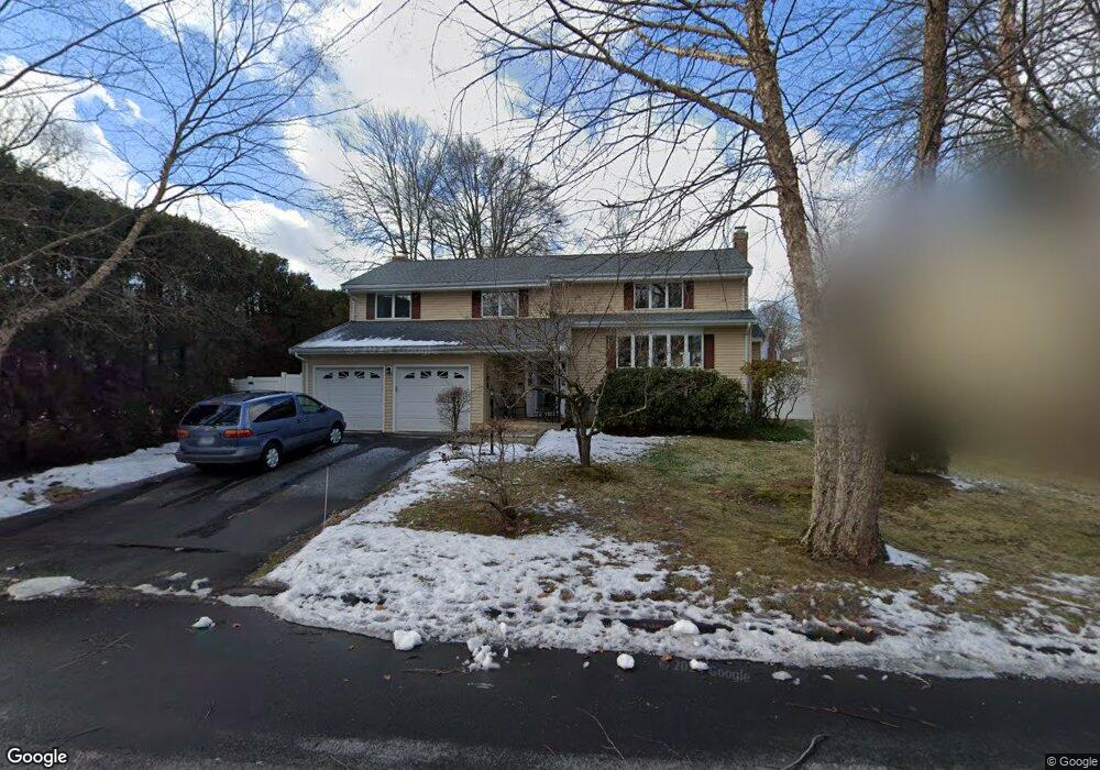
15 Foot Path Ln West Hartford, CT 06107
Estimated Value: $696,000 - $758,000
4
Beds
3
Baths
1,873
Sq Ft
$386/Sq Ft
Est. Value
About This Home
This home is located at 15 Foot Path Ln, West Hartford, CT 06107 and is currently estimated at $722,242, approximately $385 per square foot. 15 Foot Path Ln is a home located in Hartford County with nearby schools including Duffy School, Sedgwick Middle School, and Conard High School.
Ownership History
Date
Name
Owned For
Owner Type
Purchase Details
Closed on
Feb 28, 2020
Sold by
Joseph Katalin P
Bought by
Joseph Douglas A and Joseph Katalin P
Current Estimated Value
Purchase Details
Closed on
Nov 19, 2012
Sold by
Joseph Douglas A
Bought by
Joseph Katalin P
Purchase Details
Closed on
Oct 3, 2011
Sold by
Joseph Katalin P
Bought by
Joseph Douglas A and Joseph Katalin P
Home Financials for this Owner
Home Financials are based on the most recent Mortgage that was taken out on this home.
Original Mortgage
$310,000
Interest Rate
3.38%
Purchase Details
Closed on
Jul 27, 2010
Sold by
Joseph Douglas A
Bought by
Joseph Kathlin P
Purchase Details
Closed on
Dec 23, 2008
Sold by
Hopkinson Rand A and Hopkinson Sharon B
Bought by
Joseph Douglas A and Joseph Katalin P
Purchase Details
Closed on
Jul 16, 2003
Sold by
Caparas Lolita S
Bought by
Hopkinson Rand A and Hopkinson Sharon B
Create a Home Valuation Report for This Property
The Home Valuation Report is an in-depth analysis detailing your home's value as well as a comparison with similar homes in the area
Home Values in the Area
Average Home Value in this Area
Purchase History
| Date | Buyer | Sale Price | Title Company |
|---|---|---|---|
| Joseph Douglas A | -- | None Available | |
| Joseph Katalin P | -- | -- | |
| Joseph Douglas A | -- | -- | |
| Joseph Kathlin P | -- | -- | |
| Joseph Katalin P | -- | -- | |
| Joseph Douglas A | $440,900 | -- | |
| Hopkinson Rand A | $345,500 | -- |
Source: Public Records
Mortgage History
| Date | Status | Borrower | Loan Amount |
|---|---|---|---|
| Previous Owner | Hopkinson Rand A | $100,000 | |
| Previous Owner | Hopkinson Rand A | $310,000 |
Source: Public Records
Tax History Compared to Growth
Tax History
| Year | Tax Paid | Tax Assessment Tax Assessment Total Assessment is a certain percentage of the fair market value that is determined by local assessors to be the total taxable value of land and additions on the property. | Land | Improvement |
|---|---|---|---|---|
| 2025 | $14,294 | $319,200 | $112,980 | $206,220 |
| 2024 | $13,518 | $319,200 | $112,980 | $206,220 |
| 2023 | $13,062 | $319,200 | $112,980 | $206,220 |
| 2022 | $12,985 | $319,200 | $112,980 | $206,220 |
| 2021 | $12,578 | $296,520 | $116,270 | $180,250 |
| 2020 | $11,944 | $285,740 | $108,780 | $176,960 |
| 2019 | $11,944 | $285,740 | $108,780 | $176,960 |
| 2018 | $11,715 | $285,740 | $108,780 | $176,960 |
| 2017 | $11,727 | $285,740 | $108,780 | $176,960 |
| 2016 | $10,405 | $263,340 | $91,420 | $171,920 |
| 2015 | $10,089 | $263,340 | $91,420 | $171,920 |
| 2014 | $9,841 | $263,340 | $91,420 | $171,920 |
Source: Public Records
Map
Nearby Homes
- 39 Pheasant Hill Dr
- 43 Spring Ln
- 50 Tunxis Rd
- 96 Bentwood Rd
- 236 Ridgewood Rd
- 34 Sandhurst Dr
- 29 Fairwood Farms Dr
- 11 Fairwood Farms Dr
- 57 Wardwell Rd
- 51 Lemay St
- 32 Miles Standish Dr
- 61 Waterside Ln
- 1640 Boulevard
- 25 Ellsworth Rd
- 394 Trout Brook Dr
- 422 S Main St
- 2 Arapahoe Rd Unit 313
- 2 Arapahoe Rd Unit 308
- 2 Arapahoe Rd Unit 611
- 2 Arapahoe Rd Unit 601
- 11 Foot Path Ln
- 44 Pheasant Hill Dr
- 40 Pheasant Hill Dr
- 29 Farm Hill Rd
- 5 Foot Path Ln
- 38 Pheasant Hill Dr
- 16 Foot Path Ln
- 30 Farm Hill Rd
- 3 Pine Brook Ln
- 25 Farm Hill Rd
- 50 Pheasant Hill Dr
- 43 Pheasant Hill Dr
- 34 Pheasant Hill Dr
- 2 Pine Brook Ln
- 49 Pheasant Hill Dr
- 26 Farm Hill Rd
- 11 Pine Brook Ln
- 78 Westminster Dr
- 72 Westminster Dr
- 6 Pine Brook Ln