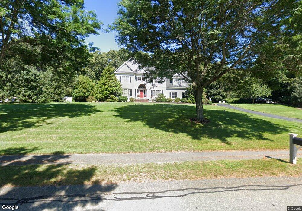
15 Fox Run Rd Wrentham, MA 02093
Estimated Value: $1,226,783 - $1,438,000
4
Beds
3
Baths
3,800
Sq Ft
$351/Sq Ft
Est. Value
About This Home
This home is located at 15 Fox Run Rd, Wrentham, MA 02093 and is currently estimated at $1,335,196, approximately $351 per square foot. 15 Fox Run Rd is a home located in Norfolk County with nearby schools including Delaney Elementary School, Charles E Roderick, and Foxborough Regional Charter School.
Ownership History
Date
Name
Owned For
Owner Type
Purchase Details
Closed on
Nov 16, 2017
Sold by
Harnpukdipatima Amornrut and Harnpukdipatima Amornut
Bought by
15 Fox Run Road Rt
Current Estimated Value
Purchase Details
Closed on
Sep 13, 1999
Sold by
Monti James F and Monti Victoria L
Bought by
Harnpukdipatima Bandit and Harnpukdipatima A
Home Financials for this Owner
Home Financials are based on the most recent Mortgage that was taken out on this home.
Original Mortgage
$427,250
Interest Rate
7.65%
Mortgage Type
Purchase Money Mortgage
Purchase Details
Closed on
Sep 5, 1997
Sold by
Voyager Building Corp
Bought by
Monti James F and Monti Victoria L
Create a Home Valuation Report for This Property
The Home Valuation Report is an in-depth analysis detailing your home's value as well as a comparison with similar homes in the area
Home Values in the Area
Average Home Value in this Area
Purchase History
| Date | Buyer | Sale Price | Title Company |
|---|---|---|---|
| 15 Fox Run Road Rt | -- | -- | |
| Harnpukdipatima Bandit | $534,100 | -- | |
| Monti James F | $462,000 | -- |
Source: Public Records
Mortgage History
| Date | Status | Borrower | Loan Amount |
|---|---|---|---|
| Previous Owner | Monti James F | $322,700 | |
| Previous Owner | Monti James F | $150,000 | |
| Previous Owner | Monti James F | $427,250 |
Source: Public Records
Tax History Compared to Growth
Tax History
| Year | Tax Paid | Tax Assessment Tax Assessment Total Assessment is a certain percentage of the fair market value that is determined by local assessors to be the total taxable value of land and additions on the property. | Land | Improvement |
|---|---|---|---|---|
| 2025 | $12,029 | $1,037,900 | $338,000 | $699,900 |
| 2024 | $11,432 | $952,700 | $338,000 | $614,700 |
| 2023 | $11,680 | $925,500 | $307,300 | $618,200 |
| 2022 | $10,921 | $798,900 | $279,200 | $519,700 |
| 2021 | $10,647 | $756,700 | $279,200 | $477,500 |
| 2020 | $11,008 | $772,500 | $229,600 | $542,900 |
| 2019 | $10,555 | $747,500 | $229,600 | $517,900 |
| 2018 | $10,689 | $750,600 | $229,600 | $521,000 |
| 2017 | $10,602 | $744,000 | $225,200 | $518,800 |
| 2016 | $10,389 | $727,500 | $218,700 | $508,800 |
| 2015 | $10,528 | $702,800 | $210,200 | $492,600 |
| 2014 | $9,411 | $614,700 | $202,200 | $412,500 |
Source: Public Records
Map
Nearby Homes
- 362 East St
- 1 Lorraine Metcalf Dr
- 270 Dedham St
- 65 Pond St
- 10 Nature View Dr
- 15 Nature View Dr
- 319 Taunton St
- 120 Hawes St
- 483 Thurston St
- 131 Creek St Unit 7
- 11 Earle Stewart Ln
- Lot 3 - 14 Earle Stewart Ln
- Lot 1 - Blueberry 2 Car Plan at King Philip Estates
- Lot 8 - Blueberry 2 Car Plan at King Philip Estates
- Lot 6 - Blueberry 3 Car Plan at King Philip Estates
- Lot 2 - Camden 2 Car Plan at King Philip Estates
- Lot 7 - Cedar Plan at King Philip Estates
- Lot 4 - Hemingway 2 Car Plan at King Philip Estates
- Lot 3 - Blueberry 2 Car Plan at King Philip Estates
- 25 Foxboro Rd
- 5 Hidden Meadows Ln
- 61 Pheasant Run Ct
- 58 Pheasant Run Ct
- 20 Fox Run Rd
- 68 Pheasant Run Ct
- 5 Lot 5 Fox Run Rd
- 30 Fox Run Rd
- 10 Fox Run Rd
- 330 East St
- 350 East St
- 340 East St
- 40 Fox Run Rd
- 11 Fox Run Rd
- 320 East St
- 05 Fox Run Rd
- 10 Hidden Meadows Ln
- 55 Cobb Rd Unit 55
- 55 Cobb Rd Unit B
- 55 Cobb Rd
- 45 Cobb Rd