Estimated Value: $637,680 - $966,000
--
Bed
--
Bath
2,075
Sq Ft
$375/Sq Ft
Est. Value
About This Home
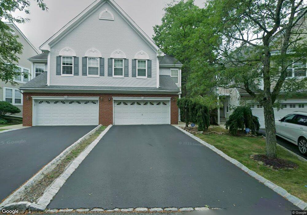
This home is located at 15 Gannett Ct, Wayne, NJ 07470 and is currently estimated at $777,420, approximately $374 per square foot. 15 Gannett Ct is a home located in Passaic County with nearby schools including John F. Kennedy Elementary School, Anthony Wayne Middle School, and Wayne Hills High School.
Ownership History
Date
Name
Owned For
Owner Type
Purchase Details
Closed on
Jan 26, 2004
Sold by
Abrams Andrew
Bought by
Tsuboi Satoshi and Mix Pak
Current Estimated Value
Home Financials for this Owner
Home Financials are based on the most recent Mortgage that was taken out on this home.
Original Mortgage
$369,000
Outstanding Balance
$172,940
Interest Rate
5.82%
Estimated Equity
$604,480
Purchase Details
Closed on
Nov 29, 1999
Sold by
Lipari Joseph and Lipari Susan M
Bought by
Abrams Andrew C and Abrams Karen E
Home Financials for this Owner
Home Financials are based on the most recent Mortgage that was taken out on this home.
Original Mortgage
$235,000
Interest Rate
7%
Purchase Details
Closed on
Aug 26, 1993
Sold by
Hovnanian K
Bought by
Lipari Joseph and Lipari Sue
Home Financials for this Owner
Home Financials are based on the most recent Mortgage that was taken out on this home.
Original Mortgage
$185,000
Interest Rate
6.73%
Create a Home Valuation Report for This Property
The Home Valuation Report is an in-depth analysis detailing your home's value as well as a comparison with similar homes in the area
Home Values in the Area
Average Home Value in this Area
Purchase History
| Date | Buyer | Sale Price | Title Company |
|---|---|---|---|
| Tsuboi Satoshi | $461,500 | -- | |
| Abrams Andrew C | $297,000 | -- | |
| Lipari Joseph | $207,000 | -- |
Source: Public Records
Mortgage History
| Date | Status | Borrower | Loan Amount |
|---|---|---|---|
| Open | Tsuboi Satoshi | $369,000 | |
| Previous Owner | Abrams Andrew C | $235,000 | |
| Previous Owner | Lipari Joseph | $185,000 |
Source: Public Records
Tax History Compared to Growth
Tax History
| Year | Tax Paid | Tax Assessment Tax Assessment Total Assessment is a certain percentage of the fair market value that is determined by local assessors to be the total taxable value of land and additions on the property. | Land | Improvement |
|---|---|---|---|---|
| 2025 | $12,487 | $210,000 | $75,000 | $135,000 |
| 2024 | $12,008 | $210,000 | $75,000 | $135,000 |
| 2022 | $11,873 | $210,000 | $75,000 | $135,000 |
| 2021 | $8,882 | $210,000 | $75,000 | $135,000 |
| 2020 | $11,808 | $210,000 | $75,000 | $135,000 |
| 2019 | $11,579 | $210,000 | $75,000 | $135,000 |
| 2018 | $11,477 | $210,000 | $75,000 | $135,000 |
| 2017 | $11,372 | $210,000 | $75,000 | $135,000 |
| 2016 | $11,212 | $210,000 | $75,000 | $135,000 |
| 2015 | $11,078 | $210,000 | $75,000 | $135,000 |
| 2014 | $10,765 | $210,000 | $75,000 | $135,000 |
Source: Public Records
Map
Nearby Homes
- 59 Morning Watch Rd
- 41 Dorothy Dr
- 207 Degray St
- 41 Roosevelt Ave
- 801 Four Seasons Dr
- 156 Dorothy Dr
- 1124 Belmont Ave
- 705 Four Seasons Dr
- 511 Four Seasons Dr
- 730 Hamburg Turnpike
- 6 Micheline Ct
- 86 Hinchman Ave
- 33 Hillside Dr
- 88 Hinchman Ave
- 27 Stanford Place
- 95 Hillside Dr
- 28 Knox Terrace Unit 2B
- 28 Knox Terrace
- 102 Overlook Ave
- 28 Easedale Rd