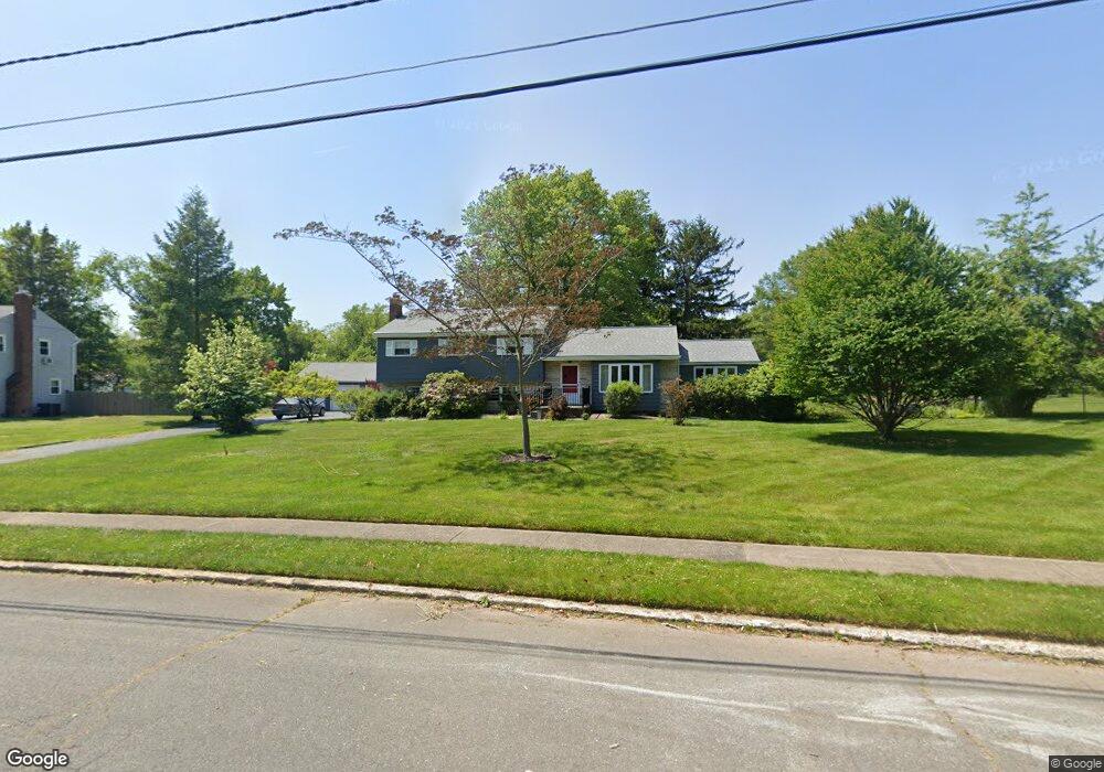
15 Gloucester Ln Ewing, NJ 08618
Ewingville NeighborhoodEstimated Value: $481,070 - $566,000
Studio
--
Bath
2,532
Sq Ft
$207/Sq Ft
Est. Value
About This Home
This home is located at 15 Gloucester Ln, Ewing, NJ 08618 and is currently estimated at $523,268, approximately $206 per square foot. 15 Gloucester Ln is a home with nearby schools including Ewing High School, Trenton Stem-To-Civics Charter School, and Guidepost Montessori at Lawrenceville.
Ownership History
Date
Name
Owned For
Owner Type
Purchase Details
Closed on
Feb 11, 2021
Sold by
Flynn Margaret Sally
Bought by
Flynn Teresa
Current Estimated Value
Create a Home Valuation Report for This Property
The Home Valuation Report is an in-depth analysis detailing your home's value as well as a comparison with similar homes in the area
Home Values in the Area
Average Home Value in this Area
Purchase History
| Date | Buyer | Sale Price | Title Company |
|---|---|---|---|
| Flynn Teresa | -- | None Listed On Document |
Source: Public Records
Tax History
| Year | Tax Paid | Tax Assessment Tax Assessment Total Assessment is a certain percentage of the fair market value that is determined by local assessors to be the total taxable value of land and additions on the property. | Land | Improvement |
|---|---|---|---|---|
| 2025 | $11,701 | $297,500 | $85,300 | $212,200 |
| 2024 | $10,999 | $297,500 | $85,300 | $212,200 |
Source: Public Records
Map
Nearby Homes
- 6 Van Gogh Ct
- 89 Upper Ferry Rd
- 51 van Duyn Dr
- 37 van Duyn Dr
- 71 Carlton Ave
- 2148 Pennington Rd
- 235 Masterson Ct
- 146 Masterson Ct
- 222 Masterson Ct
- 231 Masterson Ct
- 41 Harding St
- 345 Masterson Ct
- 611 Masterson Ct
- 438 Ewingville Rd
- 19 van Saun Dr
- 20 Steinway Ave
- 4 David Dr
- 1060 Terrace Blvd
- 1 Beth Ann Way
- 632 Timberlake Dr
- 13 Gloucester Ln
- 17 Gloucester Ln
- 14 Llanfair Ln
- 12 Llanfair Ln
- 16 Gloucester Ln
- 11 Gloucester Ln
- 14 Gloucester Ln
- 18 Gloucester Ln
- 5 Mattatuck Ln
- 10 Llanfair Ln
- 5 Mattatuck Ln
- 18 Llanfair Ln
- 16 Llanfair Ln
- 7 Mattatuck Ln
- 20 Llanfair Ln
- 12 Gloucester Ln
- 9 Gloucester Ln
- 9 Llanfair Ln
- 1 Mattatuck Ln
- 53 Bayberry Rd
Your Personal Tour Guide
Ask me questions while you tour the home.
