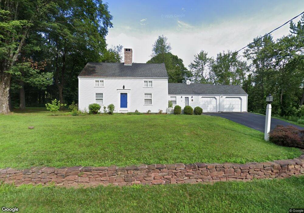
15 Goodrich Rd Simsbury, CT 06070
Estimated Value: $305,000 - $498,357
4
Beds
2
Baths
1,651
Sq Ft
$258/Sq Ft
Est. Value
About This Home
This home is located at 15 Goodrich Rd, Simsbury, CT 06070 and is currently estimated at $426,589, approximately $258 per square foot. 15 Goodrich Rd is a home located in Hartford County with nearby schools including Tariffville School, Henry James Memorial School, and Simsbury High School.
Ownership History
Date
Name
Owned For
Owner Type
Purchase Details
Closed on
Feb 3, 2020
Sold by
Charles Dietlin T
Bought by
Sullivan Patrick C and Sullivan Diane P
Current Estimated Value
Purchase Details
Closed on
Sep 14, 1989
Sold by
Andrews Dorothy
Bought by
Mackenzie Deborah
Create a Home Valuation Report for This Property
The Home Valuation Report is an in-depth analysis detailing your home's value as well as a comparison with similar homes in the area
Home Values in the Area
Average Home Value in this Area
Purchase History
| Date | Buyer | Sale Price | Title Company |
|---|---|---|---|
| Sullivan Patrick C | $186,000 | None Available | |
| Sullivan Patrick C | $124,000 | None Available | |
| Mackenzie Deborah | $36,000 | -- |
Source: Public Records
Mortgage History
| Date | Status | Borrower | Loan Amount |
|---|---|---|---|
| Previous Owner | Mackenzie Deborah | $230,000 | |
| Previous Owner | Mackenzie Deborah | $49,882 | |
| Previous Owner | Mackenzie Deborah | $54,181 |
Source: Public Records
Tax History Compared to Growth
Tax History
| Year | Tax Paid | Tax Assessment Tax Assessment Total Assessment is a certain percentage of the fair market value that is determined by local assessors to be the total taxable value of land and additions on the property. | Land | Improvement |
|---|---|---|---|---|
| 2025 | $9,538 | $279,230 | $114,450 | $164,780 |
| 2024 | $9,301 | $279,230 | $114,450 | $164,780 |
| 2023 | $8,885 | $279,230 | $114,450 | $164,780 |
| 2022 | $8,789 | $227,520 | $115,490 | $112,030 |
| 2021 | $8,789 | $227,520 | $115,490 | $112,030 |
| 2020 | $8,439 | $227,520 | $115,490 | $112,030 |
| 2019 | $8,491 | $227,520 | $115,490 | $112,030 |
| 2018 | $8,552 | $227,520 | $115,490 | $112,030 |
| 2017 | $7,997 | $206,310 | $108,570 | $97,740 |
| 2016 | $7,658 | $206,310 | $108,570 | $97,740 |
| 2015 | $7,658 | $206,310 | $108,570 | $97,740 |
| 2014 | $7,662 | $206,310 | $108,570 | $97,740 |
Source: Public Records
Map
Nearby Homes
- 24 Hunting Ridge Dr
- 19 Simsbury Landing
- 45 Hoskins Rd
- 26 Winterset Ln
- 87 Cambridge Ct
- 15 Pinnacle Mountain Rd
- 25 Barry Ln
- 68 Tariffville Rd
- 48 Library Ln Unit 48
- 158 Tariffville Rd
- 2 North Dr
- 141 Firetown Rd
- 9 Gretel Ln
- 23 Maple St
- 1 West St Unit 206
- 40 Firetown Rd Unit 39
- 11 Mallard Cir
- 2 Quail Dr Unit 2
- 14 Teal Cir Unit 14
- 14 Gordon St
- 21 Goodrich Rd
- 36 Ferry Ln
- 24 Ferry Ln
- 168 Terrys Plain Rd
- 156 Terrys Plain Rd
- 160 Terrys Plain Rd
- 154 Terrys Plain Rd
- 164 Terrys Plain Rd
- 162 Terrys Plain Rd
- 145 Terrys Plain Rd
- 12 Ferry Ln
- 150 Terrys Plain Rd
- 15 Ferry Ln
- 9 Quarry Rd
- 15 Quarry Rd
- 21 Quarry Rd
- 25 Quarry Rd
- 6 Quarry Rd
- 10 Quarry Rd
- 11 Ferry Ln