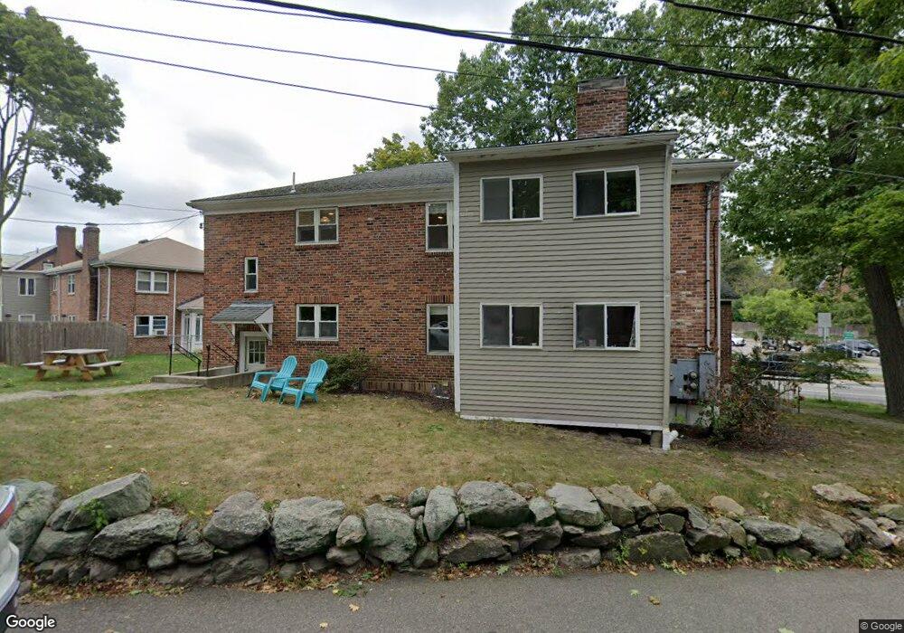
15 Heath St Brookline, MA 02445
Chestnut Hill NeighborhoodEstimated Value: $1,717,000 - $2,240,000
3
Beds
2
Baths
2,208
Sq Ft
$940/Sq Ft
Est. Value
About This Home
This home is located at 15 Heath St, Brookline, MA 02445 and is currently estimated at $2,074,615, approximately $939 per square foot. 15 Heath St is a home located in Norfolk County with nearby schools including Heath Elementary School, Maimonides School, and Brimmer & May School.
Ownership History
Date
Name
Owned For
Owner Type
Purchase Details
Closed on
Oct 15, 2009
Sold by
Wong Lana S and Wong Alan J
Bought by
15 Heath Street Rt
Current Estimated Value
Purchase Details
Closed on
Mar 1, 1988
Sold by
Stein Phyllis F
Bought by
Wong Lana S
Home Financials for this Owner
Home Financials are based on the most recent Mortgage that was taken out on this home.
Original Mortgage
$150,000
Interest Rate
10.49%
Mortgage Type
Purchase Money Mortgage
Create a Home Valuation Report for This Property
The Home Valuation Report is an in-depth analysis detailing your home's value as well as a comparison with similar homes in the area
Home Values in the Area
Average Home Value in this Area
Purchase History
| Date | Buyer | Sale Price | Title Company |
|---|---|---|---|
| 15 Heath Street Rt | $670,000 | -- | |
| Wong Lana S | $300,000 | -- |
Source: Public Records
Mortgage History
| Date | Status | Borrower | Loan Amount |
|---|---|---|---|
| Previous Owner | Wong Lana S | $150,000 |
Source: Public Records
Tax History Compared to Growth
Tax History
| Year | Tax Paid | Tax Assessment Tax Assessment Total Assessment is a certain percentage of the fair market value that is determined by local assessors to be the total taxable value of land and additions on the property. | Land | Improvement |
|---|---|---|---|---|
| 2025 | $16,017 | $1,622,800 | $734,300 | $888,500 |
| 2024 | $15,822 | $1,619,400 | $706,100 | $913,300 |
| 2023 | $15,672 | $1,571,900 | $643,700 | $928,200 |
| 2022 | $13,174 | $1,292,800 | $613,000 | $679,800 |
| 2021 | $12,182 | $1,243,100 | $589,400 | $653,700 |
| 2020 | $11,456 | $1,212,300 | $535,900 | $676,400 |
| 2019 | $10,817 | $1,154,400 | $510,300 | $644,100 |
| 2018 | $10,506 | $1,110,600 | $502,400 | $608,200 |
| 2017 | $10,160 | $1,028,300 | $473,900 | $554,400 |
| 2016 | $9,741 | $934,800 | $442,900 | $491,900 |
| 2015 | $9,077 | $849,900 | $414,000 | $435,900 |
| 2014 | $8,848 | $776,800 | $380,700 | $396,100 |
Source: Public Records
Map
Nearby Homes
- 675 Chestnut Hill Ave
- 55 Reservoir Rd Unit 2
- 55 Leicester St
- 120 Seaver St Unit A103
- 120 Seaver St Unit C-102
- 30 Ackers Ave
- 88 Cutler Ln
- 59 Ackers Ave Unit 1
- 372 Warren St
- 39 Clyde St
- 80 Dudley St
- 540 Chestnut Hill Ave
- 469 Walnut St
- 130 Cabot St
- 9 Willard Rd
- 487 Boylston St Unit 3
- 71 Sears Rd
- 142 Crafts Rd
- 333 Clark Rd
- 371 Walnut St
- 15 Heath St
- 15 Heath St
- 15 Heath St Unit 15
- 15 Heath St Unit 1
- 15 Heath St Unit 2
- 15 Heath St Unit A
- 15 Heath St Unit B
- 15 Heath St Unit 15
- 15 Heath St Unit A
- 15 Heath St Unit A1
- 17 Heath St Unit 1
- 17 Heath St Unit 1B
- 17 Heath St Unit 1A
- 17 Heath St Unit A
- 23 Heath St
- 23 Heath St Unit 1
- 23 Heath St Unit 2
- 728 Boylston St
- 25 Heath St Unit 2
- 27 Heath St