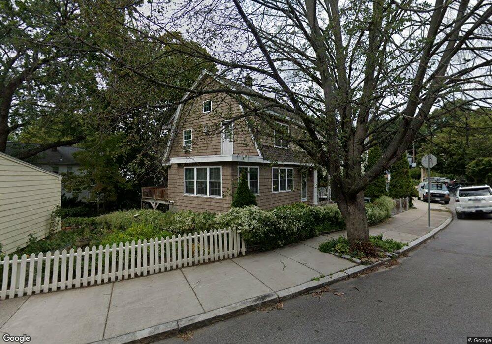
15 Herbertson Rd Jamaica Plain, MA 02130
Jamaica Plain NeighborhoodEstimated Value: $883,000 - $930,000
3
Beds
3
Baths
1,416
Sq Ft
$644/Sq Ft
Est. Value
About This Home
This home is located at 15 Herbertson Rd, Jamaica Plain, MA 02130 and is currently estimated at $911,945, approximately $644 per square foot. 15 Herbertson Rd is a home located in Suffolk County with nearby schools including Brooke Charter School Roslindale, The Croft School - Jamaica Plain, and St. Clare High School.
Ownership History
Date
Name
Owned For
Owner Type
Purchase Details
Closed on
Nov 22, 1994
Sold by
Cronin Timothy J and Sullivan Marie P
Bought by
Frascarelli William A
Current Estimated Value
Home Financials for this Owner
Home Financials are based on the most recent Mortgage that was taken out on this home.
Original Mortgage
$120,650
Interest Rate
8.9%
Mortgage Type
Purchase Money Mortgage
Create a Home Valuation Report for This Property
The Home Valuation Report is an in-depth analysis detailing your home's value as well as a comparison with similar homes in the area
Home Values in the Area
Average Home Value in this Area
Purchase History
| Date | Buyer | Sale Price | Title Company |
|---|---|---|---|
| Frascarelli William A | $127,000 | -- |
Source: Public Records
Mortgage History
| Date | Status | Borrower | Loan Amount |
|---|---|---|---|
| Closed | Frascarelli William A | $120,650 |
Source: Public Records
Tax History Compared to Growth
Tax History
| Year | Tax Paid | Tax Assessment Tax Assessment Total Assessment is a certain percentage of the fair market value that is determined by local assessors to be the total taxable value of land and additions on the property. | Land | Improvement |
|---|---|---|---|---|
| 2025 | $9,335 | $806,100 | $232,900 | $573,200 |
| 2024 | $8,632 | $791,900 | $218,900 | $573,000 |
| 2023 | $7,947 | $739,900 | $204,500 | $535,400 |
| 2022 | $7,383 | $678,600 | $187,600 | $491,000 |
| 2021 | $7,029 | $658,800 | $182,100 | $476,700 |
| 2020 | $5,915 | $560,100 | $175,100 | $385,000 |
| 2019 | $5,623 | $533,500 | $143,200 | $390,300 |
| 2018 | $4,992 | $476,300 | $143,200 | $333,100 |
| 2017 | $4,947 | $467,100 | $143,200 | $323,900 |
| 2016 | $5,038 | $458,000 | $143,200 | $314,800 |
| 2015 | $5,103 | $421,400 | $135,100 | $286,300 |
| 2014 | $4,642 | $369,000 | $135,100 | $233,900 |
Source: Public Records
Map
Nearby Homes
- 35 Eldridge Rd Unit 209
- 5 Eldridge Rd Unit 3
- 31 Rodman St Unit 2
- 31 Rodman St Unit 1
- 46 Southbourne Rd
- 158 Wachusett St Unit 3
- 51 Walk Hill St Unit 3
- 11 Goodway Rd Unit 2
- 98-100 Bourne St Unit 100
- 98 Bourne St
- 12 Wyvern St Unit 2
- 173 Brookway Rd
- 143-171 Hyde Park Ave Unit 169A
- 39 Harrison St Unit B
- 375 Hyde Park Ave Unit 3
- 37 Halliday St
- 24 Waterman Rd
- 391 Hyde Park Ave Unit 112
- 77 Wenham St Unit 2
- 620 South St
- 11 Herbertson Rd Unit 11A
- 11 Herbertson Rd
- 11 Herbertson Rd Unit 1
- 11 Herbertson Rd Unit 3
- 11 Herbertson Rd Unit C
- 11 Herbertson Rd Unit 2
- 11-11A Herbertson Rd
- 30 Northbourne Rd
- 230 Wachusett St Unit 232
- 232 Wachusett St Unit 232
- 232 Wachusett St
- 226 Wachusett St
- 9 Herbertson Rd Unit 1
- 7-9 Herbertson Rd
- 79 Herbertson Rd
- 236 Wachusett St
- 222 Wachusett St
- 7 Herbertson Rd Unit 2
- 39 Northbourne Rd
- 43 Northbourne Rd